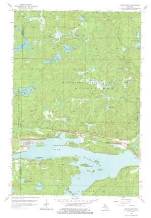
Michigamme Topo Map Michigan
To zoom in, hover over the map of Michigamme
USGS Topo Quad 46088e1 - 1:24,000 scale
| Topo Map Name: | Michigamme |
| USGS Topo Quad ID: | 46088e1 |
| Print Size: | ca. 21 1/4" wide x 27" high |
| Southeast Coordinates: | 46.5° N latitude / 88° W longitude |
| Map Center Coordinates: | 46.5625° N latitude / 88.0625° W longitude |
| U.S. State: | MI |
| Filename: | o46088e1.jpg |
| Download Map JPG Image: | Michigamme topo map 1:24,000 scale |
| Map Type: | Topographic |
| Topo Series: | 7.5´ |
| Map Scale: | 1:24,000 |
| Source of Map Images: | United States Geological Survey (USGS) |
| Alternate Map Versions: |
Michigamme MI 1956, updated 1957 Download PDF Buy paper map Michigamme MI 1956, updated 1972 Download PDF Buy paper map Michigamme MI 1956, updated 1978 Download PDF Buy paper map Michigamme MI 2011 Download PDF Buy paper map Michigamme MI 2014 Download PDF Buy paper map Michigamme MI 2016 Download PDF Buy paper map |
1:24,000 Topo Quads surrounding Michigamme
> Back to 46088e1 at 1:100,000 scale
> Back to 46088a1 at 1:250,000 scale
> Back to U.S. Topo Maps home
Michigamme topo map: Gazetteer
Michigamme: Capes
Dutchman Point elevation 484m 1587′Presbytery Point elevation 477m 1564′
Michigamme: Falls
Dee Lundeen Falls elevation 494m 1620′Michigamme: Islands
Ramsay Island elevation 495m 1624′Sundstrum Island elevation 473m 1551′
Michigamme: Lakes
Arsenault Lake elevation 510m 1673′Gibson Lake elevation 506m 1660′
Gravel Lake elevation 474m 1555′
Hilltop Lake elevation 516m 1692′
Indian Lake elevation 512m 1679′
Lake Arvid elevation 509m 1669′
Lake Keewaydin elevation 526m 1725′
Lake Sixteen elevation 509m 1669′
Little Michigamme Lake elevation 504m 1653′
Little White Goat Lake elevation 508m 1666′
Mud Lake elevation 510m 1673′
Northwestern Lake elevation 480m 1574′
Section Twenty-eight Lake elevation 509m 1669′
Thomas Lake elevation 517m 1696′
Michigamme: Parks
Sam Cohodas Historical Marker elevation 476m 1561′Sam Cohodas Lodge Historical Marker elevation 476m 1561′
Michigamme: Populated Places
Michigamme elevation 497m 1630′Michigamme: Post Offices
Michigamme Post Office elevation 483m 1584′Michigamme: Streams
Peshekee River elevation 473m 1551′West Branch Peshekee River elevation 478m 1568′
Michigamme digital topo map on disk
Buy this Michigamme topo map showing relief, roads, GPS coordinates and other geographical features, as a high-resolution digital map file on DVD:


