L'Anse Topo Map Michigan
To zoom in, hover over the map of L'Anse
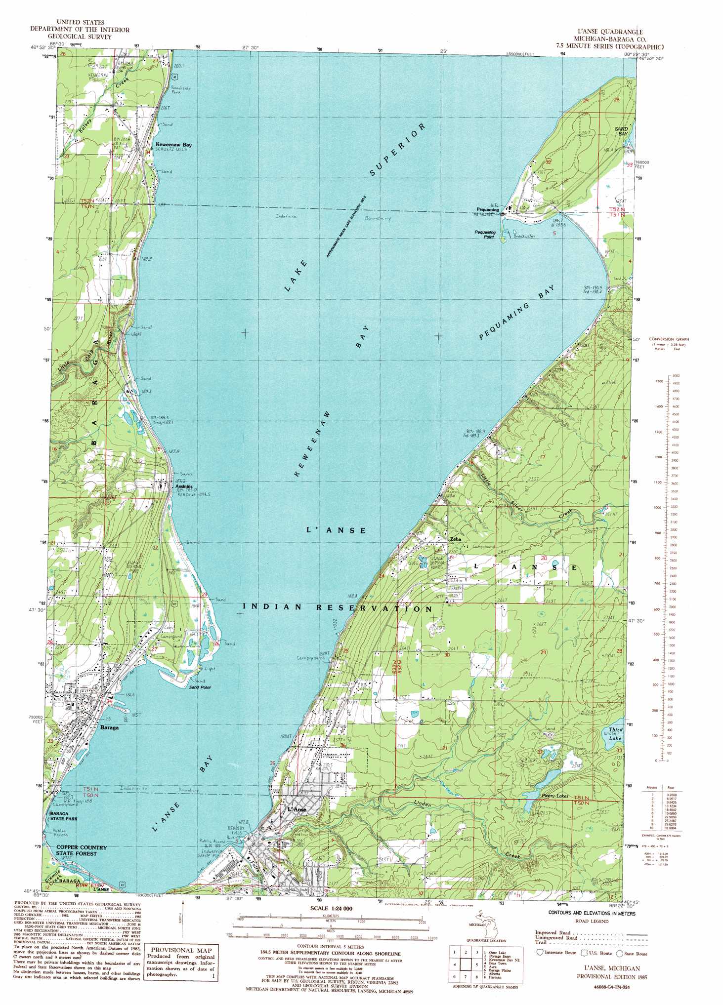
USGS Topo Quad 46088g4 - 1:24,000 scale
| Topo Map Name: | L'Anse |
| USGS Topo Quad ID: | 46088g4 |
| Print Size: | ca. 21 1/4" wide x 27" high |
| Southeast Coordinates: | 46.75° N latitude / 88.375° W longitude |
| Map Center Coordinates: | 46.8125° N latitude / 88.4375° W longitude |
| U.S. State: | MI |
| Filename: | o46088g4.jpg |
| Download Map JPG Image: | L'Anse topo map 1:24,000 scale |
| Map Type: | Topographic |
| Topo Series: | 7.5´ |
| Map Scale: | 1:24,000 |
| Source of Map Images: | United States Geological Survey (USGS) |
| Alternate Map Versions: |
L'Anse MI 1985, updated 1985 Download PDF Buy paper map L'Anse MI 2011 Download PDF Buy paper map L'Anse MI 2014 Download PDF Buy paper map L'Anse MI 2017 Download PDF Buy paper map |
1:24,000 Topo Quads surrounding L'Anse
South Range |
Chassell |
Point Mills |
Traverse Island |
|
Pine Lake |
Otter Lake |
Portage Entry |
Keweenaw Bay Ne |
Skanee North |
Pelkie |
Bear Town |
L'Anse |
Aura |
Skanee South |
Prickett Lake |
Baraga Plains |
Alberta |
Herman |
Mount Curwood |
Sidnaw |
Covington |
Vermilac |
Nestoria |
Three Lakes |
> Back to 46088e1 at 1:100,000 scale
> Back to 46088a1 at 1:250,000 scale
> Back to U.S. Topo Maps home
L'Anse topo map: Gazetteer
L'Anse: Bays
Keweenaw Bay elevation 184m 603′L'Anse Bay elevation 184m 603′
Pequaming Bay elevation 184m 603′
L'Anse: Capes
Pequaming Point elevation 185m 606′Sand Point elevation 184m 603′
L'Anse: Lakes
Pinery Lakes elevation 256m 839′Third Lake elevation 256m 839′
L'Anse: Parks
L'Anse Township Park elevation 192m 629′Zeba Indian United Methodist Church Historical Marker elevation 223m 731′
L'Anse: Populated Places
Assinins elevation 212m 695′Baraga elevation 192m 629′
Keweenaw Bay elevation 206m 675′
L'Anse elevation 189m 620′
Pequaming elevation 190m 623′
Zeba elevation 224m 734′
L'Anse: Post Offices
Assinins Post Office (historical) elevation 200m 656′Baraga Post Office elevation 189m 620′
Keweenaw Bay Post Office (historical) elevation 206m 675′
L'Anse Post Office elevation 187m 613′
Pequaming Post Office (historical) elevation 190m 623′
Zeba Post Office (historical) elevation 223m 731′
L'Anse: Streams
Falls River elevation 184m 603′Linden Creek elevation 184m 603′
Little Carp River elevation 184m 603′
Little Silver Creek elevation 185m 606′
Sixmile Creek elevation 186m 610′
L'Anse digital topo map on disk
Buy this L'Anse topo map showing relief, roads, GPS coordinates and other geographical features, as a high-resolution digital map file on DVD: