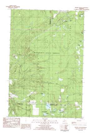
Winona South Topo Map Michigan
To zoom in, hover over the map of Winona South
USGS Topo Quad 46088g8 - 1:25,000 scale
| Topo Map Name: | Winona South |
| USGS Topo Quad ID: | 46088g8 |
| Print Size: | ca. 21 1/4" wide x 27" high |
| Southeast Coordinates: | 46.75° N latitude / 88.875° W longitude |
| Map Center Coordinates: | 46.8125° N latitude / 88.9375° W longitude |
| U.S. State: | MI |
| Filename: | l46088g8.jpg |
| Download Map JPG Image: | Winona South topo map 1:25,000 scale |
| Map Type: | Topographic |
| Topo Series: | 7.5´ |
| Map Scale: | 1:25,000 |
| Source of Map Images: | United States Geological Survey (USGS) |
| Alternate Map Versions: | |
| FStopo: | US Forest Service topo Winona South is available: Download FStopo PDF Download FStopo TIF |
1:24,000 Topo Quads surrounding Winona South
> Back to 46088e1 at 1:100,000 scale
> Back to 46088a1 at 1:250,000 scale
> Back to U.S. Topo Maps home
Winona South topo map: Gazetteer
Winona South: Airports
Simar Landing Strip elevation 356m 1167′Winona South: Dams
Sleepy Dam elevation 360m 1181′Winona South: Lakes
Bob Hall Lake elevation 373m 1223′Bohmier Lake elevation 367m 1204′
Butterfield Lake elevation 360m 1181′
Cemetery Lake elevation 375m 1230′
Courtney Lake elevation 352m 1154′
Horseshoe Lake elevation 366m 1200′
Sixmile Lake elevation 356m 1167′
Storms Lake elevation 354m 1161′
Winona Lake elevation 375m 1230′
Winona South: Mines
Indiana Mine elevation 322m 1056′Winona Mine elevation 385m 1263′
Winona South: Populated Places
Winona elevation 390m 1279′Winona South: Post Offices
Winona Post Office (historical) elevation 390m 1279′Winona South: Streams
Black Creek elevation 315m 1033′Senecal Creek elevation 356m 1167′
Silver Creek elevation 283m 928′
Winona South digital topo map on disk
Buy this Winona South topo map showing relief, roads, GPS coordinates and other geographical features, as a high-resolution digital map file on DVD:


