Skanee North Topo Map Michigan
To zoom in, hover over the map of Skanee North
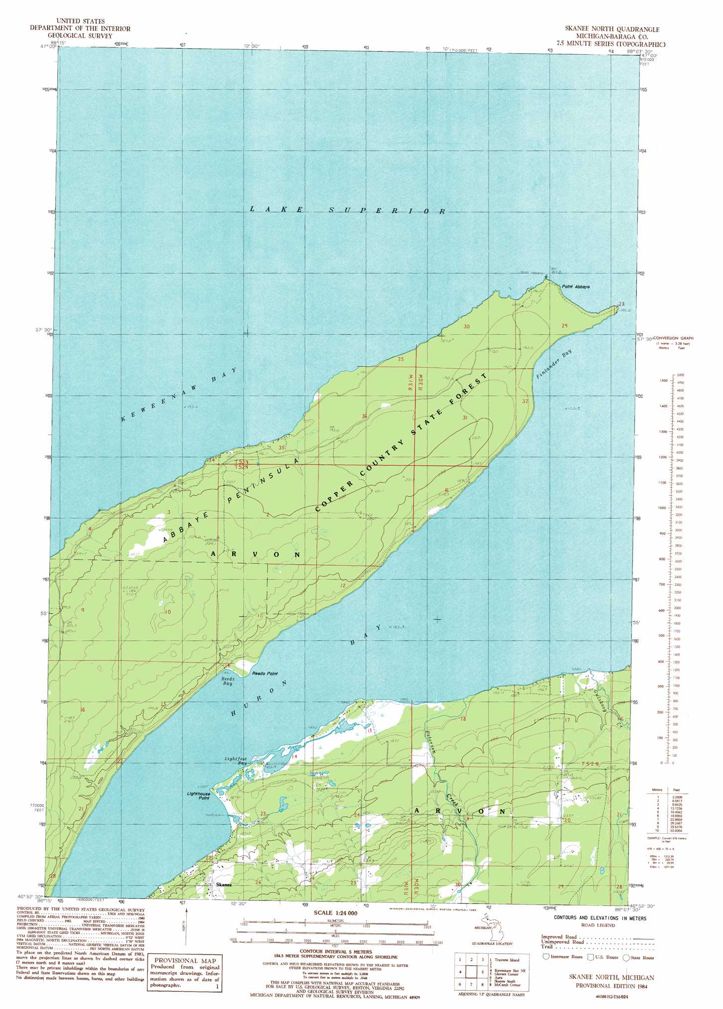
USGS Topo Quad 46088h2 - 1:24,000 scale
| Topo Map Name: | Skanee North |
| USGS Topo Quad ID: | 46088h2 |
| Print Size: | ca. 21 1/4" wide x 27" high |
| Southeast Coordinates: | 46.875° N latitude / 88.125° W longitude |
| Map Center Coordinates: | 46.9375° N latitude / 88.1875° W longitude |
| U.S. State: | MI |
| Filename: | o46088h2.jpg |
| Download Map JPG Image: | Skanee North topo map 1:24,000 scale |
| Map Type: | Topographic |
| Topo Series: | 7.5´ |
| Map Scale: | 1:24,000 |
| Source of Map Images: | United States Geological Survey (USGS) |
| Alternate Map Versions: |
Skanee North MI 1984, updated 1985 Download PDF Buy paper map Skanee North MI 2011 Download PDF Buy paper map Skanee North MI 2014 Download PDF Buy paper map Skanee North MI 2016 Download PDF Buy paper map |
1:24,000 Topo Quads surrounding Skanee North
Laurium |
Rice Lake |
Gay |
||
Point Mills |
Traverse Island |
|||
Portage Entry |
Keweenaw Bay Ne |
Skanee North |
Glovers Corner |
Howe Lake |
L'Anse |
Aura |
Skanee South |
Mccomb Corner |
Mountain Lake |
Alberta |
Herman |
Mount Curwood |
Summit Lake |
Bulldog Lake |
> Back to 46088e1 at 1:100,000 scale
> Back to 46088a1 at 1:250,000 scale
> Back to U.S. Topo Maps home
Skanee North topo map: Gazetteer
Skanee North: Bays
Finlander Bay elevation 183m 600′Huron Bay elevation 183m 600′
Lightfoot Bay elevation 183m 600′
Reeds Bay elevation 183m 600′
Skanee North: Capes
Abbaye Peninsula elevation 212m 695′Lighthouse Point elevation 184m 603′
Point Abbaye elevation 186m 610′
Reeds Point elevation 184m 603′
Skanee North: Post Offices
Skanee Post Office elevation 211m 692′Skanee North: Streams
Gulskoog Creek elevation 183m 600′Peterson Creek elevation 183m 600′
Skanee North digital topo map on disk
Buy this Skanee North topo map showing relief, roads, GPS coordinates and other geographical features, as a high-resolution digital map file on DVD: