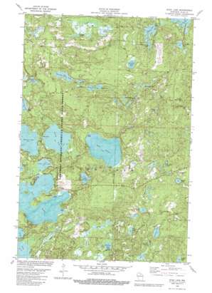
Star Lake Topo Map Wisconsin
To zoom in, hover over the map of Star Lake
USGS Topo Quad 46089a4 - 1:24,000 scale
| Topo Map Name: | Star Lake |
| USGS Topo Quad ID: | 46089a4 |
| Print Size: | ca. 21 1/4" wide x 27" high |
| Southeast Coordinates: | 46° N latitude / 89.375° W longitude |
| Map Center Coordinates: | 46.0625° N latitude / 89.4375° W longitude |
| U.S. State: | WI |
| Filename: | o46089a4.jpg |
| Download Map JPG Image: | Star Lake topo map 1:24,000 scale |
| Map Type: | Topographic |
| Topo Series: | 7.5´ |
| Map Scale: | 1:24,000 |
| Source of Map Images: | United States Geological Survey (USGS) |
| Alternate Map Versions: |
Star Lake WI 1982, updated 1982 Download PDF Buy paper map Star Lake WI 2010 Download PDF Buy paper map Star Lake WI 2013 Download PDF Buy paper map Star Lake WI 2015 Download PDF Buy paper map |
1:24,000 Topo Quads surrounding Star Lake
> Back to 46089a1 at 1:100,000 scale
> Back to 46088a1 at 1:250,000 scale
> Back to U.S. Topo Maps home
Star Lake topo map: Gazetteer
Star Lake: Lakes
Ballard Lake elevation 514m 1686′Camp Five Lake elevation 528m 1732′
Decker Lake elevation 515m 1689′
Dorothy Dunn Lake elevation 520m 1706′
Drott Lake elevation 525m 1722′
Eloise Lake elevation 522m 1712′
Hennig Lake elevation 533m 1748′
Horseshoe Lake elevation 531m 1742′
Indian Lake elevation 531m 1742′
Irving Lake elevation 515m 1689′
Jean Lake elevation 521m 1709′
Lake Alva elevation 512m 1679′
Lake Laura elevation 520m 1706′
Lake Salsich elevation 517m 1696′
Langley Lake elevation 523m 1715′
Lewis Lake elevation 507m 1663′
Little Star Lake elevation 510m 1673′
Nineweb Lake elevation 529m 1735′
Snyder Lake elevation 511m 1676′
Star Lake elevation 510m 1673′
Stewart Lake elevation 509m 1669′
Wharton Lake elevation 508m 1666′
White Squaw Lake elevation 527m 1729′
Wilson Lake elevation 510m 1673′
Star Lake: Parks
Goodyear Springs - East State Natural Area elevation 515m 1689′Plum Lake Hemlock Forest State Natural Area elevation 513m 1683′
Star Lake: Populated Places
Star Lake elevation 529m 1735′Star Lake: Springs
Goodyear Springs elevation 515m 1689′Rainbow Spring elevation 502m 1646′
Siphon Springs elevation 515m 1689′
Star Lake: Streams
Star Creek elevation 498m 1633′Star Lake digital topo map on disk
Buy this Star Lake topo map showing relief, roads, GPS coordinates and other geographical features, as a high-resolution digital map file on DVD:


