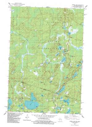
Harris Lake Topo Map Michigan
To zoom in, hover over the map of Harris Lake
USGS Topo Quad 46089c7 - 1:24,000 scale
| Topo Map Name: | Harris Lake |
| USGS Topo Quad ID: | 46089c7 |
| Print Size: | ca. 21 1/4" wide x 27" high |
| Southeast Coordinates: | 46.25° N latitude / 89.75° W longitude |
| Map Center Coordinates: | 46.3125° N latitude / 89.8125° W longitude |
| U.S. States: | MI, WI |
| Filename: | o46089c7.jpg |
| Download Map JPG Image: | Harris Lake topo map 1:24,000 scale |
| Map Type: | Topographic |
| Topo Series: | 7.5´ |
| Map Scale: | 1:24,000 |
| Source of Map Images: | United States Geological Survey (USGS) |
| Alternate Map Versions: |
Harris Lake WI 1982, updated 1983 Download PDF Buy paper map Harris Lake WI 2011 Download PDF Buy paper map Harris Lake WI 2013 Download PDF Buy paper map Harris Lake WI 2015 Download PDF Buy paper map |
| FStopo: | US Forest Service topo Harris Lake is available: Download FStopo PDF Download FStopo TIF |
1:24,000 Topo Quads surrounding Harris Lake
> Back to 46089a1 at 1:100,000 scale
> Back to 46088a1 at 1:250,000 scale
> Back to U.S. Topo Maps home
Harris Lake topo map: Gazetteer
Harris Lake: Lakes
Anne Lake elevation 504m 1653′Bluejay Lake elevation 484m 1587′
Brown Beaver Lake elevation 510m 1673′
Crawford Lake elevation 505m 1656′
Eel Lake elevation 480m 1574′
Elbow Lake elevation 480m 1574′
Feather Lake elevation 478m 1568′
Foxpaw Lake elevation 477m 1564′
Geneveive Lake elevation 499m 1637′
Glen Lake elevation 484m 1587′
Grant Lake elevation 510m 1673′
Harris Lake elevation 499m 1637′
Henry Lake elevation 480m 1574′
Heron Lake elevation 477m 1564′
Mink Lake elevation 478m 1568′
Mishike Lake elevation 476m 1561′
Moraine Lake elevation 490m 1607′
Moraine Lake elevation 490m 1607′
Murphy Lake elevation 507m 1663′
Nell Lake elevation 498m 1633′
Orchid Lake elevation 479m 1571′
Osprey Lake elevation 494m 1620′
Plymouth Lake elevation 476m 1561′
Redboat Lake elevation 477m 1564′
Ridge Lake elevation 483m 1584′
Rock Lake elevation 496m 1627′
Taps Lake elevation 476m 1561′
Thrush Lake elevation 483m 1584′
Twin Pups Lakes elevation 510m 1673′
Harris Lake: Streams
Harris Creek elevation 483m 1584′Harris Creek elevation 483m 1584′
Moraine Creek elevation 478m 1568′
Osprey Creek elevation 477m 1564′
Polecat Creek elevation 477m 1564′
Harris Lake digital topo map on disk
Buy this Harris Lake topo map showing relief, roads, GPS coordinates and other geographical features, as a high-resolution digital map file on DVD:


