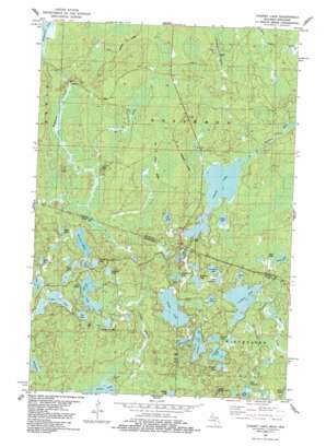
Chaney Lake Topo Map Michigan
To zoom in, hover over the map of Chaney Lake
USGS Topo Quad 46089c8 - 1:24,000 scale
| Topo Map Name: | Chaney Lake |
| USGS Topo Quad ID: | 46089c8 |
| Print Size: | ca. 21 1/4" wide x 27" high |
| Southeast Coordinates: | 46.25° N latitude / 89.875° W longitude |
| Map Center Coordinates: | 46.3125° N latitude / 89.9375° W longitude |
| U.S. States: | MI, WI |
| Filename: | o46089c8.jpg |
| Download Map JPG Image: | Chaney Lake topo map 1:24,000 scale |
| Map Type: | Topographic |
| Topo Series: | 7.5´ |
| Map Scale: | 1:24,000 |
| Source of Map Images: | United States Geological Survey (USGS) |
| Alternate Map Versions: |
Chaney Lake MI 1982, updated 1983 Download PDF Buy paper map Chaney Lake MI 2011 Download PDF Buy paper map Chaney Lake MI 2014 Download PDF Buy paper map Chaney Lake MI 2017 Download PDF Buy paper map |
1:24,000 Topo Quads surrounding Chaney Lake
> Back to 46089a1 at 1:100,000 scale
> Back to 46088a1 at 1:250,000 scale
> Back to U.S. Topo Maps home
Chaney Lake topo map: Gazetteer
Chaney Lake: Dams
McFadyen Dam elevation 512m 1679′Chaney Lake: Lakes
Beatrice Lake elevation 509m 1669′Bena Lake elevation 498m 1633′
Camp Twelve Lake elevation 503m 1650′
Chaney Lake elevation 495m 1624′
Constance Lake elevation 506m 1660′
Cranberry Lake elevation 506m 1660′
Dumbell Lake elevation 503m 1650′
Etna Lake elevation 501m 1643′
Findler Lake elevation 509m 1669′
Fox Lake elevation 502m 1646′
George Lake elevation 501m 1643′
Gretchen Lake elevation 509m 1669′
Hawk Lake elevation 491m 1610′
Hewitt Lake elevation 504m 1653′
Hill Lake elevation 506m 1660′
Hook Lake elevation 507m 1663′
Jeannie Lake elevation 506m 1660′
Joann Lake elevation 495m 1624′
Lake Franchian elevation 509m 1669′
Lake Helen elevation 505m 1656′
Lake Rose elevation 508m 1666′
Lake Yolanda elevation 505m 1656′
Little Oak Lake elevation 500m 1640′
Lynx Lake elevation 507m 1663′
Marell Lake elevation 512m 1679′
Marion Lake elevation 500m 1640′
Mary Lake elevation 505m 1656′
Negro Lakes elevation 508m 1666′
No Mans Lake elevation 498m 1633′
Oak Lake elevation 498m 1633′
Oriole Lake elevation 506m 1660′
Otter Lake elevation 500m 1640′
Owl Lake elevation 500m 1640′
Pardee Lake elevation 500m 1640′
Spinnet Lake elevation 504m 1653′
Trostel Lake elevation 506m 1660′
Virgin Lake elevation 498m 1633′
Chaney Lake: Parks
Mary Lake State Natural Area elevation 507m 1663′Chaney Lake: Streams
Christopher Creek elevation 478m 1568′Mosinee Creek elevation 483m 1584′
No Mans Creek elevation 500m 1640′
Pardee Creek elevation 491m 1610′
Chaney Lake digital topo map on disk
Buy this Chaney Lake topo map showing relief, roads, GPS coordinates and other geographical features, as a high-resolution digital map file on DVD:


