Wakefield Ne Topo Map Michigan
To zoom in, hover over the map of Wakefield Ne
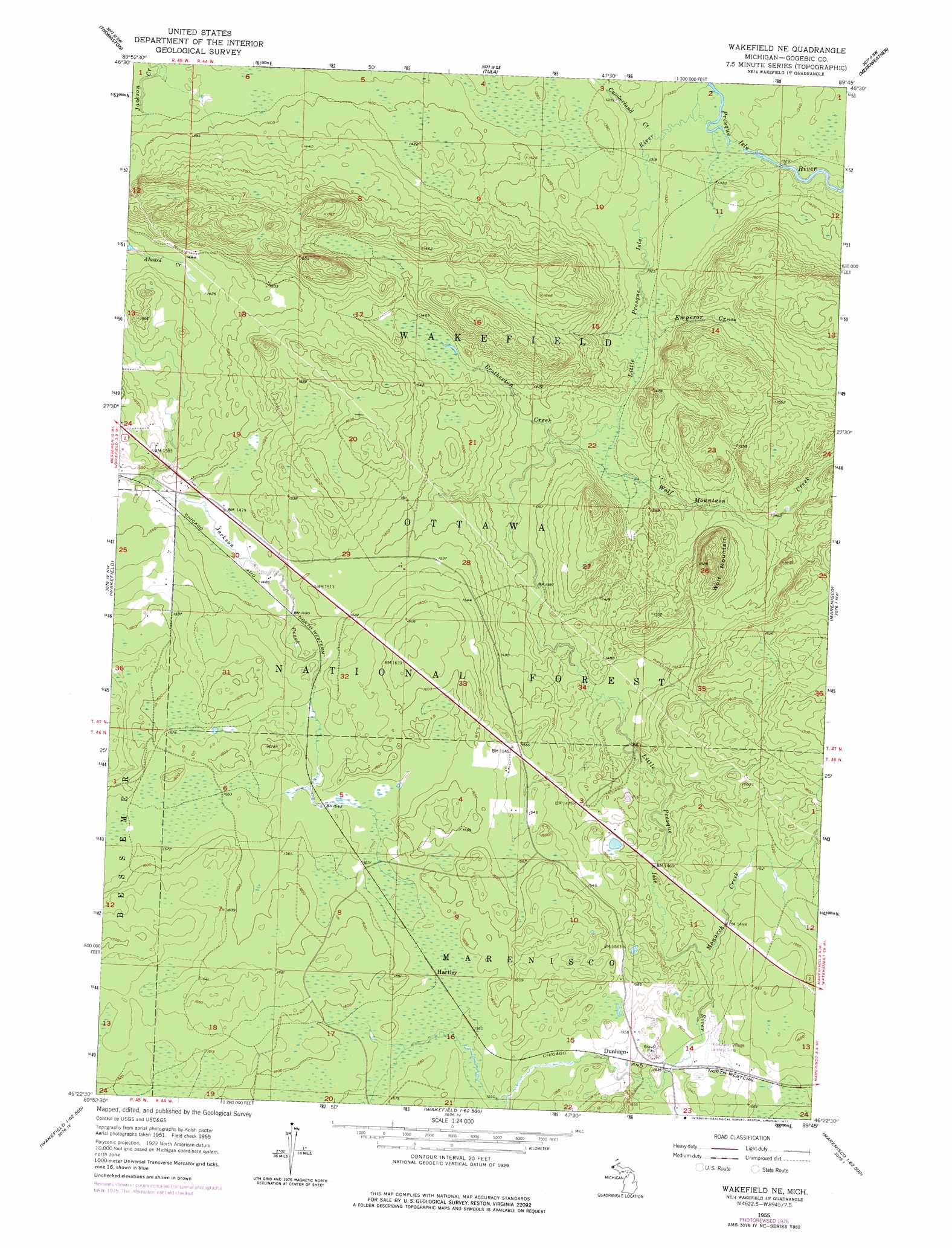
USGS Topo Quad 46089d7 - 1:24,000 scale
| Topo Map Name: | Wakefield Ne |
| USGS Topo Quad ID: | 46089d7 |
| Print Size: | ca. 21 1/4" wide x 27" high |
| Southeast Coordinates: | 46.375° N latitude / 89.75° W longitude |
| Map Center Coordinates: | 46.4375° N latitude / 89.8125° W longitude |
| U.S. State: | MI |
| Filename: | o46089d7.jpg |
| Download Map JPG Image: | Wakefield Ne topo map 1:24,000 scale |
| Map Type: | Topographic |
| Topo Series: | 7.5´ |
| Map Scale: | 1:24,000 |
| Source of Map Images: | United States Geological Survey (USGS) |
| Alternate Map Versions: |
Wakefield NE MI 1955, updated 1957 Download PDF Buy paper map Wakefield NE MI 1955, updated 1977 Download PDF Buy paper map Wakefield NE MI 1999, updated 2004 Download PDF Buy paper map Wakefield NE MI 2011 Download PDF Buy paper map Wakefield NE MI 2014 Download PDF Buy paper map Wakefield NE MI 2017 Download PDF Buy paper map |
| FStopo: | US Forest Service topo Wakefield NE is available: Download FStopo PDF Download FStopo TIF |
1:24,000 Topo Quads surrounding Wakefield Ne
Black River Harbor |
Underwood Hill |
Aldridge Creek |
Bergland Ne |
|
Copper Peak |
Tula |
Merriweather |
Bergland |
|
Bessemer |
Wakefield |
Wakefield Ne |
Marenisco |
Marshall Creek |
Lake Evelyn |
Chaney Lake |
Harris Lake |
Stateline Lake |
Gogebic |
Mercer |
Winchester |
Papoose Lake |
Presque Isle |
Tenderfoot Lake |
> Back to 46089a1 at 1:100,000 scale
> Back to 46088a1 at 1:250,000 scale
> Back to U.S. Topo Maps home
Wakefield Ne topo map: Gazetteer
Wakefield Ne: Airports
Hide-Away Village Landing Strip elevation 463m 1519′Wakefield Ne: Populated Places
Dunham elevation 472m 1548′Hartley elevation 478m 1568′
Wakefield Ne: Post Offices
Dunham Post Office (historical) elevation 472m 1548′Wakefield Ne: Streams
Brotherton Creek elevation 412m 1351′Cumberland Creek elevation 400m 1312′
Emperor Creek elevation 404m 1325′
Little Presque Isle River elevation 399m 1309′
McVichie Creek elevation 446m 1463′
Monarch Creek elevation 451m 1479′
Veron Creek elevation 418m 1371′
Wolf Mountain Creek elevation 407m 1335′
Wakefield Ne: Summits
Wolf Mountain elevation 553m 1814′Wakefield Ne digital topo map on disk
Buy this Wakefield Ne topo map showing relief, roads, GPS coordinates and other geographical features, as a high-resolution digital map file on DVD: