Bruce Crossing Topo Map Michigan
To zoom in, hover over the map of Bruce Crossing
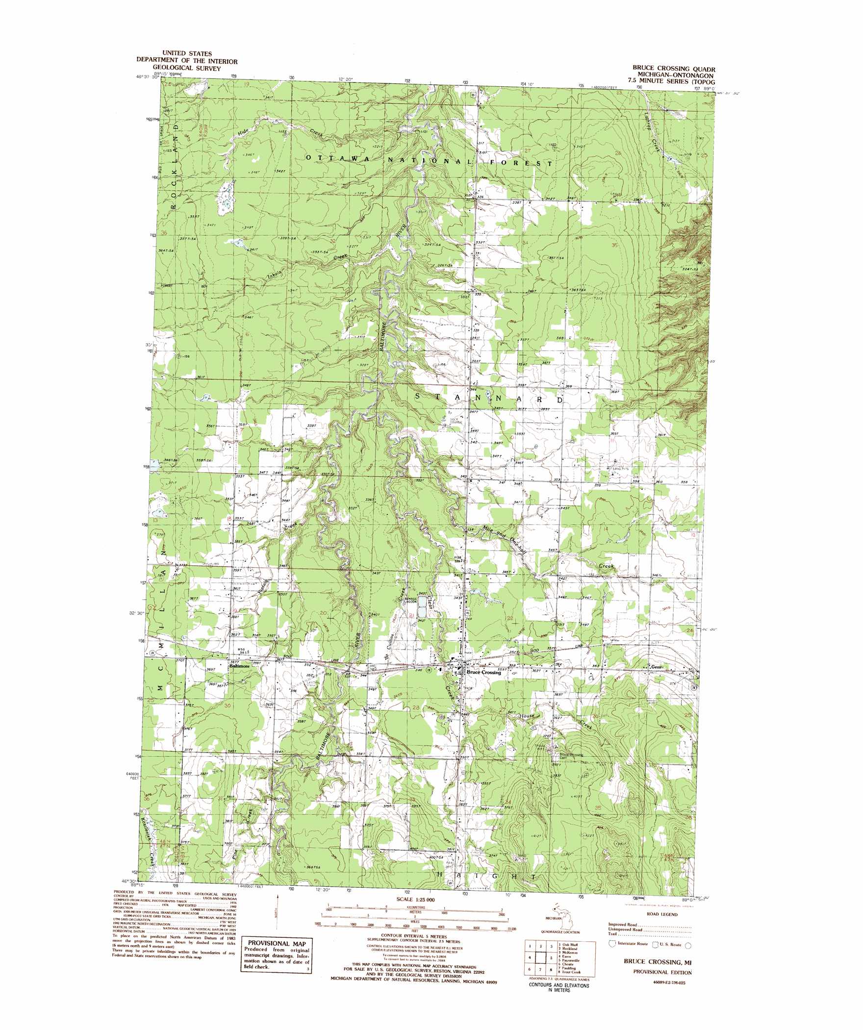
USGS Topo Quad 46089e2 - 1:25,000 scale
| Topo Map Name: | Bruce Crossing |
| USGS Topo Quad ID: | 46089e2 |
| Print Size: | ca. 21 1/4" wide x 27" high |
| Southeast Coordinates: | 46.5° N latitude / 89.125° W longitude |
| Map Center Coordinates: | 46.5625° N latitude / 89.1875° W longitude |
| U.S. State: | MI |
| Filename: | l46089e2.jpg |
| Download Map JPG Image: | Bruce Crossing topo map 1:25,000 scale |
| Map Type: | Topographic |
| Topo Series: | 7.5´ |
| Map Scale: | 1:25,000 |
| Source of Map Images: | United States Geological Survey (USGS) |
| Alternate Map Versions: | |
| FStopo: | US Forest Service topo Bruce Crossing is available: Download FStopo PDF Download FStopo TIF |
1:24,000 Topo Quads surrounding Bruce Crossing
Green |
Ontonagon South |
Firesteel |
Greenland |
Winona South |
Matchwood Nw |
Oak Bluff |
Rockland |
Mckeever |
Rousseau |
Matchwood |
Ewen |
Bruce Crossing |
Paynesville |
Sparrows Rapids |
Cup Lake |
Choate |
Paulding |
Trout Creek |
Kenton |
Thayer |
Beaton |
Watersmeet |
Fuller |
Lake Mitigwaki |
> Back to 46089e1 at 1:100,000 scale
> Back to 46088a1 at 1:250,000 scale
> Back to U.S. Topo Maps home
Bruce Crossing topo map: Gazetteer
Bruce Crossing: Parks
Stannard Township Park elevation 348m 1141′Bruce Crossing: Populated Places
Balitmore elevation 365m 1197′Bruce Crossing elevation 347m 1138′
Gem elevation 388m 1272′
Bruce Crossing: Post Offices
Bruce Crossing Post Office elevation 385m 1263′Bruce Crossing: Streams
Clear Creek elevation 309m 1013′Hide Creek elevation 296m 971′
House Creek elevation 344m 1128′
Inkala Creek elevation 303m 994′
Mile and One-half Creek elevation 312m 1023′
Pietila Creek elevation 321m 1053′
Pine Creek elevation 346m 1135′
Saint Cullins Creek elevation 311m 1020′
Bruce Crossing digital topo map on disk
Buy this Bruce Crossing topo map showing relief, roads, GPS coordinates and other geographical features, as a high-resolution digital map file on DVD: