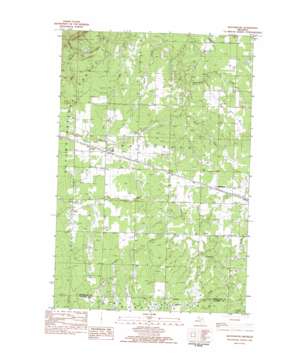
Matchwood Topo Map Michigan
To zoom in, hover over the map of Matchwood
USGS Topo Quad 46089e4 - 1:25,000 scale
| Topo Map Name: | Matchwood |
| USGS Topo Quad ID: | 46089e4 |
| Print Size: | ca. 21 1/4" wide x 27" high |
| Southeast Coordinates: | 46.5° N latitude / 89.375° W longitude |
| Map Center Coordinates: | 46.5625° N latitude / 89.4375° W longitude |
| U.S. State: | MI |
| Filename: | l46089e4.jpg |
| Download Map JPG Image: | Matchwood topo map 1:25,000 scale |
| Map Type: | Topographic |
| Topo Series: | 7.5´ |
| Map Scale: | 1:25,000 |
| Source of Map Images: | United States Geological Survey (USGS) |
| Alternate Map Versions: |
Matchwood MI 1982, updated 1983 Download PDF Buy paper map |
| FStopo: | US Forest Service topo Matchwood is available: Download FStopo PDF Download FStopo TIF |
1:24,000 Topo Quads surrounding Matchwood
> Back to 46089e1 at 1:100,000 scale
> Back to 46088a1 at 1:250,000 scale
> Back to U.S. Topo Maps home
Matchwood topo map: Gazetteer
Matchwood: Populated Places
Matchwood elevation 379m 1243′Topaz elevation 383m 1256′
Matchwood: Post Offices
Matchwood Post Office (historical) elevation 379m 1243′Topaz Post Office (historical) elevation 383m 1256′
Matchwood: Streams
Brown Creek elevation 347m 1138′Iddings Creek elevation 358m 1174′
Russell Creek elevation 383m 1256′
Shoemaker Creek elevation 334m 1095′
Toles Creek elevation 359m 1177′
Weir Creek elevation 360m 1181′
Matchwood digital topo map on disk
Buy this Matchwood topo map showing relief, roads, GPS coordinates and other geographical features, as a high-resolution digital map file on DVD:


