Bergland Topo Map Michigan
To zoom in, hover over the map of Bergland
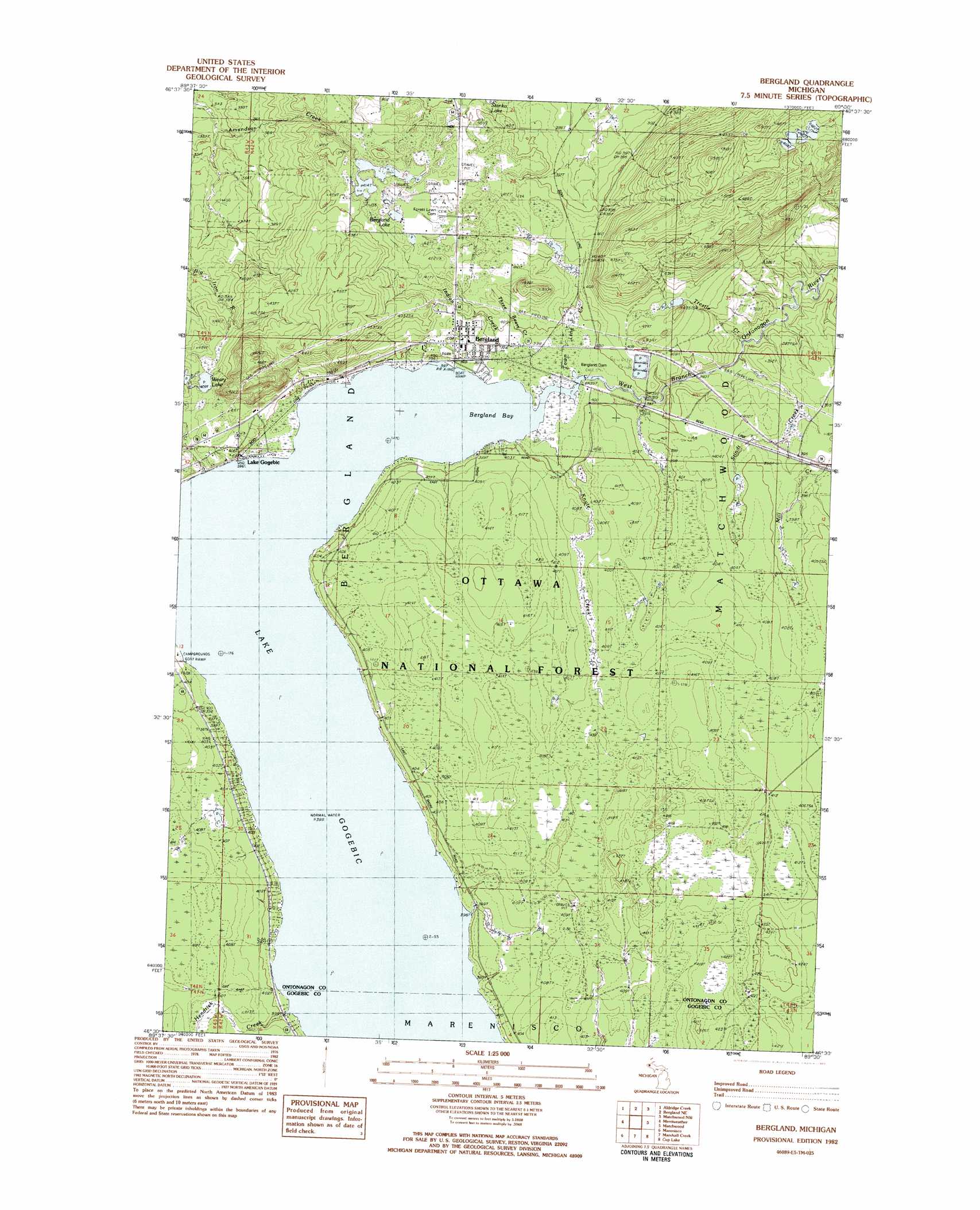
USGS Topo Quad 46089e5 - 1:25,000 scale
| Topo Map Name: | Bergland |
| USGS Topo Quad ID: | 46089e5 |
| Print Size: | ca. 21 1/4" wide x 27" high |
| Southeast Coordinates: | 46.5° N latitude / 89.5° W longitude |
| Map Center Coordinates: | 46.5625° N latitude / 89.5625° W longitude |
| U.S. State: | MI |
| Filename: | l46089e5.jpg |
| Download Map JPG Image: | Bergland topo map 1:25,000 scale |
| Map Type: | Topographic |
| Topo Series: | 7.5´ |
| Map Scale: | 1:25,000 |
| Source of Map Images: | United States Geological Survey (USGS) |
| Alternate Map Versions: |
Bergland MI 1982, updated 1983 Download PDF Buy paper map |
| FStopo: | US Forest Service topo Bergland is available: Download FStopo PDF Download FStopo TIF |
1:24,000 Topo Quads surrounding Bergland
Carp River East |
Government Peak |
White Pine |
Green |
Ontonagon South |
Underwood Hill |
Aldridge Creek |
Bergland Ne |
Matchwood Nw |
Oak Bluff |
Tula |
Merriweather |
Bergland |
Matchwood |
Ewen |
Wakefield Ne |
Marenisco |
Marshall Creek |
Cup Lake |
Choate |
Harris Lake |
Stateline Lake |
Gogebic |
Thayer |
Beaton |
> Back to 46089e1 at 1:100,000 scale
> Back to 46088a1 at 1:250,000 scale
> Back to U.S. Topo Maps home
Bergland topo map: Gazetteer
Bergland: Bays
Bergland Bay elevation 395m 1295′Bergland: Forests
Ottawa National Forest elevation 422m 1384′Bergland: Lakes
Berland Lake elevation 414m 1358′Weary Lake elevation 409m 1341′
Bergland: Parks
Ontonagon County Park elevation 402m 1318′Bergland: Populated Places
Bergland elevation 405m 1328′Lake Gogebic elevation 396m 1299′
Bergland: Post Offices
Bergland Post Office elevation 405m 1328′Lake Gogebic Post Office (historical) elevation 397m 1302′
Bergland: Streams
Hendrick Creek elevation 395m 1295′Indian Creek elevation 396m 1299′
Knute Creek elevation 396m 1299′
Stindt Creek elevation 375m 1230′
Three Bears Creek elevation 406m 1332′
Town Line Creek elevation 395m 1295′
Trestle Creek elevation 373m 1223′
Bergland: Trails
Bergland Cross-Country Ski Trail elevation 415m 1361′Bergland digital topo map on disk
Buy this Bergland topo map showing relief, roads, GPS coordinates and other geographical features, as a high-resolution digital map file on DVD: