Oak Bluff Topo Map Michigan
To zoom in, hover over the map of Oak Bluff
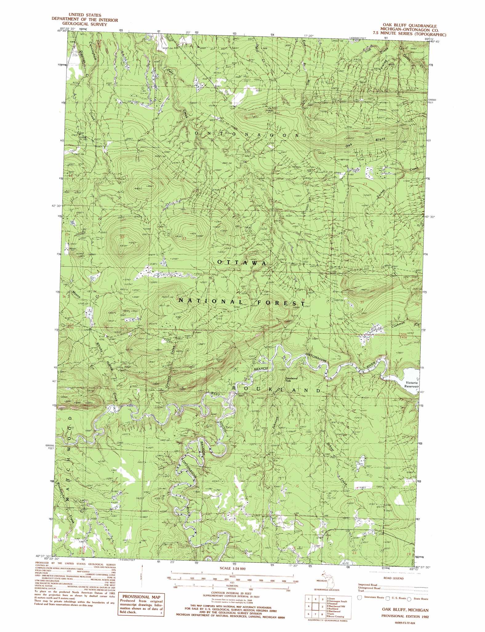
USGS Topo Quad 46089f3 - 1:24,000 scale
| Topo Map Name: | Oak Bluff |
| USGS Topo Quad ID: | 46089f3 |
| Print Size: | ca. 21 1/4" wide x 27" high |
| Southeast Coordinates: | 46.625° N latitude / 89.25° W longitude |
| Map Center Coordinates: | 46.6875° N latitude / 89.3125° W longitude |
| U.S. State: | MI |
| Filename: | o46089f3.jpg |
| Download Map JPG Image: | Oak Bluff topo map 1:24,000 scale |
| Map Type: | Topographic |
| Topo Series: | 7.5´ |
| Map Scale: | 1:24,000 |
| Source of Map Images: | United States Geological Survey (USGS) |
| Alternate Map Versions: |
Oak Bluff MI 1982, updated 1983 Download PDF Buy paper map Oak Bluff MI 1999, updated 2004 Download PDF Buy paper map Oak Bluff MI 2011 Download PDF Buy paper map Oak Bluff MI 2014 Download PDF Buy paper map Oak Bluff MI 2017 Download PDF Buy paper map |
| FStopo: | US Forest Service topo Oak Bluff is available: Download FStopo PDF Download FStopo TIF |
1:24,000 Topo Quads surrounding Oak Bluff
Ontonagon North |
Tenmile Point |
Four Corners |
||
White Pine |
Green |
Ontonagon South |
Firesteel |
Greenland |
Bergland Ne |
Matchwood Nw |
Oak Bluff |
Rockland |
Mckeever |
Bergland |
Matchwood |
Ewen |
Bruce Crossing |
Paynesville |
Marshall Creek |
Cup Lake |
Choate |
Paulding |
Trout Creek |
> Back to 46089e1 at 1:100,000 scale
> Back to 46088a1 at 1:250,000 scale
> Back to U.S. Topo Maps home
Oak Bluff topo map: Gazetteer
Oak Bluff: Cliffs
Oak Bluff elevation 389m 1276′Oak Bluff: Falls
Gleason Creek Falls elevation 427m 1400′Sandstone Falls elevation 292m 958′
Oak Bluff: Streams
Forsling Creek elevation 215m 705′Gleason Creek elevation 305m 1000′
Johnson Creek elevation 289m 948′
Schaat Creek elevation 288m 944′
South Branch Ontonagon River elevation 293m 961′
Whisky Hollow Creek elevation 314m 1030′
Oak Bluff digital topo map on disk
Buy this Oak Bluff topo map showing relief, roads, GPS coordinates and other geographical features, as a high-resolution digital map file on DVD: