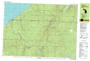
Underwood Hill Topo Map Michigan
To zoom in, hover over the map of Underwood Hill
USGS Topo Quad 46089f7 - 1:25,000 scale
| Topo Map Name: | Underwood Hill |
| USGS Topo Quad ID: | 46089f7 |
| Print Size: | ca. 39" wide x 24" high |
| Southeast Coordinates: | 46.625° N latitude / 89.75° W longitude |
| Map Center Coordinates: | 46.6875° N latitude / 89.875° W longitude |
| U.S. State: | MI |
| Filename: | k46089f7.jpg |
| Download Map JPG Image: | Underwood Hill topo map 1:25,000 scale |
| Map Type: | Topographic |
| Topo Series: | 7.5´x15´ |
| Map Scale: | 1:25,000 |
| Source of Map Images: | United States Geological Survey (USGS) |
| Alternate Map Versions: |
Tiebel Creek MI 1980, updated 1981 Download PDF Buy paper map |
| FStopo: | US Forest Service topo Underwood Hill is available: Download FStopo PDF Download FStopo TIF |
1:24,000 Topo Quads surrounding Underwood Hill
Carp River East |
Government Peak |
White Pine |
||
Black River Harbor |
Underwood Hill |
Aldridge Creek |
Bergland Ne |
|
Copper Peak |
Tula |
Merriweather |
Bergland |
|
Bessemer |
Wakefield |
Wakefield Ne |
Marenisco |
Marshall Creek |
> Back to 46089e1 at 1:100,000 scale
> Back to 46088a1 at 1:250,000 scale
> Back to U.S. Topo Maps home
Underwood Hill topo map: Gazetteer
Underwood Hill: Falls
Abinodji Falls elevation 315m 1033′Explorers Falls elevation 256m 839′
Greenstone Falls elevation 362m 1187′
Iagoo Falls elevation 264m 866′
Lepisto Falls elevation 268m 879′
Manabezho Falls elevation 189m 620′
Manido Falls elevation 195m 639′
Nawadaha Falls elevation 225m 738′
Nokomis Falls elevation 318m 1043′
Ogima Falls elevation 331m 1085′
Ogimakwe Falls elevation 321m 1053′
Pinkerton Falls elevation 241m 790′
Trappers Falls elevation 260m 853′
Underwood Hill: Lakes
Bass Lake elevation 408m 1338′Clark Lake elevation 408m 1338′
Lily Pond elevation 454m 1489′
Underwood Hill: Parks
Presque Isle Park elevation 206m 675′Underwood Hill: Streams
Beaver Creek elevation 414m 1358′Bessemer Creek elevation 360m 1181′
Canyon Creek elevation 366m 1200′
Cardinal Creek elevation 183m 600′
Copper Creek elevation 283m 928′
Crowned Creek elevation 345m 1131′
Eden Creek elevation 362m 1187′
Gipsy Creek elevation 185m 606′
Kenabeek Creek elevation 184m 603′
Ledge Creek elevation 351m 1151′
Lookout Creek elevation 306m 1003′
Memengwa Creek elevation 215m 705′
Peboan Creek elevation 247m 810′
Pinkerton Creek elevation 183m 600′
Presque Isle River elevation 183m 600′
Redstart Creek elevation 375m 1230′
Sahwa Creek elevation 183m 600′
Song Creek elevation 368m 1207′
Sooty Creek elevation 354m 1161′
Speaker Creek elevation 183m 600′
Texas Creek elevation 365m 1197′
Tiebel Creek elevation 184m 603′
Towhee Creek elevation 366m 1200′
Vesper Creek elevation 348m 1141′
Wabeno Creek elevation 280m 918′
Underwood Hill: Summits
Porcupine Peak elevation 530m 1738′Underwood Hill: Swamps
Beaver Lake elevation 458m 1502′Underwood Hill digital topo map on disk
Buy this Underwood Hill topo map showing relief, roads, GPS coordinates and other geographical features, as a high-resolution digital map file on DVD:


