Peeksville Topo Map Wisconsin
To zoom in, hover over the map of Peeksville
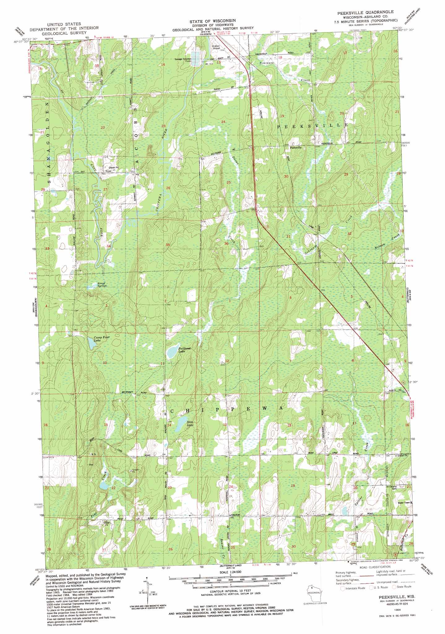
USGS Topo Quad 46090a5 - 1:24,000 scale
| Topo Map Name: | Peeksville |
| USGS Topo Quad ID: | 46090a5 |
| Print Size: | ca. 21 1/4" wide x 27" high |
| Southeast Coordinates: | 46° N latitude / 90.5° W longitude |
| Map Center Coordinates: | 46.0625° N latitude / 90.5625° W longitude |
| U.S. State: | WI |
| Filename: | o46090a5.jpg |
| Download Map JPG Image: | Peeksville topo map 1:24,000 scale |
| Map Type: | Topographic |
| Topo Series: | 7.5´ |
| Map Scale: | 1:24,000 |
| Source of Map Images: | United States Geological Survey (USGS) |
| Alternate Map Versions: |
Peeksville WI 1984, updated 1984 Download PDF Buy paper map Peeksville WI 2010 Download PDF Buy paper map Peeksville WI 2013 Download PDF Buy paper map Peeksville WI 2015 Download PDF Buy paper map |
1:24,000 Topo Quads surrounding Peeksville
Mineral Lake |
Mellen |
Mount Whittlesey |
Upson |
Turntable Creek |
Clam Lake Ne |
Morse |
Glidden |
Augustine Lake |
Lake Six |
Clam Lake Se |
Shanagolden |
Peeksville |
Butternut |
Hay Creek Flowage |
Loretta |
Kennedy |
Butternut Lake |
Park Falls |
Blockhouse Lake |
Babbs Island |
Oxbo |
Lugerville |
Priest Lake |
Gates Lake |
> Back to 46090a1 at 1:100,000 scale
> Back to 46090a1 at 1:250,000 scale
> Back to U.S. Topo Maps home
Peeksville topo map: Gazetteer
Peeksville: Airports
Glidden Municipal Airport elevation 465m 1525′Peeksville: Lakes
Bullhead Lake elevation 467m 1532′Camp Four Lake elevation 472m 1548′
Slim Lake elevation 482m 1581′
Peeksville: Populated Places
Peeksville elevation 466m 1528′Peeksville: Springs
Kempf Springs elevation 459m 1505′Peeksville: Streams
Dorns Creek elevation 459m 1505′Nelson Creek elevation 469m 1538′
Schraum Creek elevation 463m 1519′
Peeksville digital topo map on disk
Buy this Peeksville topo map showing relief, roads, GPS coordinates and other geographical features, as a high-resolution digital map file on DVD: