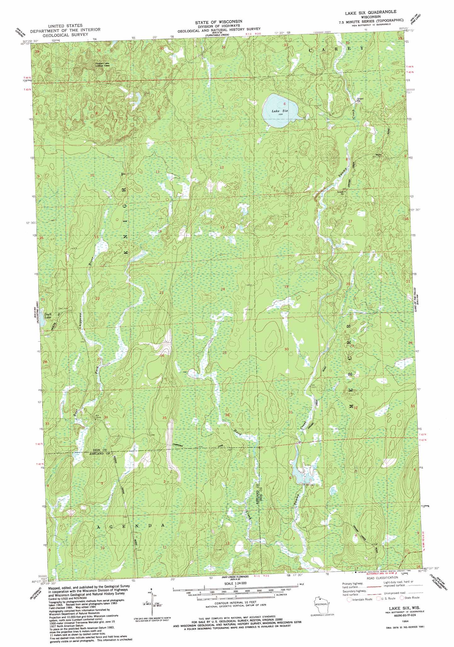
Lake Six Topo Map Wisconsin
To zoom in, hover over the map of Lake Six
USGS Topo Quad 46090b3 - 1:24,000 scale
| Topo Map Name: | Lake Six |
| USGS Topo Quad ID: | 46090b3 |
| Print Size: | ca. 21 1/4" wide x 27" high |
| Southeast Coordinates: | 46.125° N latitude / 90.25° W longitude |
| Map Center Coordinates: | 46.1875° N latitude / 90.3125° W longitude |
| U.S. State: | WI |
| Filename: | o46090b3.jpg |
| Download Map JPG Image: | Lake Six topo map 1:24,000 scale |
| Map Type: | Topographic |
| Topo Series: | 7.5´ |
| Map Scale: | 1:24,000 |
| Source of Map Images: | United States Geological Survey (USGS) |
| Alternate Map Versions: |
Lake Six WI 1984, updated 1984 Download PDF Buy paper map Lake Six WI 2010 Download PDF Buy paper map Lake Six WI 2013 Download PDF Buy paper map Lake Six WI 2015 Download PDF Buy paper map |
1:24,000 Topo Quads surrounding Lake Six
Gurney |
Saxon |
Iron Belt |
Ironwood |
Bessemer |
Mount Whittlesey |
Upson |
Turntable Creek |
Pine Lake |
Lake Evelyn |
Glidden |
Augustine Lake |
Lake Six |
Lake Of The Falls |
Mercer |
Peeksville |
Butternut |
Hay Creek Flowage |
Turtle-Flambeau Flowage |
Wilson Lake |
Butternut Lake |
Park Falls |
Blockhouse Lake |
Pike Lake Nw |
Pike Lake |
> Back to 46090a1 at 1:100,000 scale
> Back to 46090a1 at 1:250,000 scale
> Back to U.S. Topo Maps home
Lake Six topo map: Gazetteer
Lake Six: Dams
Forest Wander Lake 2WP41 Dam elevation 485m 1591′Lake Six: Lakes
Lake Six elevation 517m 1696′Lake Six: Reservoirs
Forest Wander Lake 17 elevation 485m 1591′Lake Six: Streams
Hurd Creek elevation 485m 1591′Lake Six digital topo map on disk
Buy this Lake Six topo map showing relief, roads, GPS coordinates and other geographical features, as a high-resolution digital map file on DVD: