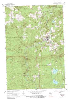
Mellen Topo Map Wisconsin
To zoom in, hover over the map of Mellen
USGS Topo Quad 46090c6 - 1:24,000 scale
| Topo Map Name: | Mellen |
| USGS Topo Quad ID: | 46090c6 |
| Print Size: | ca. 21 1/4" wide x 27" high |
| Southeast Coordinates: | 46.25° N latitude / 90.625° W longitude |
| Map Center Coordinates: | 46.3125° N latitude / 90.6875° W longitude |
| U.S. State: | WI |
| Filename: | o46090c6.jpg |
| Download Map JPG Image: | Mellen topo map 1:24,000 scale |
| Map Type: | Topographic |
| Topo Series: | 7.5´ |
| Map Scale: | 1:24,000 |
| Source of Map Images: | United States Geological Survey (USGS) |
| Alternate Map Versions: |
Mellen WI 1956, updated 1958 Download PDF Buy paper map Mellen WI 1967, updated 1969 Download PDF Buy paper map Mellen WI 1967, updated 1989 Download PDF Buy paper map Mellen WI 2005, updated 2006 Download PDF Buy paper map Mellen WI 2011 Download PDF Buy paper map Mellen WI 2013 Download PDF Buy paper map Mellen WI 2015 Download PDF Buy paper map |
| FStopo: | US Forest Service topo Mellen is available: Download FStopo PDF Download FStopo TIF |
1:24,000 Topo Quads surrounding Mellen
> Back to 46090a1 at 1:100,000 scale
> Back to 46090a1 at 1:250,000 scale
> Back to U.S. Topo Maps home
Mellen topo map: Gazetteer
Mellen: Falls
Copper Falls elevation 314m 1030′Mellen: Lakes
Conley Lake elevation 430m 1410′Long Lake elevation 454m 1489′
Loon Lake elevation 373m 1223′
Meder Lake elevation 454m 1489′
Murphy Lake elevation 349m 1145′
Mellen: Parks
Copper Falls State Park elevation 345m 1131′Mellen: Populated Places
Foster Junction elevation 387m 1269′Mellen elevation 381m 1250′
Tannery Town elevation 380m 1246′
White City elevation 374m 1227′
Mellen: Streams
City Creek elevation 380m 1246′Devils Creek elevation 371m 1217′
Gravelly Brook elevation 397m 1302′
Happy Creek elevation 396m 1299′
Hardscrabble Creek elevation 394m 1292′
Iron River elevation 425m 1394′
Krause Creek elevation 325m 1066′
Montreal Creek elevation 371m 1217′
Rocky Run elevation 380m 1246′
Scott-Taylor Creek elevation 328m 1076′
Squaw Creek elevation 426m 1397′
Tafelski Creek elevation 375m 1230′
Mellen: Summits
Eagles Peak elevation 507m 1663′Mellen digital topo map on disk
Buy this Mellen topo map showing relief, roads, GPS coordinates and other geographical features, as a high-resolution digital map file on DVD:


