Ashland East Topo Map Wisconsin
To zoom in, hover over the map of Ashland East
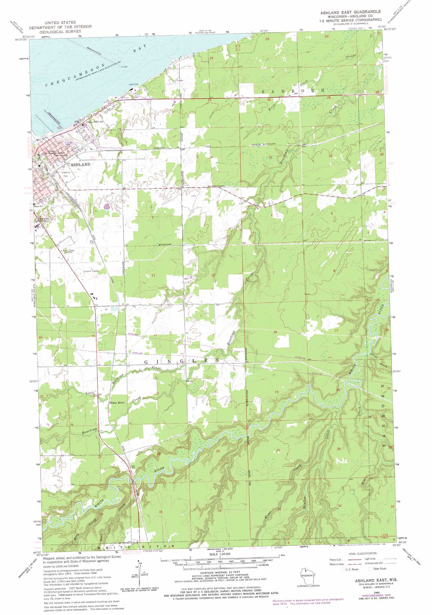
USGS Topo Quad 46090e7 - 1:24,000 scale
| Topo Map Name: | Ashland East |
| USGS Topo Quad ID: | 46090e7 |
| Print Size: | ca. 21 1/4" wide x 27" high |
| Southeast Coordinates: | 46.5° N latitude / 90.75° W longitude |
| Map Center Coordinates: | 46.5625° N latitude / 90.8125° W longitude |
| U.S. State: | WI |
| Filename: | o46090e7.jpg |
| Download Map JPG Image: | Ashland East topo map 1:24,000 scale |
| Map Type: | Topographic |
| Topo Series: | 7.5´ |
| Map Scale: | 1:24,000 |
| Source of Map Images: | United States Geological Survey (USGS) |
| Alternate Map Versions: |
Ashland East WI 1964, updated 1965 Download PDF Buy paper map Ashland East WI 1964, updated 1976 Download PDF Buy paper map Ashland East WI 2010 Download PDF Buy paper map Ashland East WI 2013 Download PDF Buy paper map Ashland East WI 2015 Download PDF Buy paper map |
1:24,000 Topo Quads surrounding Ashland East
Cornucopia |
Mount Ashwabay |
Bayfield |
Madeline Island |
Amnicon Point |
Mount Valhalla |
Washburn |
Long Island |
Chequamegon Point |
|
Moquah |
Ashland West |
Ashland East |
Odanah |
Cedar |
Mason |
Sanborn |
Marengo |
High Bridge |
Gurney |
Grand View |
Marengo Lake |
Mineral Lake |
Mellen |
Mount Whittlesey |
> Back to 46090e1 at 1:100,000 scale
> Back to 46090a1 at 1:250,000 scale
> Back to U.S. Topo Maps home
Ashland East topo map: Gazetteer
Ashland East: Parks
Ellis Park elevation 202m 662′Hodgkins Park elevation 206m 675′
Lake Park elevation 191m 626′
Ashland East: Populated Places
White River elevation 223m 731′Ashland East: Streams
Bishigokwe Creek elevation 184m 603′Deer Creek elevation 192m 629′
Elm Creek elevation 188m 616′
Hyms Creek elevation 189m 620′
Little Beartrap Creek elevation 207m 679′
Meadow Creek elevation 187m 613′
Rock Creek elevation 195m 639′
Silver Creek elevation 186m 610′
Thornapple Creek elevation 193m 633′
Ashland East digital topo map on disk
Buy this Ashland East topo map showing relief, roads, GPS coordinates and other geographical features, as a high-resolution digital map file on DVD: