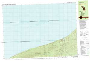
Black River Harbor Topo Map Michigan
To zoom in, hover over the map of Black River Harbor
USGS Topo Quad 46090f1 - 1:25,000 scale
| Topo Map Name: | Black River Harbor |
| USGS Topo Quad ID: | 46090f1 |
| Print Size: | ca. 39" wide x 24" high |
| Southeast Coordinates: | 46.625° N latitude / 90° W longitude |
| Map Center Coordinates: | 46.6875° N latitude / 90.125° W longitude |
| U.S. State: | MI |
| Filename: | k46090f1.jpg |
| Download Map JPG Image: | Black River Harbor topo map 1:25,000 scale |
| Map Type: | Topographic |
| Topo Series: | 7.5´x15´ |
| Map Scale: | 1:25,000 |
| Source of Map Images: | United States Geological Survey (USGS) |
| Alternate Map Versions: |
Black River Harbor MI 1980, updated 1981 Download PDF Buy paper map |
| FStopo: | US Forest Service topo Black River Harbor is available: Download FStopo PDF Download FStopo TIF |
1:24,000 Topo Quads surrounding Black River Harbor
Carp River East |
||||
Black River Harbor |
Underwood Hill |
|||
Little Girls Point |
Copper Peak |
Tula |
||
Iron Belt |
Ironwood |
Bessemer |
Wakefield |
Wakefield Ne |
> Back to 46090e1 at 1:100,000 scale
> Back to 46090a1 at 1:250,000 scale
> Back to U.S. Topo Maps home
Black River Harbor topo map: Gazetteer
Black River Harbor: Falls
Gorge Falls elevation 244m 800′Great Conglomerate Falls elevation 278m 912′
Manakiki Falls elevation 259m 849′
Maple Creek Falls elevation 224m 734′
Potawatomi Falls elevation 264m 866′
Rainbow Falls elevation 196m 643′
Sandstone Falls elevation 217m 711′
Black River Harbor: Lakes
Sagaigan Lake elevation 346m 1135′Black River Harbor: Parks
Black River County Park elevation 225m 738′Black River Harbor: Post Offices
Black River Harbor Post Office (historical) elevation 184m 603′Black River Harbor: Streams
Black River elevation 205m 672′Black River elevation 183m 600′
Bobolink Creek elevation 183m 600′
Chickadee Creek elevation 183m 600′
Ghost Creek elevation 188m 616′
Gijik Creek elevation 183m 600′
Lehigh Creek elevation 183m 600′
Maple Creek elevation 183m 600′
Namebinag Creek elevation 183m 600′
Nighthawk Creek elevation 190m 623′
Poleface Creek elevation 183m 600′
Sagaigan Creek elevation 204m 669′
Tanager Creek elevation 183m 600′
Black River Harbor: Trails
Rainbow Falls Trail elevation 201m 659′Black River Harbor digital topo map on disk
Buy this Black River Harbor topo map showing relief, roads, GPS coordinates and other geographical features, as a high-resolution digital map file on DVD:


