Chittamo Ne Topo Map Wisconsin
To zoom in, hover over the map of Chittamo Ne
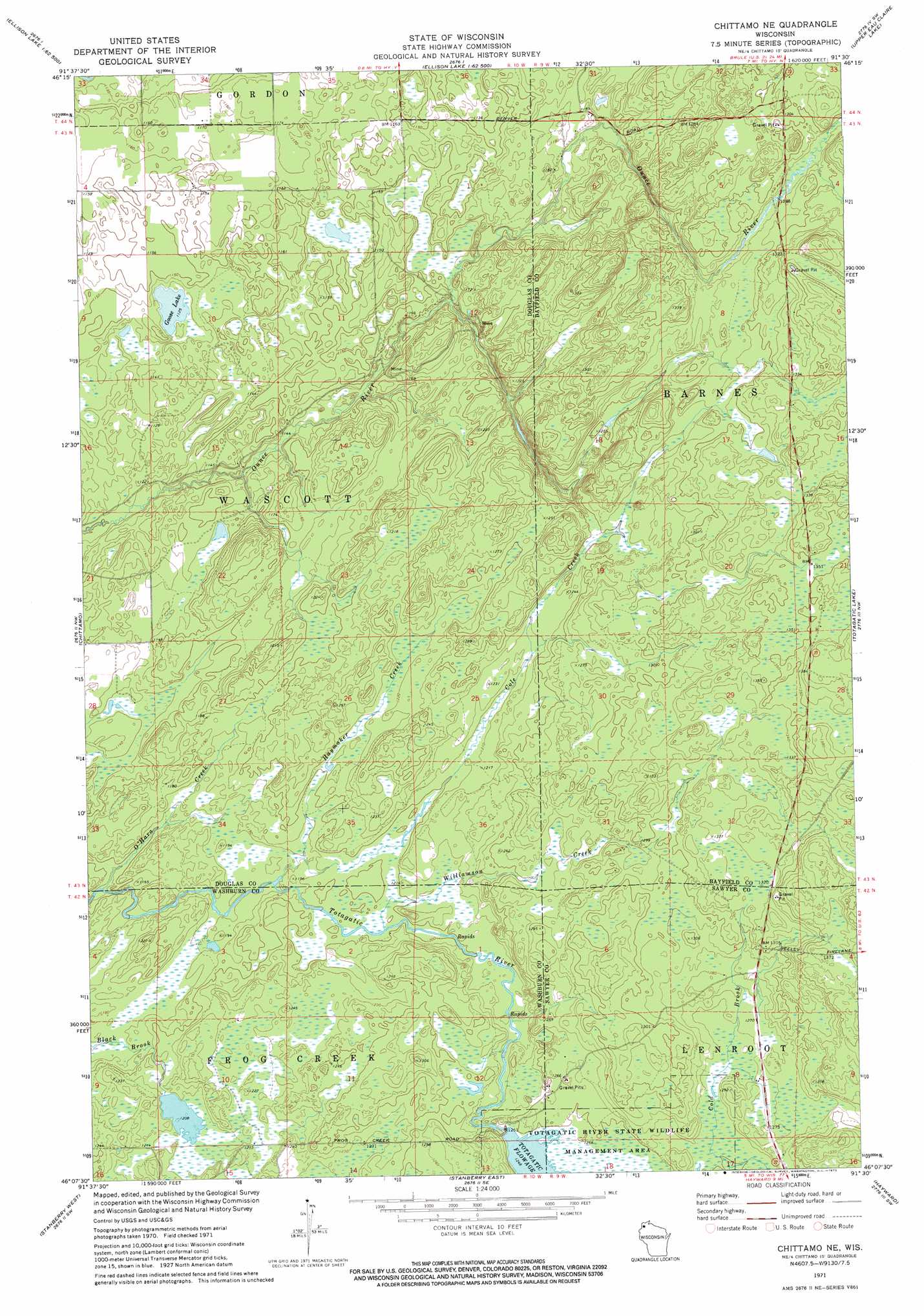
USGS Topo Quad 46091b5 - 1:24,000 scale
| Topo Map Name: | Chittamo Ne |
| USGS Topo Quad ID: | 46091b5 |
| Print Size: | ca. 21 1/4" wide x 27" high |
| Southeast Coordinates: | 46.125° N latitude / 91.5° W longitude |
| Map Center Coordinates: | 46.1875° N latitude / 91.5625° W longitude |
| U.S. State: | WI |
| Filename: | o46091b5.jpg |
| Download Map JPG Image: | Chittamo Ne topo map 1:24,000 scale |
| Map Type: | Topographic |
| Topo Series: | 7.5´ |
| Map Scale: | 1:24,000 |
| Source of Map Images: | United States Geological Survey (USGS) |
| Alternate Map Versions: |
Chittamo NE WI 1971, updated 1973 Download PDF Buy paper map Chittamo NE WI 2010 Download PDF Buy paper map Chittamo NE WI 2013 Download PDF Buy paper map Chittamo NE WI 2015 Download PDF Buy paper map |
1:24,000 Topo Quads surrounding Chittamo Ne
Bennett |
Lake Minnesuing |
Island Lake |
Drummond Nw |
Delta |
Solon Springs |
Metzger Lake |
Ellison Lake |
Upper Eau Claire Lake |
Drummond |
Gordon |
Chittamo |
Chittamo Ne |
Totagatic Lake |
Cable |
Minong |
Stanberry West |
Stanberry East |
Hayward |
Seeley |
Trego |
Springbrook |
Bean Lake |
Reserve |
Chief Lake |
> Back to 46091a1 at 1:100,000 scale
> Back to 46090a1 at 1:250,000 scale
> Back to U.S. Topo Maps home
Chittamo Ne topo map: Gazetteer
Chittamo Ne: Dams
Totagatic Wildlife 2WP804 Dam elevation 380m 1246′Chittamo Ne: Lakes
Goose Lake elevation 343m 1125′Chittamo Ne: Parks
Totagatic River State Wildlife Managemnet Area elevation 380m 1246′Chittamo Ne: Reservoirs
Totagatic Flowage elevation 380m 1246′Totagatic Flowage 67 elevation 383m 1256′
Chittamo Ne: Streams
Cole Creek elevation 359m 1177′Haymaker Creek elevation 359m 1177′
O'Hara Creek elevation 346m 1135′
Williamson Creek elevation 366m 1200′
Chittamo Ne digital topo map on disk
Buy this Chittamo Ne topo map showing relief, roads, GPS coordinates and other geographical features, as a high-resolution digital map file on DVD: