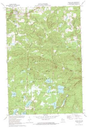
Grand View Topo Map Wisconsin
To zoom in, hover over the map of Grand View
USGS Topo Quad 46091c1 - 1:24,000 scale
| Topo Map Name: | Grand View |
| USGS Topo Quad ID: | 46091c1 |
| Print Size: | ca. 21 1/4" wide x 27" high |
| Southeast Coordinates: | 46.25° N latitude / 91° W longitude |
| Map Center Coordinates: | 46.3125° N latitude / 91.0625° W longitude |
| U.S. State: | WI |
| Filename: | o46091c1.jpg |
| Download Map JPG Image: | Grand View topo map 1:24,000 scale |
| Map Type: | Topographic |
| Topo Series: | 7.5´ |
| Map Scale: | 1:24,000 |
| Source of Map Images: | United States Geological Survey (USGS) |
| Alternate Map Versions: |
Grand View WI 1971, updated 1973 Download PDF Buy paper map Grand View WI 2005, updated 2006 Download PDF Buy paper map Grand View WI 2011 Download PDF Buy paper map Grand View WI 2013 Download PDF Buy paper map Grand View WI 2015 Download PDF Buy paper map |
| FStopo: | US Forest Service topo Grand View is available: Download FStopo PDF Download FStopo TIF |
1:24,000 Topo Quads surrounding Grand View
> Back to 46091a1 at 1:100,000 scale
> Back to 46090a1 at 1:250,000 scale
> Back to U.S. Topo Maps home
Grand View topo map: Gazetteer
Grand View: Lakes
Atkins Lake elevation 436m 1430′Bass Lake elevation 436m 1430′
Bullhead Lake elevation 431m 1414′
Club Lake elevation 443m 1453′
Deer Lake elevation 326m 1069′
East Davis Lake elevation 442m 1450′
Friedbauer Lake elevation 430m 1410′
Holmes Lake elevation 438m 1437′
Lake Knotting elevation 430m 1410′
Lake Lizzie elevation 433m 1420′
Lake Osborn elevation 356m 1167′
Olson Lake elevation 335m 1099′
Pre-emption Creek Pond elevation 439m 1440′
Siegal Lake elevation 326m 1069′
Spruce Lake elevation 439m 1440′
Taylor Lake elevation 433m 1420′
Trapper Lake elevation 428m 1404′
West Davis Lake elevation 440m 1443′
Grand View: Populated Places
Grand View elevation 320m 1049′Grand View: Streams
Jackson Creek elevation 424m 1391′Little Spring Creek elevation 316m 1036′
Pre-emption Creek elevation 311m 1020′
Grand View digital topo map on disk
Buy this Grand View topo map showing relief, roads, GPS coordinates and other geographical features, as a high-resolution digital map file on DVD:


