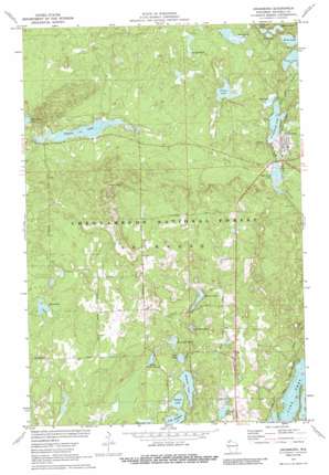
Drummond Topo Map Wisconsin
To zoom in, hover over the map of Drummond
USGS Topo Quad 46091c3 - 1:24,000 scale
| Topo Map Name: | Drummond |
| USGS Topo Quad ID: | 46091c3 |
| Print Size: | ca. 21 1/4" wide x 27" high |
| Southeast Coordinates: | 46.25° N latitude / 91.25° W longitude |
| Map Center Coordinates: | 46.3125° N latitude / 91.3125° W longitude |
| U.S. State: | WI |
| Filename: | o46091c3.jpg |
| Download Map JPG Image: | Drummond topo map 1:24,000 scale |
| Map Type: | Topographic |
| Topo Series: | 7.5´ |
| Map Scale: | 1:24,000 |
| Source of Map Images: | United States Geological Survey (USGS) |
| Alternate Map Versions: |
Drummond WI 1971, updated 1973 Download PDF Buy paper map Drummond WI 1971, updated 1985 Download PDF Buy paper map Drummond WI 1971, updated 1989 Download PDF Buy paper map Drummond WI 2005, updated 2006 Download PDF Buy paper map Drummond WI 2011 Download PDF Buy paper map Drummond WI 2013 Download PDF Buy paper map Drummond WI 2015 Download PDF Buy paper map |
| FStopo: | US Forest Service topo Drummond is available: Download FStopo PDF Download FStopo TIF |
1:24,000 Topo Quads surrounding Drummond
> Back to 46091a1 at 1:100,000 scale
> Back to 46090a1 at 1:250,000 scale
> Back to U.S. Topo Maps home
Drummond topo map: Gazetteer
Drummond: Dams
Cisco Lake Dam elevation 378m 1240′Drummond Dam elevation 398m 1305′
Drummond Lake 2WP1339 Dam elevation 380m 1246′
Drummond: Lakes
Armstrong Lake elevation 386m 1266′Balsam Pond elevation 393m 1289′
Bullhead Lake elevation 361m 1184′
Cisco Lake elevation 375m 1230′
Drummond Lake elevation 379m 1243′
Egg Lake elevation 380m 1246′
Esox Lake elevation 358m 1174′
Flynn Lake elevation 367m 1204′
Hammil Lake elevation 422m 1384′
Jorgenson Lake elevation 386m 1266′
Lake Dinner Camp elevation 428m 1404′
Lake Half Moon elevation 419m 1374′
Lake Holly elevation 422m 1384′
Lake Horseshoe elevation 419m 1374′
Lake Sixteen elevation 425m 1394′
Mill Pond Lake elevation 398m 1305′
Mirror Lake elevation 362m 1187′
Mountain Lake elevation 364m 1194′
Pigeon Lake elevation 375m 1230′
Rana Lake elevation 361m 1184′
Samoset Lake elevation 425m 1394′
Stewart Lake elevation 419m 1374′
Drummond: Populated Places
Drummond elevation 397m 1302′Lake Owen elevation 426m 1397′
Lake Owen (historical) elevation 422m 1384′
Drummond: Reservoirs
Cisco Lake 0.41 elevation 378m 1240′Drummond Lake 50 elevation 380m 1246′
Mill Pond Lake 45 elevation 398m 1305′
Drummond: Trails
Pigeon Lake Trail elevation 381m 1250′Drummond digital topo map on disk
Buy this Drummond topo map showing relief, roads, GPS coordinates and other geographical features, as a high-resolution digital map file on DVD:


