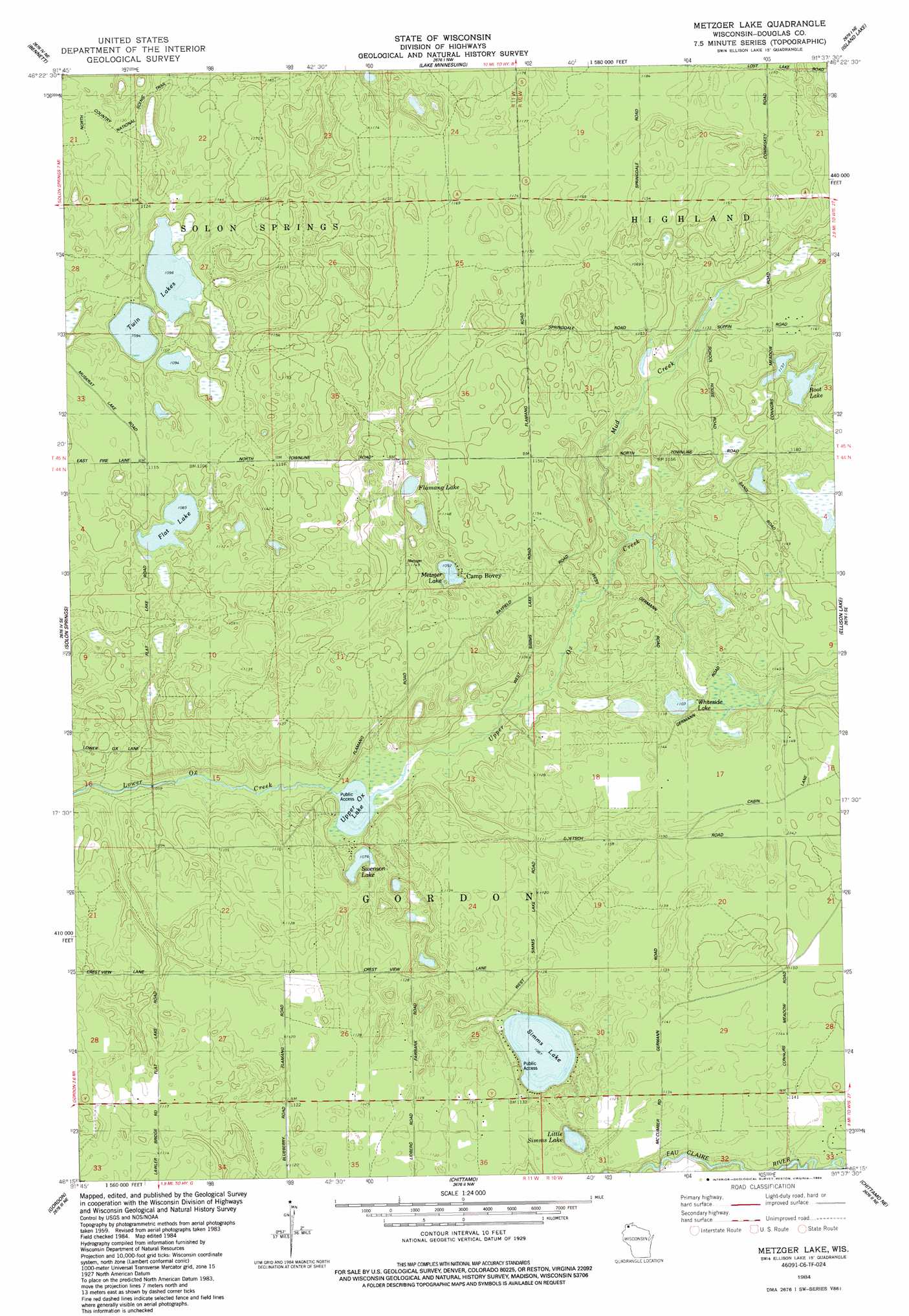
Metzger Lake Topo Map Wisconsin
To zoom in, hover over the map of Metzger Lake
USGS Topo Quad 46091c6 - 1:24,000 scale
| Topo Map Name: | Metzger Lake |
| USGS Topo Quad ID: | 46091c6 |
| Print Size: | ca. 21 1/4" wide x 27" high |
| Southeast Coordinates: | 46.25° N latitude / 91.625° W longitude |
| Map Center Coordinates: | 46.3125° N latitude / 91.6875° W longitude |
| U.S. State: | WI |
| Filename: | o46091c6.jpg |
| Download Map JPG Image: | Metzger Lake topo map 1:24,000 scale |
| Map Type: | Topographic |
| Topo Series: | 7.5´ |
| Map Scale: | 1:24,000 |
| Source of Map Images: | United States Geological Survey (USGS) |
| Alternate Map Versions: |
Metzger Lake WI 1984, updated 1984 Download PDF Buy paper map Metzger Lake WI 2010 Download PDF Buy paper map Metzger Lake WI 2013 Download PDF Buy paper map Metzger Lake WI 2015 Download PDF Buy paper map |
1:24,000 Topo Quads surrounding Metzger Lake
South Range |
Poplar |
Lake Nebagamon |
Brule |
Iron Lake |
Lyman Lake |
Bennett |
Lake Minnesuing |
Island Lake |
Drummond Nw |
Buckety Creek |
Solon Springs |
Metzger Lake |
Ellison Lake |
Upper Eau Claire Lake |
Minong Flowage |
Gordon |
Chittamo |
Chittamo Ne |
Totagatic Lake |
Horseshoe Lake |
Minong |
Stanberry West |
Stanberry East |
Hayward |
> Back to 46091a1 at 1:100,000 scale
> Back to 46090a1 at 1:250,000 scale
> Back to U.S. Topo Maps home
Metzger Lake topo map: Gazetteer
Metzger Lake: Airports
Solon Springs Municipal Airport elevation 335m 1099′Metzger Lake: Lakes
Boot Lake elevation 346m 1135′Flamang Lake elevation 337m 1105′
Flat Lake elevation 331m 1085′
Little Simms Lake elevation 329m 1079′
Metzger Lake elevation 332m 1089′
Simms Lake elevation 329m 1079′
Swenson Lake elevation 329m 1079′
Twin Lakes elevation 333m 1092′
Upper Ox Lake elevation 329m 1079′
Whiteside Lake elevation 336m 1102′
Metzger Lake: Streams
Mud Creek elevation 333m 1092′Upper Ox Creek elevation 329m 1079′
Metzger Lake digital topo map on disk
Buy this Metzger Lake topo map showing relief, roads, GPS coordinates and other geographical features, as a high-resolution digital map file on DVD: