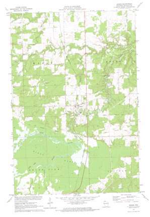
Mason Topo Map Wisconsin
To zoom in, hover over the map of Mason
USGS Topo Quad 46091d1 - 1:24,000 scale
| Topo Map Name: | Mason |
| USGS Topo Quad ID: | 46091d1 |
| Print Size: | ca. 21 1/4" wide x 27" high |
| Southeast Coordinates: | 46.375° N latitude / 91° W longitude |
| Map Center Coordinates: | 46.4375° N latitude / 91.0625° W longitude |
| U.S. State: | WI |
| Filename: | o46091d1.jpg |
| Download Map JPG Image: | Mason topo map 1:24,000 scale |
| Map Type: | Topographic |
| Topo Series: | 7.5´ |
| Map Scale: | 1:24,000 |
| Source of Map Images: | United States Geological Survey (USGS) |
| Alternate Map Versions: |
Mason WI 1971, updated 1973 Download PDF Buy paper map Mason WI 2010 Download PDF Buy paper map Mason WI 2013 Download PDF Buy paper map Mason WI 2015 Download PDF Buy paper map |
1:24,000 Topo Quads surrounding Mason
> Back to 46091a1 at 1:100,000 scale
> Back to 46090a1 at 1:250,000 scale
> Back to U.S. Topo Maps home
Mason topo map: Gazetteer
Mason: Parks
Bibon Swamp State Natural Area elevation 278m 912′Mason: Populated Places
Mason elevation 286m 938′Mason: Streams
Eighteenmile Creek elevation 277m 908′Long Lake Branch elevation 276m 905′
Mud Creek elevation 280m 918′
Schramm Creek elevation 253m 830′
Spring Creek elevation 255m 836′
Twentymile Creek elevation 275m 902′
Mason: Swamps
Bibon Marsh elevation 278m 912′Mason digital topo map on disk
Buy this Mason topo map showing relief, roads, GPS coordinates and other geographical features, as a high-resolution digital map file on DVD:


