Mount Valhalla Topo Map Wisconsin
To zoom in, hover over the map of Mount Valhalla
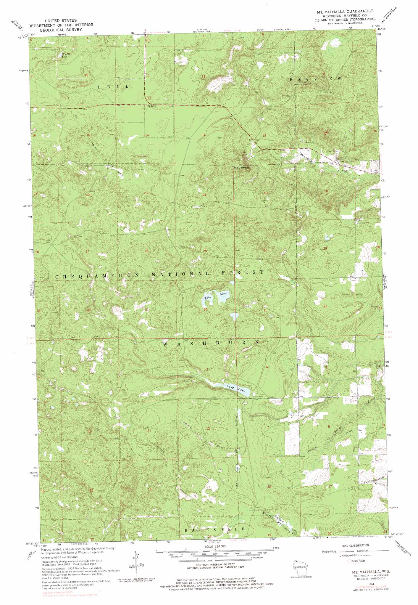
USGS Topo Quad 46091f1 - 1:24,000 scale
| Topo Map Name: | Mount Valhalla |
| USGS Topo Quad ID: | 46091f1 |
| Print Size: | ca. 21 1/4" wide x 27" high |
| Southeast Coordinates: | 46.625° N latitude / 91° W longitude |
| Map Center Coordinates: | 46.6875° N latitude / 91.0625° W longitude |
| U.S. State: | WI |
| Filename: | o46091f1.jpg |
| Download Map JPG Image: | Mount Valhalla topo map 1:24,000 scale |
| Map Type: | Topographic |
| Topo Series: | 7.5´ |
| Map Scale: | 1:24,000 |
| Source of Map Images: | United States Geological Survey (USGS) |
| Alternate Map Versions: |
Mt. Valhalla WI 1964, updated 1965 Download PDF Buy paper map Mt. Valhalla WI 1964, updated 1977 Download PDF Buy paper map Mt. Valhalla WI 1964, updated 1985 Download PDF Buy paper map Mount Valhalla WI 2005, updated 2006 Download PDF Buy paper map Mount Valhalla WI 2011 Download PDF Buy paper map Mount Valhalla WI 2013 Download PDF Buy paper map Mount Valhalla WI 2015 Download PDF Buy paper map |
| FStopo: | US Forest Service topo Mount Valhalla is available: Download FStopo PDF Download FStopo TIF |
1:24,000 Topo Quads surrounding Mount Valhalla
Squaw Bay |
Sand Island |
York Island |
||
Herbster |
Bark Bay |
Cornucopia |
Mount Ashwabay |
Bayfield |
Iron Lake Ne |
Moquah Nw |
Mount Valhalla |
Washburn |
Long Island |
Hart Lake |
Ino |
Moquah |
Ashland West |
Ashland East |
Delta |
Grandview Nw |
Mason |
Sanborn |
Marengo |
> Back to 46091e1 at 1:100,000 scale
> Back to 46090a1 at 1:250,000 scale
> Back to U.S. Topo Maps home
Mount Valhalla topo map: Gazetteer
Mount Valhalla: Lakes
Crystal Lake elevation 348m 1141′Long Lake elevation 326m 1069′
Twin Lakes elevation 335m 1099′
Mount Valhalla: Summits
Mount Valhalla elevation 412m 1351′Mount Valhalla digital topo map on disk
Buy this Mount Valhalla topo map showing relief, roads, GPS coordinates and other geographical features, as a high-resolution digital map file on DVD: