Cloverland Topo Map Wisconsin
To zoom in, hover over the map of Cloverland
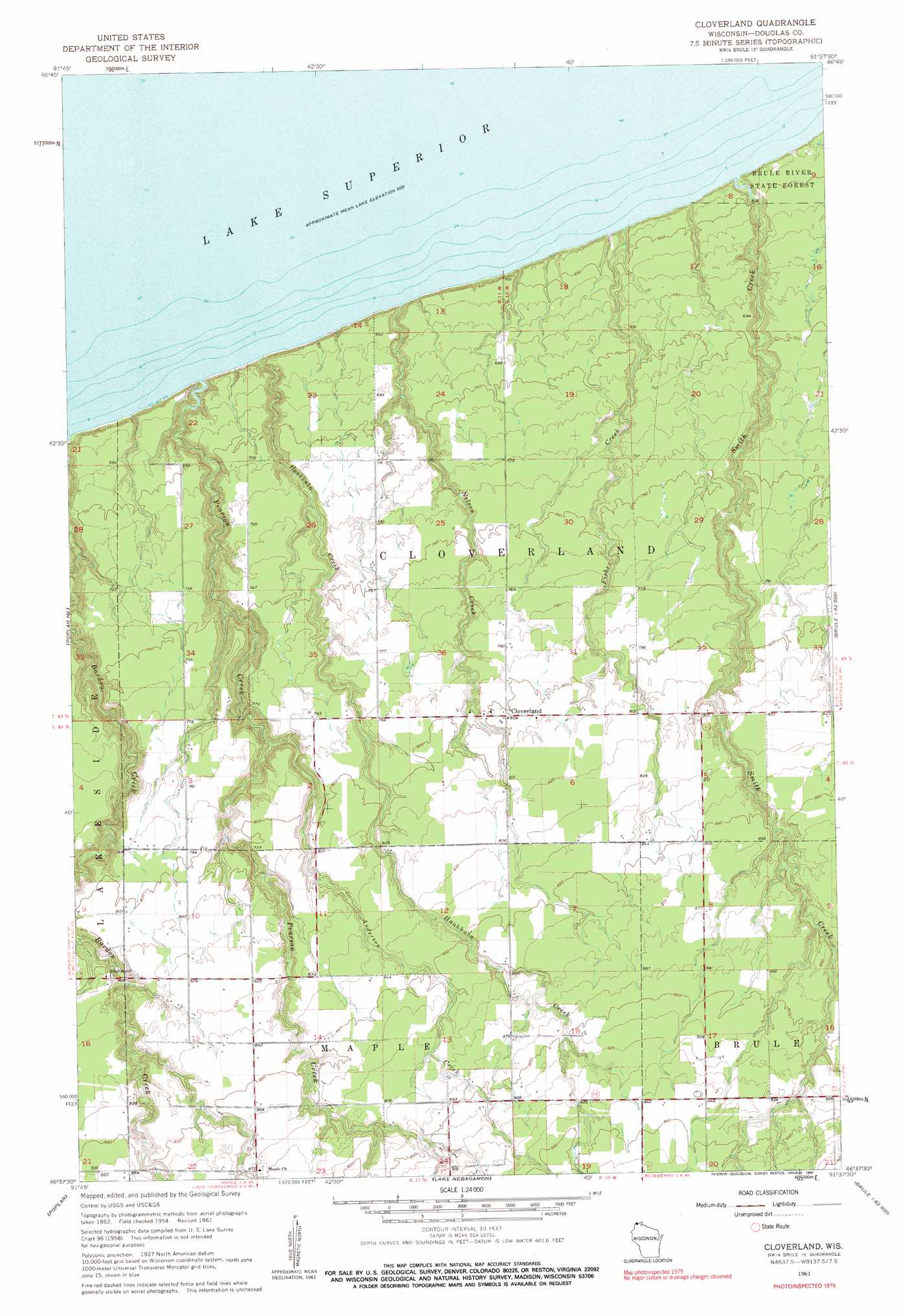
USGS Topo Quad 46091f6 - 1:24,000 scale
| Topo Map Name: | Cloverland |
| USGS Topo Quad ID: | 46091f6 |
| Print Size: | ca. 21 1/4" wide x 27" high |
| Southeast Coordinates: | 46.625° N latitude / 91.625° W longitude |
| Map Center Coordinates: | 46.6875° N latitude / 91.6875° W longitude |
| U.S. State: | WI |
| Filename: | o46091f6.jpg |
| Download Map JPG Image: | Cloverland topo map 1:24,000 scale |
| Map Type: | Topographic |
| Topo Series: | 7.5´ |
| Map Scale: | 1:24,000 |
| Source of Map Images: | United States Geological Survey (USGS) |
| Alternate Map Versions: |
Cloverland WI 1954, updated 1955 Download PDF Buy paper map Cloverland WI 1961, updated 1962 Download PDF Buy paper map Cloverland WI 1961, updated 1990 Download PDF Buy paper map Cloverland WI 2010 Download PDF Buy paper map Cloverland WI 2013 Download PDF Buy paper map Cloverland WI 2015 Download PDF Buy paper map |
1:24,000 Topo Quads surrounding Cloverland
French River |
Knife River |
|||
Lakewood |
Port Wing |
|||
Parkland |
Poplar Ne |
Cloverland |
Oulu |
Blaine Creek |
South Range |
Poplar |
Lake Nebagamon |
Brule |
Iron Lake |
Lyman Lake |
Bennett |
Lake Minnesuing |
Island Lake |
Drummond Nw |
> Back to 46091e1 at 1:100,000 scale
> Back to 46090a1 at 1:250,000 scale
> Back to U.S. Topo Maps home
Cloverland topo map: Gazetteer
Cloverland: Parks
Bear Beach State Natural Area elevation 191m 626′Cloverland: Populated Places
Cloverland elevation 244m 800′Cloverland: Streams
Anderson Creek elevation 215m 705′Bardon Creek elevation 184m 603′
Fisher Creek elevation 186m 610′
Haukkala Creek elevation 184m 603′
Nelson Creek elevation 183m 600′
Pearson Creek elevation 184m 603′
Smith Creek elevation 184m 603′
Cloverland digital topo map on disk
Buy this Cloverland topo map showing relief, roads, GPS coordinates and other geographical features, as a high-resolution digital map file on DVD: