Frog Lake Topo Map Wisconsin
To zoom in, hover over the map of Frog Lake
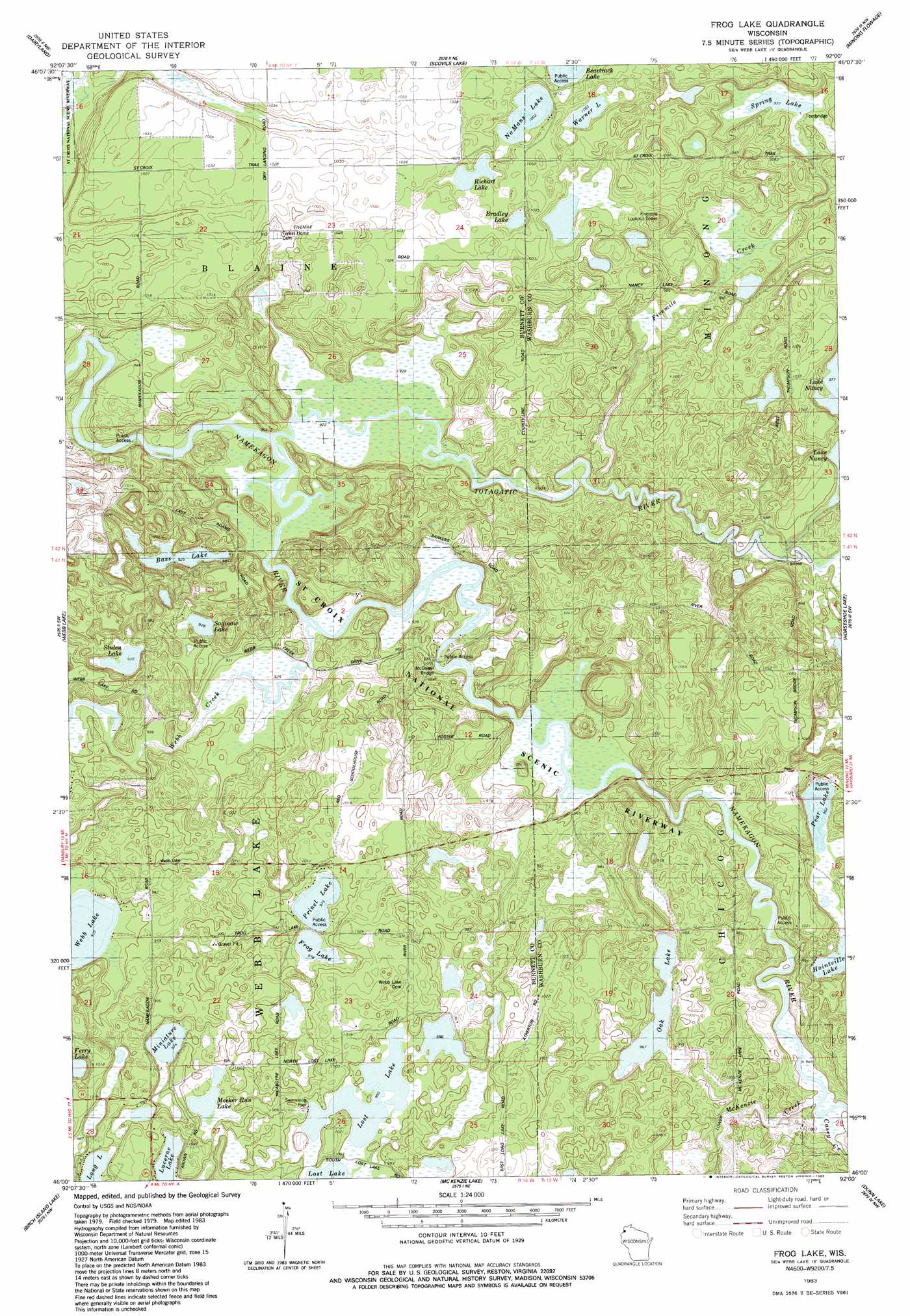
USGS Topo Quad 46092a1 - 1:24,000 scale
| Topo Map Name: | Frog Lake |
| USGS Topo Quad ID: | 46092a1 |
| Print Size: | ca. 21 1/4" wide x 27" high |
| Southeast Coordinates: | 46° N latitude / 92° W longitude |
| Map Center Coordinates: | 46.0625° N latitude / 92.0625° W longitude |
| U.S. State: | WI |
| Filename: | o46092a1.jpg |
| Download Map JPG Image: | Frog Lake topo map 1:24,000 scale |
| Map Type: | Topographic |
| Topo Series: | 7.5´ |
| Map Scale: | 1:24,000 |
| Source of Map Images: | United States Geological Survey (USGS) |
| Alternate Map Versions: |
Frog Lake WI 1983, updated 1983 Download PDF Buy paper map Frog Lake WI 2010 Download PDF Buy paper map Frog Lake WI 2013 Download PDF Buy paper map Frog Lake WI 2015 Download PDF Buy paper map |
1:24,000 Topo Quads surrounding Frog Lake
Black Lake |
Moose Junction |
Empire Swamp |
Buckety Creek |
Solon Springs |
Cloverton |
Dairyland |
Scovils Lake |
Minong Flowage |
Gordon |
Danbury East |
Webb Lake |
Frog Lake |
Horseshoe Lake |
Minong |
Webster |
Birch Island Lake |
Mckenzie Lake |
Dunn Lake |
Trego |
Siren East |
Hertel |
Poquettes Lake |
Spooner |
Spooner Lake |
> Back to 46092a1 at 1:100,000 scale
> Back to 46092a1 at 1:250,000 scale
> Back to U.S. Topo Maps home
Frog Lake topo map: Gazetteer
Frog Lake: Bridges
McDowel Bridge elevation 284m 931′Frog Lake: Dams
Lower Lost Lake 2WP936 Dam elevation 301m 987′Webb Lake 2WP466 Dam elevation 284m 931′
Frog Lake: Lakes
Bass Lake elevation 281m 921′Bradley Lake elevation 305m 1000′
Ferry Lake elevation 290m 951′
Frog Lake elevation 296m 971′
Lucerne Lake elevation 299m 980′
Meeker Run Lake elevation 299m 980′
Miniature Lake elevation 296m 971′
No Mans Lake elevation 305m 1000′
Oak Lake elevation 293m 961′
Pear Lake elevation 293m 961′
Prinel Lake elevation 297m 974′
Richart Lake elevation 305m 1000′
Saginaw Lake elevation 282m 925′
Spring Lake elevation 296m 971′
Stulen Lake elevation 284m 931′
Warner Lake elevation 305m 1000′
Frog Lake: Reservoirs
Lost Lake elevation 301m 987′Webb Lake 18 elevation 284m 931′
Frog Lake: Streams
Casey Creek elevation 288m 944′Fivemile Creek elevation 284m 931′
McKenzie Creek elevation 288m 944′
Totagatic River elevation 281m 921′
Webb Creek elevation 282m 925′
Frog Lake digital topo map on disk
Buy this Frog Lake topo map showing relief, roads, GPS coordinates and other geographical features, as a high-resolution digital map file on DVD: