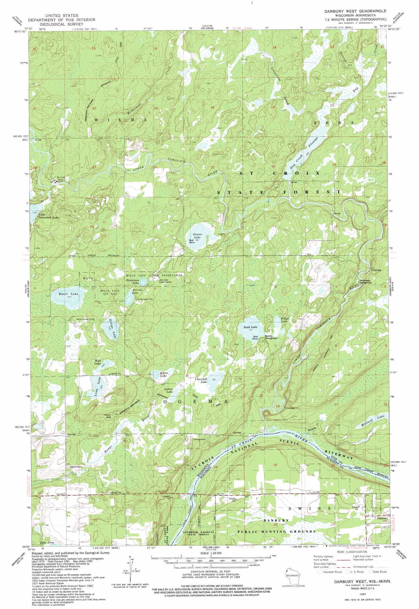
Danbury West Topo Map Minnesota
To zoom in, hover over the map of Danbury West
USGS Topo Quad 46092a4 - 1:24,000 scale
| Topo Map Name: | Danbury West |
| USGS Topo Quad ID: | 46092a4 |
| Print Size: | ca. 21 1/4" wide x 27" high |
| Southeast Coordinates: | 46° N latitude / 92.375° W longitude |
| Map Center Coordinates: | 46.0625° N latitude / 92.4375° W longitude |
| U.S. States: | MN, WI |
| Filename: | o46092a4.jpg |
| Download Map JPG Image: | Danbury West topo map 1:24,000 scale |
| Map Type: | Topographic |
| Topo Series: | 7.5´ |
| Map Scale: | 1:24,000 |
| Source of Map Images: | United States Geological Survey (USGS) |
| Alternate Map Versions: |
Danbury West WI 1983, updated 1983 Download PDF Buy paper map Danbury West WI 2010 Download PDF Buy paper map Danbury West WI 2013 Download PDF Buy paper map Danbury West WI 2015 Download PDF Buy paper map |
1:24,000 Topo Quads surrounding Danbury West
Bruno |
Kerrick |
Holyoke Sw |
Black Lake |
Moose Junction |
Askov Lookout Tower |
Duxbury |
Ox Creek |
Cloverton |
Dairyland |
Cloverdale |
Wilbur Lake |
Danbury West |
Danbury East |
Webb Lake |
Lake Clayton |
Saint Johns Landing |
Yellow Lake |
Webster |
Birch Island Lake |
Grantsburg |
Falun |
Siren West |
Siren East |
Hertel |
> Back to 46092a1 at 1:100,000 scale
> Back to 46092a1 at 1:250,000 scale
> Back to U.S. Topo Maps home
Danbury West topo map: Gazetteer
Danbury West: Dams
Hay Creek Dam elevation 313m 1026′Danbury West: Forests
Saint Croix State Forest elevation 308m 1010′Danbury West: Lakes
Benjamin Lake elevation 309m 1013′Billys Lake elevation 302m 990′
Churchill Lake elevation 304m 997′
Graces Lake elevation 299m 980′
Greigs Lake elevation 308m 1010′
Hay Creek Flowage elevation 299m 980′
Keene Lake elevation 298m 977′
Lena Lake elevation 305m 1000′
Mallard Lake elevation 290m 951′
Mud Lake elevation 305m 1000′
Razor Lake elevation 308m 1010′
Rock Lake elevation 302m 990′
Stevens Lake elevation 308m 1010′
Sutton Lake elevation 300m 984′
Danbury West: Reservoirs
Hay Creek Reservoir elevation 313m 1026′Danbury West: Streams
Albrechts Creek elevation 284m 931′Hanson Creek elevation 303m 994′
Hay Creek elevation 299m 980′
Longstrem Brook elevation 301m 987′
Lower Tamarack River elevation 265m 869′
McDermott Creek elevation 309m 1013′
Sangeta Creek elevation 265m 869′
Danbury West: Trails
Markville Snowmobile Trail elevation 302m 990′Danbury West digital topo map on disk
Buy this Danbury West topo map showing relief, roads, GPS coordinates and other geographical features, as a high-resolution digital map file on DVD: