Empire Swamp Topo Map Wisconsin
To zoom in, hover over the map of Empire Swamp
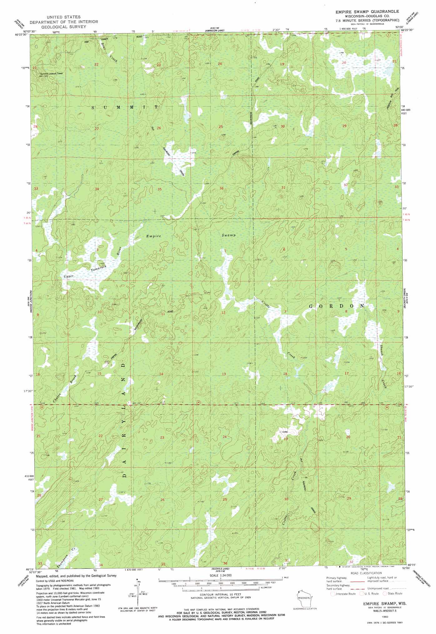
USGS Topo Quad 46092c1 - 1:24,000 scale
| Topo Map Name: | Empire Swamp |
| USGS Topo Quad ID: | 46092c1 |
| Print Size: | ca. 21 1/4" wide x 27" high |
| Southeast Coordinates: | 46.25° N latitude / 92° W longitude |
| Map Center Coordinates: | 46.3125° N latitude / 92.0625° W longitude |
| U.S. State: | WI |
| Filename: | o46092c1.jpg |
| Download Map JPG Image: | Empire Swamp topo map 1:24,000 scale |
| Map Type: | Topographic |
| Topo Series: | 7.5´ |
| Map Scale: | 1:24,000 |
| Source of Map Images: | United States Geological Survey (USGS) |
| Alternate Map Versions: |
Empire Swamp WI 1983, updated 1983 Download PDF Buy paper map Empire Swamp WI 2010 Download PDF Buy paper map Empire Swamp WI 2013 Download PDF Buy paper map Empire Swamp WI 2015 Download PDF Buy paper map |
1:24,000 Topo Quads surrounding Empire Swamp
Frogner |
Borea |
Sunnyside |
South Range |
Poplar |
Foxboro |
Patzau |
Amnicon Lake |
Lyman Lake |
Bennett |
Black Lake |
Moose Junction |
Empire Swamp |
Buckety Creek |
Solon Springs |
Cloverton |
Dairyland |
Scovils Lake |
Minong Flowage |
Gordon |
Danbury East |
Webb Lake |
Frog Lake |
Horseshoe Lake |
Minong |
> Back to 46092a1 at 1:100,000 scale
> Back to 46092a1 at 1:250,000 scale
> Back to U.S. Topo Maps home
Empire Swamp digital topo map on disk
Buy this Empire Swamp topo map showing relief, roads, GPS coordinates and other geographical features, as a high-resolution digital map file on DVD: