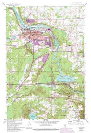
Cloquet Topo Map Minnesota
To zoom in, hover over the map of Cloquet
USGS Topo Quad 46092f4 - 1:24,000 scale
| Topo Map Name: | Cloquet |
| USGS Topo Quad ID: | 46092f4 |
| Print Size: | ca. 21 1/4" wide x 27" high |
| Southeast Coordinates: | 46.625° N latitude / 92.375° W longitude |
| Map Center Coordinates: | 46.6875° N latitude / 92.4375° W longitude |
| U.S. State: | MN |
| Filename: | o46092f4.jpg |
| Download Map JPG Image: | Cloquet topo map 1:24,000 scale |
| Map Type: | Topographic |
| Topo Series: | 7.5´ |
| Map Scale: | 1:24,000 |
| Source of Map Images: | United States Geological Survey (USGS) |
| Alternate Map Versions: |
Cloquet MN 1954, updated 1955 Download PDF Buy paper map Cloquet MN 1954, updated 1967 Download PDF Buy paper map Cloquet MN 1954, updated 1971 Download PDF Buy paper map Cloquet MN 1954, updated 1976 Download PDF Buy paper map Cloquet MN 1954, updated 1993 Download PDF Buy paper map Cloquet MN 2010 Download PDF Buy paper map Cloquet MN 2013 Download PDF Buy paper map Cloquet MN 2016 Download PDF Buy paper map |
1:24,000 Topo Quads surrounding Cloquet
> Back to 46092e1 at 1:100,000 scale
> Back to 46092a1 at 1:250,000 scale
> Back to U.S. Topo Maps home
Cloquet topo map: Gazetteer
Cloquet: Crossings
Interchange 235 elevation 356m 1167′Interchange 237 elevation 366m 1200′
Interchange 239 elevation 343m 1125′
Cloquet: Dams
Cloquet Dam elevation 357m 1171′Knife Falls Dam elevation 360m 1181′
Scanlon Dam elevation 342m 1122′
Thomson Dam elevation 326m 1069′
Cloquet: Islands
Dunlap Island elevation 361m 1184′Cloquet: Lakes
First Lake elevation 385m 1263′Second Lake elevation 385m 1263′
Cloquet: Parks
Athletic Park elevation 379m 1243′Braun Park elevation 370m 1213′
Fauley Park elevation 365m 1197′
Hilltop Park elevation 369m 1210′
Pine Valley Park elevation 382m 1253′
Pinehurst Park elevation 371m 1217′
Sather Park elevation 368m 1207′
Spafford Park elevation 360m 1181′
Sunnyside Park elevation 396m 1299′
Veterans Park elevation 363m 1190′
Wentworth Park elevation 365m 1197′
Cloquet: Populated Places
Alford elevation 312m 1023′Bergstrom's Mobile Home Park elevation 367m 1204′
Carlton elevation 330m 1082′
Cloquet elevation 368m 1207′
Scanlon elevation 368m 1207′
Sunnyside Estates Mobile Home Park elevation 393m 1289′
Thomson elevation 321m 1053′
Cloquet: Post Offices
Carlton Post Office elevation 329m 1079′Cloquet Post Office elevation 367m 1204′
Scanlon Post Office elevation 368m 1207′
Thomson Post Office (historical) elevation 321m 1053′
Cloquet: Reservoirs
Thomson Reservoir elevation 325m 1066′Thomson Reservoir elevation 326m 1069′
Cloquet: Streams
Crystal Creek elevation 334m 1095′Little Otter Creek elevation 341m 1118′
Midway River elevation 326m 1069′
Otter Creek elevation 303m 994′
Cloquet digital topo map on disk
Buy this Cloquet topo map showing relief, roads, GPS coordinates and other geographical features, as a high-resolution digital map file on DVD:


