Iverson Topo Map Minnesota
To zoom in, hover over the map of Iverson
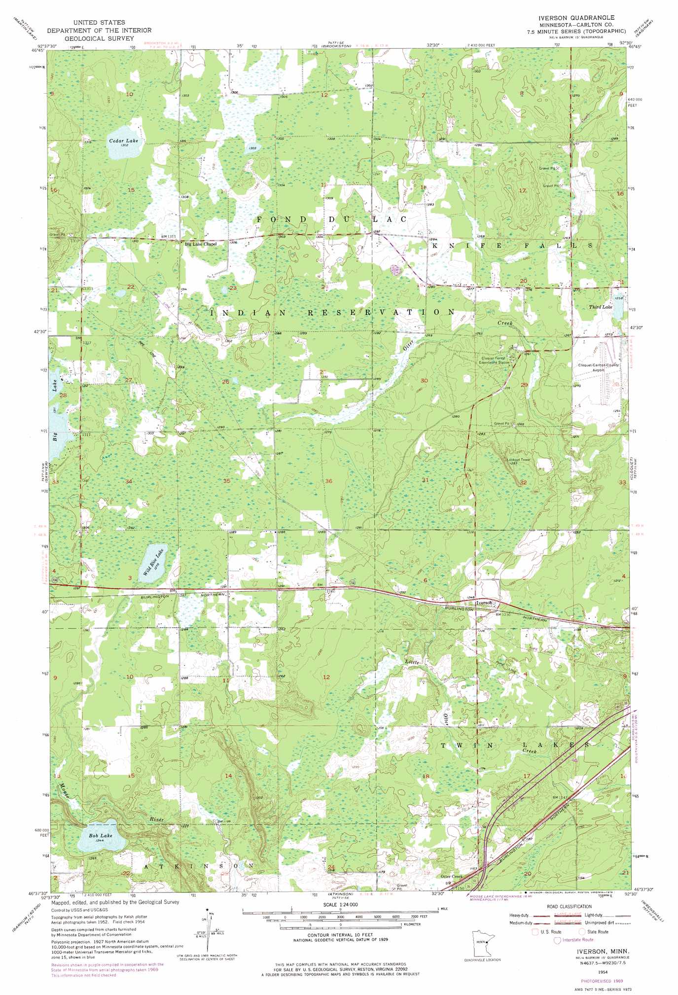
USGS Topo Quad 46092f5 - 1:24,000 scale
| Topo Map Name: | Iverson |
| USGS Topo Quad ID: | 46092f5 |
| Print Size: | ca. 21 1/4" wide x 27" high |
| Southeast Coordinates: | 46.625° N latitude / 92.5° W longitude |
| Map Center Coordinates: | 46.6875° N latitude / 92.5625° W longitude |
| U.S. State: | MN |
| Filename: | o46092f5.jpg |
| Download Map JPG Image: | Iverson topo map 1:24,000 scale |
| Map Type: | Topographic |
| Topo Series: | 7.5´ |
| Map Scale: | 1:24,000 |
| Source of Map Images: | United States Geological Survey (USGS) |
| Alternate Map Versions: |
Iverson MN 1954, updated 1955 Download PDF Buy paper map Iverson MN 1954, updated 1971 Download PDF Buy paper map Iverson MN 2010 Download PDF Buy paper map Iverson MN 2013 Download PDF Buy paper map Iverson MN 2016 Download PDF Buy paper map |
1:24,000 Topo Quads surrounding Iverson
Mccarty River |
Brookston Nw |
Alborn |
Independence |
Twig |
Gowan |
Martin Lake |
Brookston |
Saginaw |
Adolph |
Cromwell East |
Sawyer |
Iverson |
Cloquet |
Esko |
Cromwell Se |
Barnum |
Atkinson |
Wrenshall |
Frogner |
Moose Lake |
Hanging Horn Lake |
Nickerson |
Holyoke |
Foxboro |
> Back to 46092e1 at 1:100,000 scale
> Back to 46092a1 at 1:250,000 scale
> Back to U.S. Topo Maps home
Iverson topo map: Gazetteer
Iverson: Airports
Cloquet Carlton County Airport elevation 390m 1279′Iverson: Lakes
Bob Lake elevation 379m 1243′Cedar Lake elevation 397m 1302′
Third Lake elevation 384m 1259′
Wild Rice Lake elevation 390m 1279′
Iverson: Populated Places
Big Lake Chapel elevation 399m 1309′Iverson elevation 375m 1230′
Otter Creek elevation 351m 1151′
Iverson: Post Offices
Iverson Post Office elevation 375m 1230′Iverson digital topo map on disk
Buy this Iverson topo map showing relief, roads, GPS coordinates and other geographical features, as a high-resolution digital map file on DVD: