Martin Lake Topo Map Minnesota
To zoom in, hover over the map of Martin Lake
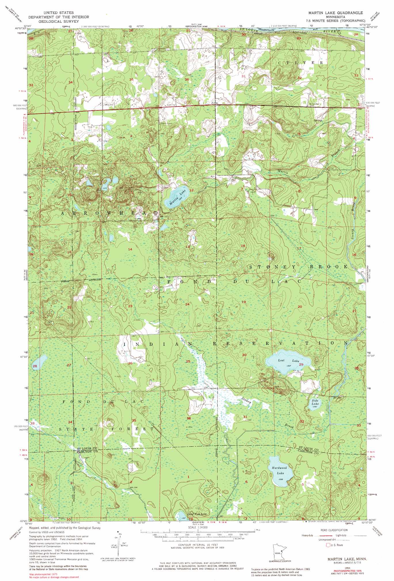
USGS Topo Quad 46092g6 - 1:24,000 scale
| Topo Map Name: | Martin Lake |
| USGS Topo Quad ID: | 46092g6 |
| Print Size: | ca. 21 1/4" wide x 27" high |
| Southeast Coordinates: | 46.75° N latitude / 92.625° W longitude |
| Map Center Coordinates: | 46.8125° N latitude / 92.6875° W longitude |
| U.S. State: | MN |
| Filename: | o46092g6.jpg |
| Download Map JPG Image: | Martin Lake topo map 1:24,000 scale |
| Map Type: | Topographic |
| Topo Series: | 7.5´ |
| Map Scale: | 1:24,000 |
| Source of Map Images: | United States Geological Survey (USGS) |
| Alternate Map Versions: |
Martin Lake MN 1954, updated 1956 Download PDF Buy paper map Martin Lake MN 1954, updated 1970 Download PDF Buy paper map Martin Lake MN 1954, updated 1980 Download PDF Buy paper map Martin Lake MN 2010 Download PDF Buy paper map Martin Lake MN 2013 Download PDF Buy paper map Martin Lake MN 2016 Download PDF Buy paper map |
1:24,000 Topo Quads surrounding Martin Lake
Toivola Sw |
Elmer |
Meadowlands |
Payne |
Canyon |
Floodwood |
Mccarty River |
Brookston Nw |
Alborn |
Independence |
Prairie Lake |
Gowan |
Martin Lake |
Brookston |
Saginaw |
Cromwell West |
Cromwell East |
Sawyer |
Iverson |
Cloquet |
Heikkila Creek |
Cromwell Se |
Barnum |
Atkinson |
Wrenshall |
> Back to 46092e1 at 1:100,000 scale
> Back to 46092a1 at 1:250,000 scale
> Back to U.S. Topo Maps home
Martin Lake topo map: Gazetteer
Martin Lake: Lakes
Hardwood Lake elevation 393m 1289′Lost Lake elevation 399m 1309′
Martin Lake elevation 401m 1315′
Side Lake elevation 391m 1282′
Martin Lake digital topo map on disk
Buy this Martin Lake topo map showing relief, roads, GPS coordinates and other geographical features, as a high-resolution digital map file on DVD: