Gowan Topo Map Minnesota
To zoom in, hover over the map of Gowan
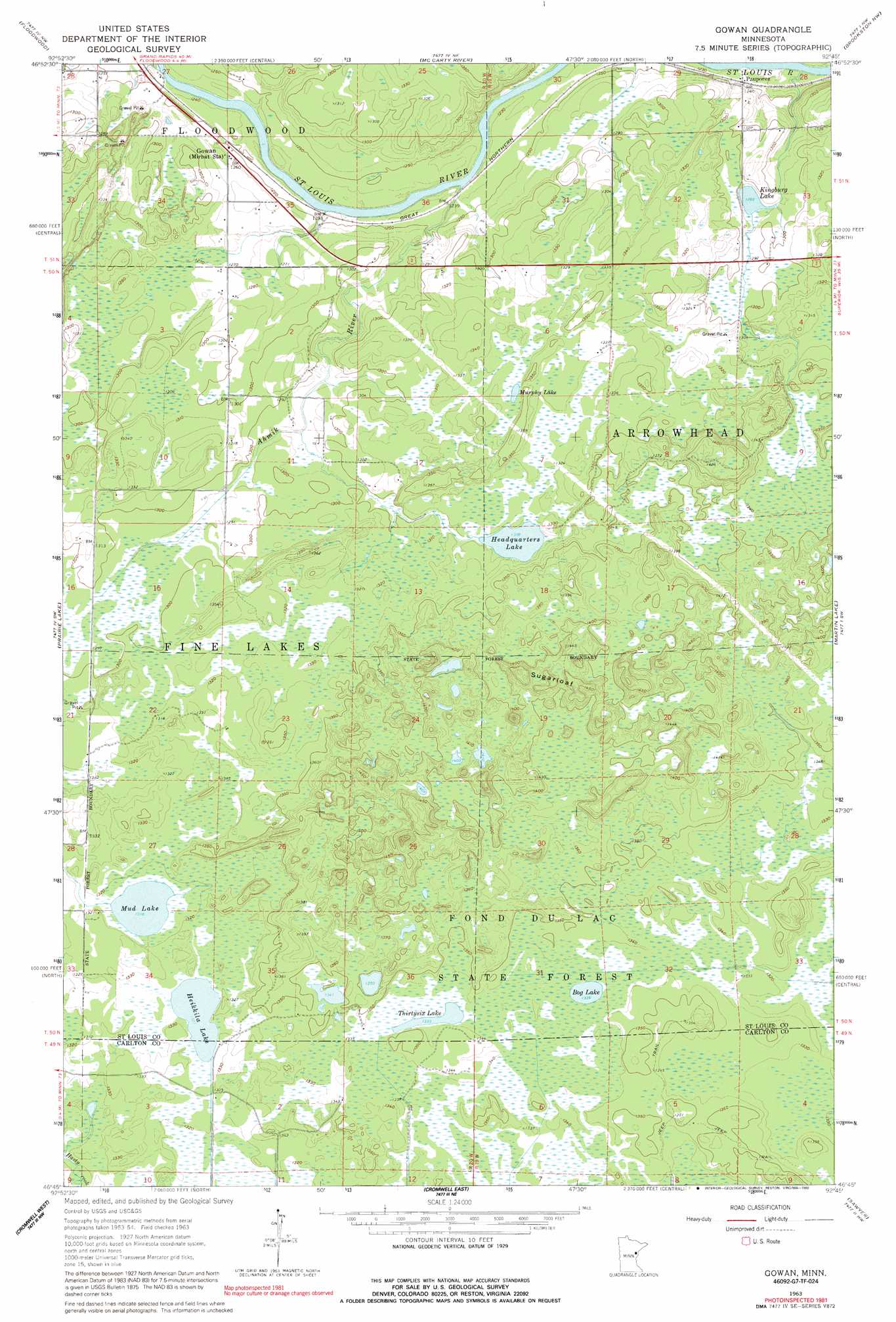
USGS Topo Quad 46092g7 - 1:24,000 scale
| Topo Map Name: | Gowan |
| USGS Topo Quad ID: | 46092g7 |
| Print Size: | ca. 21 1/4" wide x 27" high |
| Southeast Coordinates: | 46.75° N latitude / 92.75° W longitude |
| Map Center Coordinates: | 46.8125° N latitude / 92.8125° W longitude |
| U.S. State: | MN |
| Filename: | o46092g7.jpg |
| Download Map JPG Image: | Gowan topo map 1:24,000 scale |
| Map Type: | Topographic |
| Topo Series: | 7.5´ |
| Map Scale: | 1:24,000 |
| Source of Map Images: | United States Geological Survey (USGS) |
| Alternate Map Versions: |
Gowan MN 1963, updated 1964 Download PDF Buy paper map Gowan MN 1963, updated 1986 Download PDF Buy paper map Gowan MN 1963, updated 1992 Download PDF Buy paper map Gowan MN 2010 Download PDF Buy paper map Gowan MN 2013 Download PDF Buy paper map Gowan MN 2016 Download PDF Buy paper map |
1:24,000 Topo Quads surrounding Gowan
Wawina |
Toivola Sw |
Elmer |
Meadowlands |
Payne |
Island |
Floodwood |
Mccarty River |
Brookston Nw |
Alborn |
Little Prairie Lake |
Prairie Lake |
Gowan |
Martin Lake |
Brookston |
Wright |
Cromwell West |
Cromwell East |
Sawyer |
Iverson |
Automba |
Heikkila Creek |
Cromwell Se |
Barnum |
Atkinson |
> Back to 46092e1 at 1:100,000 scale
> Back to 46092a1 at 1:250,000 scale
> Back to U.S. Topo Maps home
Gowan topo map: Gazetteer
Gowan: Lakes
Bog Lake elevation 407m 1335′Headquarters Lake elevation 399m 1309′
Heikkila Lake elevation 403m 1322′
Kingburg Lake elevation 391m 1282′
Mud Lake elevation 402m 1318′
Murphy Lake elevation 404m 1325′
Thirtysix Lake elevation 406m 1332′
Gowan: Populated Places
Gowan elevation 385m 1263′Paupores elevation 381m 1250′
Gowan: Post Offices
Catlin Post Office (historical) elevation 385m 1263′Gowan Post Office (historical) elevation 384m 1259′
Gowan: Streams
Ahmik River elevation 371m 1217′Gowan: Summits
Sugarloaf elevation 452m 1482′Gowan digital topo map on disk
Buy this Gowan topo map showing relief, roads, GPS coordinates and other geographical features, as a high-resolution digital map file on DVD: