Mccarty River Topo Map Minnesota
To zoom in, hover over the map of Mccarty River
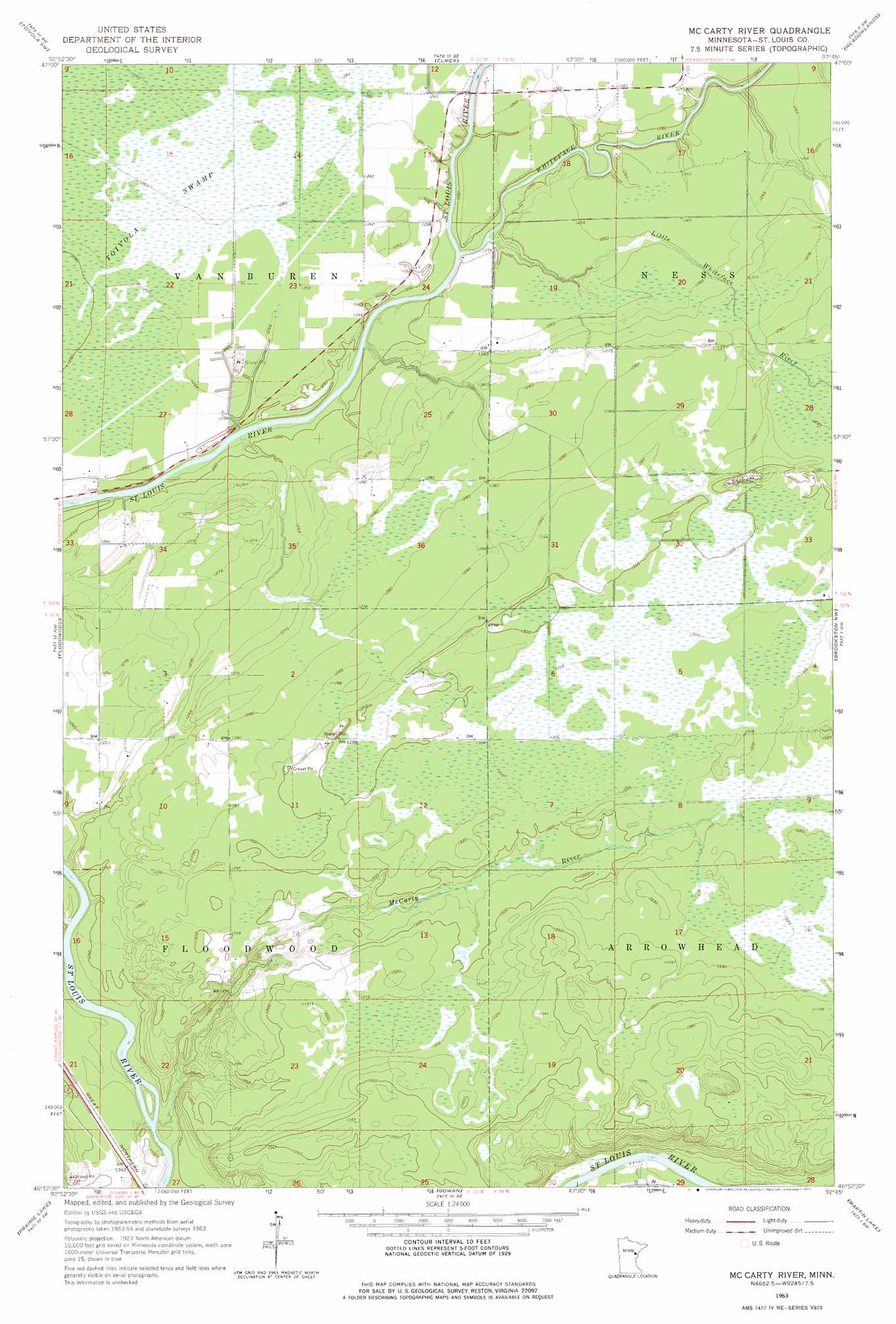
USGS Topo Quad 46092h7 - 1:24,000 scale
| Topo Map Name: | Mccarty River |
| USGS Topo Quad ID: | 46092h7 |
| Print Size: | ca. 21 1/4" wide x 27" high |
| Southeast Coordinates: | 46.875° N latitude / 92.75° W longitude |
| Map Center Coordinates: | 46.9375° N latitude / 92.8125° W longitude |
| U.S. State: | MN |
| Filename: | o46092h7.jpg |
| Download Map JPG Image: | Mccarty River topo map 1:24,000 scale |
| Map Type: | Topographic |
| Topo Series: | 7.5´ |
| Map Scale: | 1:24,000 |
| Source of Map Images: | United States Geological Survey (USGS) |
| Alternate Map Versions: |
Mc Carty River MN 1963, updated 1964 Download PDF Buy paper map Mc Carty River MN 1963, updated 1977 Download PDF Buy paper map McCarty River MN 2010 Download PDF Buy paper map McCarty River MN 2013 Download PDF Buy paper map McCarty River MN 2016 Download PDF Buy paper map |
1:24,000 Topo Quads surrounding Mccarty River
Floodwood Lake |
Upstead Lake |
Toivola |
Meadowlands Nw |
Kelsey |
Wawina |
Toivola Sw |
Elmer |
Meadowlands |
Payne |
Island |
Floodwood |
Mccarty River |
Brookston Nw |
Alborn |
Little Prairie Lake |
Prairie Lake |
Gowan |
Martin Lake |
Brookston |
Wright |
Cromwell West |
Cromwell East |
Sawyer |
Iverson |
> Back to 46092e1 at 1:100,000 scale
> Back to 46092a1 at 1:250,000 scale
> Back to U.S. Topo Maps home
Mccarty River topo map: Gazetteer
Mccarty River: Streams
Little Whiteface River elevation 378m 1240′McCarty River elevation 372m 1220′
Whiteface River elevation 377m 1236′
Mccarty River digital topo map on disk
Buy this Mccarty River topo map showing relief, roads, GPS coordinates and other geographical features, as a high-resolution digital map file on DVD: