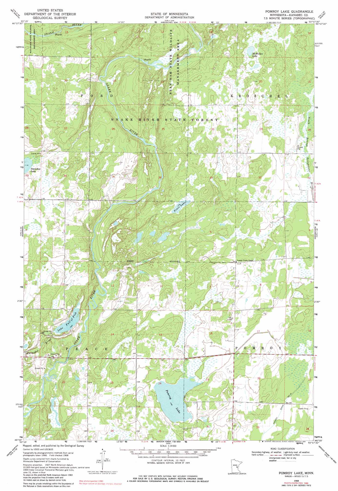
Pomroy Lake Topo Map Minnesota
To zoom in, hover over the map of Pomroy Lake
USGS Topo Quad 46093a2 - 1:24,000 scale
| Topo Map Name: | Pomroy Lake |
| USGS Topo Quad ID: | 46093a2 |
| Print Size: | ca. 21 1/4" wide x 27" high |
| Southeast Coordinates: | 46° N latitude / 93.125° W longitude |
| Map Center Coordinates: | 46.0625° N latitude / 93.1875° W longitude |
| U.S. State: | MN |
| Filename: | o46093a2.jpg |
| Download Map JPG Image: | Pomroy Lake topo map 1:24,000 scale |
| Map Type: | Topographic |
| Topo Series: | 7.5´ |
| Map Scale: | 1:24,000 |
| Source of Map Images: | United States Geological Survey (USGS) |
| Alternate Map Versions: |
Pomroy Lake MN 1968, updated 1970 Download PDF Buy paper map Pomroy Lake MN 1968, updated 1983 Download PDF Buy paper map Pomroy Lake MN 2010 Download PDF Buy paper map Pomroy Lake MN 2013 Download PDF Buy paper map Pomroy Lake MN 2016 Download PDF Buy paper map |
1:24,000 Topo Quads surrounding Pomroy Lake
Thor Sw |
Thor Se |
Solana |
Arthyde |
Denham |
Isle |
Mcgrath |
Kroschel Nw |
Giese |
Finlayson |
Isle Sw |
Warman |
Pomroy Lake |
Kroschel |
Hinckley |
Ann Lake |
Mora North |
Quamba |
Brook Park |
Beroun |
Ogilvie |
Mora South |
Grasston |
Henriette |
Pine City |
> Back to 46093a1 at 1:100,000 scale
> Back to 46092a1 at 1:250,000 scale
> Back to U.S. Topo Maps home
Pomroy Lake topo map: Gazetteer
Pomroy Lake: Canals
County Ditch Number Ten elevation 323m 1059′Pomroy Lake: Forests
Snake River State Forest elevation 349m 1145′Pomroy Lake: Lakes
Lake Full of Fish elevation 312m 1023′McMullen Lake elevation 345m 1131′
Peace Lake elevation 336m 1102′
Pomroy Lake elevation 333m 1092′
Pomroy Lake: Parks
Bean Dam State Wildlife Management Area elevation 325m 1066′Pomroy Lake: Streams
Snowshoe Brook elevation 308m 1010′Pomroy Lake digital topo map on disk
Buy this Pomroy Lake topo map showing relief, roads, GPS coordinates and other geographical features, as a high-resolution digital map file on DVD: