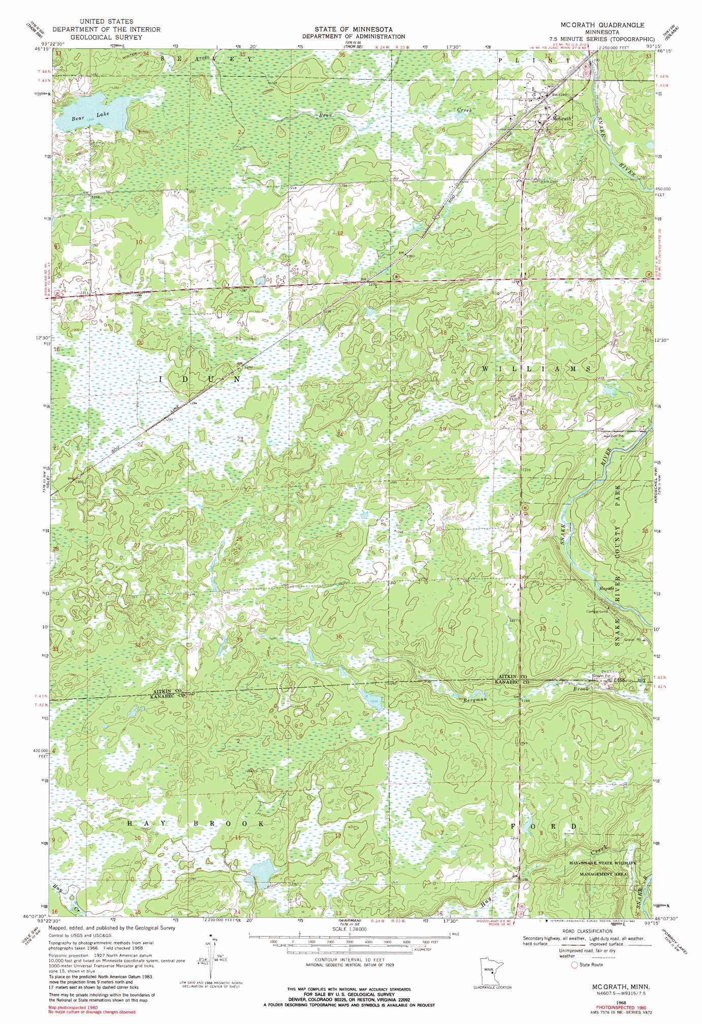
Mcgrath Topo Map Minnesota
To zoom in, hover over the map of Mcgrath
USGS Topo Quad 46093b3 - 1:24,000 scale
| Topo Map Name: | Mcgrath |
| USGS Topo Quad ID: | 46093b3 |
| Print Size: | ca. 21 1/4" wide x 27" high |
| Southeast Coordinates: | 46.125° N latitude / 93.25° W longitude |
| Map Center Coordinates: | 46.1875° N latitude / 93.3125° W longitude |
| U.S. State: | MN |
| Filename: | o46093b3.jpg |
| Download Map JPG Image: | Mcgrath topo map 1:24,000 scale |
| Map Type: | Topographic |
| Topo Series: | 7.5´ |
| Map Scale: | 1:24,000 |
| Source of Map Images: | United States Geological Survey (USGS) |
| Alternate Map Versions: |
Mc Grath MN 1968, updated 1970 Download PDF Buy paper map Mc Grath MN 1968, updated 1982 Download PDF Buy paper map McGrath MN 2010 Download PDF Buy paper map McGrath MN 2013 Download PDF Buy paper map McGrath MN 2016 Download PDF Buy paper map |
1:24,000 Topo Quads surrounding Mcgrath
Glen |
Thor |
Thor Ne |
Split Rock Lake |
Ronald |
Malmo |
Thor Sw |
Thor Se |
Solana |
Arthyde |
Wahkon North |
Isle |
Mcgrath |
Kroschel Nw |
Giese |
Wahkon South |
Isle Sw |
Warman |
Pomroy Lake |
Kroschel |
Milaca Ne |
Ann Lake |
Mora North |
Quamba |
Brook Park |
> Back to 46093a1 at 1:100,000 scale
> Back to 46092a1 at 1:250,000 scale
> Back to U.S. Topo Maps home
Mcgrath topo map: Gazetteer
Mcgrath: Lakes
Bear Lake elevation 381m 1250′Mcgrath: Parks
Snake River County Park elevation 383m 1256′Mcgrath: Populated Places
McGrath elevation 381m 1250′Mcgrath: Post Offices
McGrath Post Office elevation 381m 1250′Mcgrath: Streams
Bear Creek elevation 371m 1217′Hay Creek elevation 346m 1135′
Mcgrath digital topo map on disk
Buy this Mcgrath topo map showing relief, roads, GPS coordinates and other geographical features, as a high-resolution digital map file on DVD: