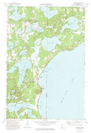
Garrison Topo Map Minnesota
To zoom in, hover over the map of Garrison
USGS Topo Quad 46093c7 - 1:24,000 scale
| Topo Map Name: | Garrison |
| USGS Topo Quad ID: | 46093c7 |
| Print Size: | ca. 21 1/4" wide x 27" high |
| Southeast Coordinates: | 46.25° N latitude / 93.75° W longitude |
| Map Center Coordinates: | 46.3125° N latitude / 93.8125° W longitude |
| U.S. State: | MN |
| Filename: | o46093c7.jpg |
| Download Map JPG Image: | Garrison topo map 1:24,000 scale |
| Map Type: | Topographic |
| Topo Series: | 7.5´ |
| Map Scale: | 1:24,000 |
| Source of Map Images: | United States Geological Survey (USGS) |
| Alternate Map Versions: |
Garrison MN 1973, updated 1976 Download PDF Buy paper map Garrison MN 2010 Download PDF Buy paper map Garrison MN 2013 Download PDF Buy paper map Garrison MN 2016 Download PDF Buy paper map |
1:24,000 Topo Quads surrounding Garrison
> Back to 46093a1 at 1:100,000 scale
> Back to 46092a1 at 1:250,000 scale
> Back to U.S. Topo Maps home
Garrison topo map: Gazetteer
Garrison: Airports
Mille Lacs Lake Airport elevation 384m 1259′Rosackers Number 2 Seaplane Base elevation 385m 1263′
Garrison: Bays
Garrison Bay elevation 382m 1253′Hunters Bay elevation 385m 1263′
Saint Albans Bay elevation 382m 1253′
Garrison: Capes
Pike Point elevation 388m 1272′Wilderness Point elevation 385m 1263′
Garrison: Dams
Borden Lake Dam elevation 382m 1253′Holt Lake Dam elevation 385m 1263′
Garrison: Lakes
Bassett Lakes elevation 383m 1256′Big Pine Lake elevation 385m 1263′
Birch Lake elevation 389m 1276′
Black Lake elevation 385m 1263′
Borden Lake elevation 382m 1253′
Chandler Lake elevation 383m 1256′
Fawcett Lake elevation 385m 1263′
Hogsback Lakes elevation 386m 1266′
Holt Lake elevation 382m 1253′
Kenney Lake elevation 385m 1263′
Maple Lake elevation 383m 1256′
Mud Lake elevation 389m 1276′
Partridge Lake elevation 388m 1272′
Round Lake elevation 383m 1256′
Scott Lake elevation 389m 1276′
Smith Lake elevation 382m 1253′
Sunfish Lake elevation 389m 1276′
Turtle Lake elevation 388m 1272′
Wilson Lake elevation 388m 1272′
Garrison: Parks
Garrison Concourse Wayside Park elevation 382m 1253′Geology of the Lake Mille Lacs Geological Marker elevation 382m 1253′
Kenney Lake Overlook elevation 389m 1276′
Garrison: Populated Places
Cutler elevation 388m 1272′Garrison elevation 383m 1256′
Garrison Trailer Park elevation 383m 1256′
Nichols elevation 386m 1266′
Garrison: Post Offices
Garrison Post Office elevation 383m 1256′Nichols Post Office (historical) elevation 385m 1263′
Garrison: Reservoirs
Borden Lake elevation 382m 1253′Holt Lake elevation 385m 1263′
Garrison: Streams
Garrison Creek elevation 382m 1253′Sequchie Creek elevation 382m 1253′
Garrison: Summits
Warren Hill elevation 443m 1453′Garrison digital topo map on disk
Buy this Garrison topo map showing relief, roads, GPS coordinates and other geographical features, as a high-resolution digital map file on DVD:


