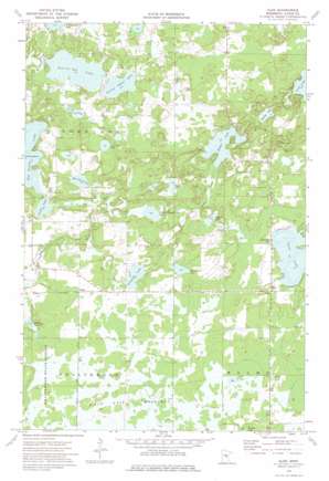
Glen Topo Map Minnesota
To zoom in, hover over the map of Glen
USGS Topo Quad 46093d5 - 1:24,000 scale
| Topo Map Name: | Glen |
| USGS Topo Quad ID: | 46093d5 |
| Print Size: | ca. 21 1/4" wide x 27" high |
| Southeast Coordinates: | 46.375° N latitude / 93.5° W longitude |
| Map Center Coordinates: | 46.4375° N latitude / 93.5625° W longitude |
| U.S. State: | MN |
| Filename: | o46093d5.jpg |
| Download Map JPG Image: | Glen topo map 1:24,000 scale |
| Map Type: | Topographic |
| Topo Series: | 7.5´ |
| Map Scale: | 1:24,000 |
| Source of Map Images: | United States Geological Survey (USGS) |
| Alternate Map Versions: |
Glen MN 1973, updated 1976 Download PDF Buy paper map Glen MN 2010 Download PDF Buy paper map Glen MN 2013 Download PDF Buy paper map Glen MN 2016 Download PDF Buy paper map |
1:24,000 Topo Quads surrounding Glen
> Back to 46093a1 at 1:100,000 scale
> Back to 46092a1 at 1:250,000 scale
> Back to U.S. Topo Maps home
Glen topo map: Gazetteer
Glen: Dams
Carrol Heft Dam elevation 383m 1256′Glen: Lakes
Clear Lake elevation 395m 1295′Johnson Lake elevation 387m 1269′
Killroy Lake elevation 381m 1250′
Linde Lake elevation 384m 1259′
Lingroth Lake elevation 381m 1250′
Monson Lake elevation 386m 1266′
Rabbit Lake elevation 385m 1263′
Section Ten Lake elevation 378m 1240′
Section Twelve Lake elevation 378m 1240′
Section Twenty-Five Lake elevation 381m 1250′
Sjodin Lake elevation 375m 1230′
Spring Lake elevation 376m 1233′
Sweetman Lake elevation 385m 1263′
Thirty-One Lake elevation 390m 1279′
Turtle Lake elevation 385m 1263′
Glen: Populated Places
Glen elevation 396m 1299′Glory elevation 385m 1263′
Glen: Post Offices
Glen Post Office (historical) elevation 396m 1299′Glory Post Office (historical) elevation 386m 1266′
Valparaiso Post Office (historical) elevation 379m 1243′
Glen: Reservoirs
Carrol Heft Reservoir elevation 383m 1256′Glen: Swamps
Mille Lacs Meadows elevation 384m 1259′Glen digital topo map on disk
Buy this Glen topo map showing relief, roads, GPS coordinates and other geographical features, as a high-resolution digital map file on DVD:


