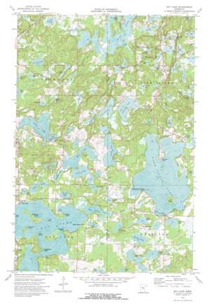
Bay Lake Topo Map Minnesota
To zoom in, hover over the map of Bay Lake
USGS Topo Quad 46093d7 - 1:24,000 scale
| Topo Map Name: | Bay Lake |
| USGS Topo Quad ID: | 46093d7 |
| Print Size: | ca. 21 1/4" wide x 27" high |
| Southeast Coordinates: | 46.375° N latitude / 93.75° W longitude |
| Map Center Coordinates: | 46.4375° N latitude / 93.8125° W longitude |
| U.S. State: | MN |
| Filename: | o46093d7.jpg |
| Download Map JPG Image: | Bay Lake topo map 1:24,000 scale |
| Map Type: | Topographic |
| Topo Series: | 7.5´ |
| Map Scale: | 1:24,000 |
| Source of Map Images: | United States Geological Survey (USGS) |
| Alternate Map Versions: |
Bay Lake MN 1973, updated 1976 Download PDF Buy paper map Bay Lake MN 2010 Download PDF Buy paper map Bay Lake MN 2013 Download PDF Buy paper map Bay Lake MN 2016 Download PDF Buy paper map |
1:24,000 Topo Quads surrounding Bay Lake
> Back to 46093a1 at 1:100,000 scale
> Back to 46092a1 at 1:250,000 scale
> Back to U.S. Topo Maps home
Bay Lake topo map: Gazetteer
Bay Lake: Airports
Birch Lake Seaplane Base elevation 390m 1279′Sethney Stolport elevation 393m 1289′
Bay Lake: Capes
Battle Point elevation 385m 1263′Brighton Point elevation 390m 1279′
Corey Point elevation 385m 1263′
Eaglewood Point elevation 392m 1286′
Johnson Point elevation 394m 1292′
Johnson Point elevation 385m 1263′
Bay Lake: Islands
Bird Island elevation 385m 1263′Farm Island elevation 388m 1272′
Malkerson Island elevation 388m 1272′
Bay Lake: Lakes
Anderson Lake elevation 370m 1213′Anderson Lake elevation 373m 1223′
Arbor Lake elevation 388m 1272′
Bass Lake elevation 388m 1272′
Bay Lake elevation 385m 1263′
Berglund Lake elevation 388m 1272′
Black Shadow Lake elevation 372m 1220′
Bodle Lake elevation 370m 1213′
Brennen Lake elevation 374m 1227′
Camp Lake elevation 373m 1223′
Camp Lake elevation 389m 1276′
Carlson Lake elevation 372m 1220′
Christmas Lake elevation 371m 1217′
Coffee Lake elevation 385m 1263′
Cranberry Lake elevation 385m 1263′
Dogfish Lake elevation 367m 1204′
Drain Lake elevation 382m 1253′
Dummer Lake elevation 388m 1272′
Erickson Lake elevation 382m 1253′
Farm Island Lake elevation 383m 1256′
Finn Lake elevation 382m 1253′
Goose Lake elevation 388m 1272′
Hamlet Lake elevation 382m 1253′
Hill Lake elevation 379m 1243′
Horseshoe Lake elevation 370m 1213′
Horseshoe Lake elevation 383m 1256′
Knieff Lake elevation 386m 1266′
Lake Four elevation 381m 1250′
Larson Lake elevation 379m 1243′
Laurel Lake elevation 386m 1266′
Little Hamlet Lake elevation 382m 1253′
Little Pete Lake elevation 386m 1266′
Little Spruce Lake elevation 385m 1263′
Long Lake elevation 379m 1243′
Long Lake elevation 373m 1223′
Pine Island Lake elevation 379m 1243′
Prescott Lake elevation 385m 1263′
Ringhand Lake elevation 366m 1200′
Round Lake elevation 382m 1253′
Sand Lake elevation 388m 1272′
Sanders Lake elevation 386m 1266′
Shirt Lake elevation 388m 1272′
Snoosebox Lake elevation 379m 1243′
Spectacle Lake elevation 389m 1276′
Spruce Lake elevation 388m 1272′
Sunset Lake elevation 386m 1266′
Tame Fish Lake elevation 385m 1263′
Taylor Lake elevation 366m 1200′
Taylor Lake elevation 389m 1276′
Thornton Lake elevation 385m 1263′
Town Line Lake elevation 385m 1263′
Townhall Lake elevation 382m 1253′
Vorse Lake elevation 370m 1213′
Bay Lake: Parks
Cedar State Wildlife Management Area elevation 374m 1227′Farm Island State Wildlife Management Area elevation 384m 1259′
Bay Lake: Populated Places
Bay Lake elevation 393m 1289′White Hawk elevation 386m 1266′
Bay Lake: Post Offices
Baylake Post Office (historical) elevation 393m 1289′Dorris Post Office (historical) elevation 402m 1318′
Bay Lake: Streams
Cedar Brook elevation 366m 1200′Bay Lake: Trails
Switzerland Trail elevation 386m 1266′Bay Lake digital topo map on disk
Buy this Bay Lake topo map showing relief, roads, GPS coordinates and other geographical features, as a high-resolution digital map file on DVD:


