Mcgregor Topo Map Minnesota
To zoom in, hover over the map of Mcgregor
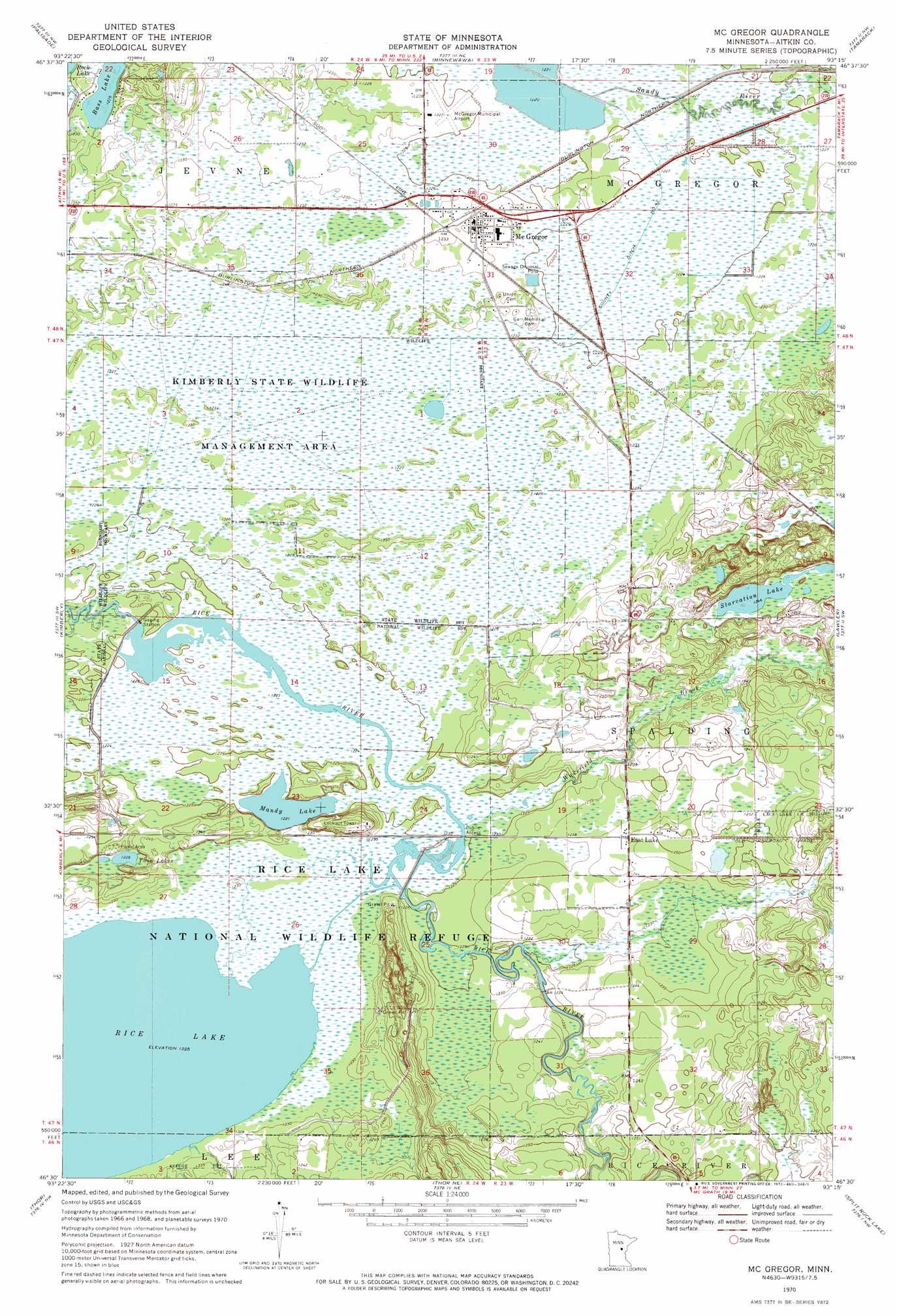
USGS Topo Quad 46093e3 - 1:24,000 scale
| Topo Map Name: | Mcgregor |
| USGS Topo Quad ID: | 46093e3 |
| Print Size: | ca. 21 1/4" wide x 27" high |
| Southeast Coordinates: | 46.5° N latitude / 93.25° W longitude |
| Map Center Coordinates: | 46.5625° N latitude / 93.3125° W longitude |
| U.S. State: | MN |
| Filename: | o46093e3.jpg |
| Download Map JPG Image: | Mcgregor topo map 1:24,000 scale |
| Map Type: | Topographic |
| Topo Series: | 7.5´ |
| Map Scale: | 1:24,000 |
| Source of Map Images: | United States Geological Survey (USGS) |
| Alternate Map Versions: |
Mc Gregor MN 1970, updated 1972 Download PDF Buy paper map McGregor MN 2010 Download PDF Buy paper map McGregor MN 2013 Download PDF Buy paper map McGregor MN 2016 Download PDF Buy paper map |
1:24,000 Topo Quads surrounding Mcgregor
Bain |
Sanders Lake |
Libby |
Balsam |
Little Prairie Lake |
Waukenabo |
Palisade |
Minnewawa |
Tamarack |
Wright |
Hassman |
Kimberly |
Mcgregor |
Lawler |
Automba |
Glen |
Thor |
Thor Ne |
Split Rock Lake |
Ronald |
Malmo |
Thor Sw |
Thor Se |
Solana |
Arthyde |
> Back to 46093e1 at 1:100,000 scale
> Back to 46092a1 at 1:250,000 scale
> Back to U.S. Topo Maps home
Mcgregor topo map: Gazetteer
Mcgregor: Airports
Isedor Iverson Airport elevation 374m 1227′Mcgregor: Dams
Rice Lake Pool Dam elevation 373m 1223′Rice River Pool Dam elevation 373m 1223′
Mcgregor: Lakes
Bass Lake elevation 374m 1227′Mandy Lake elevation 372m 1220′
Starvation Lake elevation 381m 1250′
Twin Lakes elevation 374m 1227′
Mcgregor: Parks
Kimberly State Wildlife Management Area elevation 375m 1230′Rice Lake National Wildlife Refuge elevation 374m 1227′
Mcgregor: Populated Places
East Lake elevation 380m 1246′McGregor elevation 375m 1230′
Mcgregor: Post Offices
East Lake Post Office (historical) elevation 380m 1246′McGregor Post Office (historical) elevation 375m 1230′
Mcgregor: Reservoirs
Rice Lake elevation 373m 1223′Rice Lake Pool elevation 373m 1223′
Rice River Pool elevation 373m 1223′
Mcgregor: Streams
Wakefield Brook elevation 374m 1227′Mcgregor digital topo map on disk
Buy this Mcgregor topo map showing relief, roads, GPS coordinates and other geographical features, as a high-resolution digital map file on DVD: