Randall West Topo Map Minnesota
To zoom in, hover over the map of Randall West
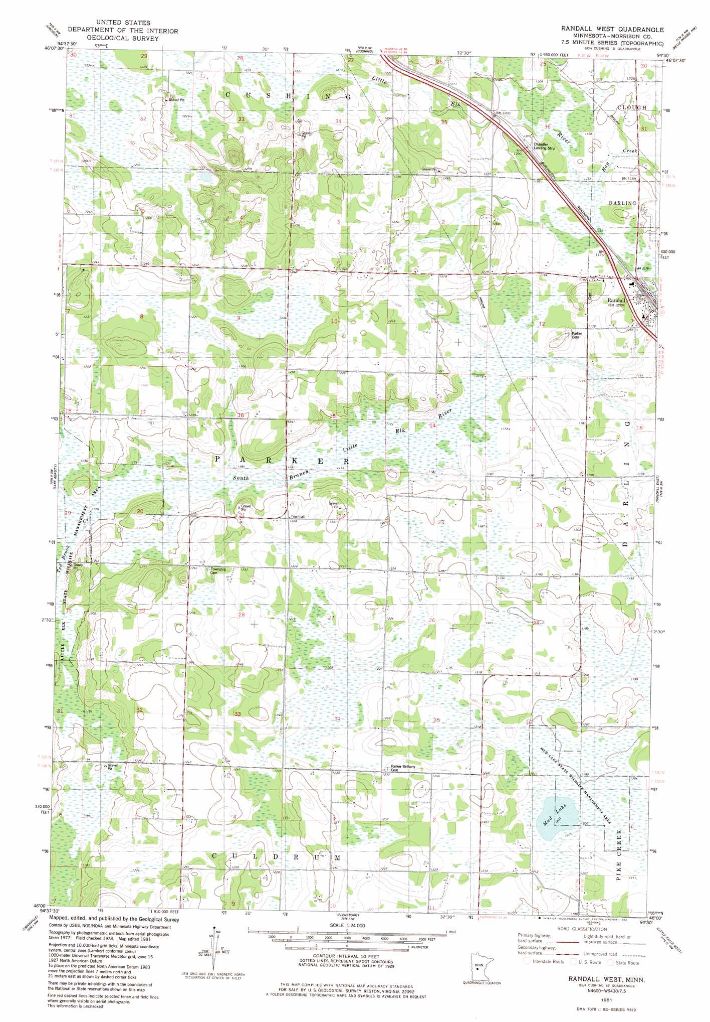
USGS Topo Quad 46094a5 - 1:24,000 scale
| Topo Map Name: | Randall West |
| USGS Topo Quad ID: | 46094a5 |
| Print Size: | ca. 21 1/4" wide x 27" high |
| Southeast Coordinates: | 46° N latitude / 94.5° W longitude |
| Map Center Coordinates: | 46.0625° N latitude / 94.5625° W longitude |
| U.S. State: | MN |
| Filename: | o46094a5.jpg |
| Download Map JPG Image: | Randall West topo map 1:24,000 scale |
| Map Type: | Topographic |
| Topo Series: | 7.5´ |
| Map Scale: | 1:24,000 |
| Source of Map Images: | United States Geological Survey (USGS) |
| Alternate Map Versions: |
Randall West MN 1981, updated 1982 Download PDF Buy paper map Randall West MN 2010 Download PDF Buy paper map Randall West MN 2013 Download PDF Buy paper map Randall West MN 2016 Download PDF Buy paper map |
1:24,000 Topo Quads surrounding Randall West
Staples |
Motley |
Motley Se |
Pillager |
Baxter |
Browerville Ne |
Lincoln |
Cushing |
Belle Prairie Nw |
Fort Ripley |
Browerville |
Lake Beauty |
Randall West |
Randall |
Belle Prairie |
Long Prairie |
Swanville |
Flensburg |
Little Falls West |
Little Falls East |
Ward Springs |
Burtrum |
Upsala |
Bowlus |
Royalton |
> Back to 46094a1 at 1:100,000 scale
> Back to 46094a1 at 1:250,000 scale
> Back to U.S. Topo Maps home
Randall West topo map: Gazetteer
Randall West: Airports
Chandler Field elevation 360m 1181′Randall West: Lakes
Mud Lake elevation 367m 1204′Randall West: Parks
Mud Lake State Wildlife Management Area elevation 366m 1200′Randall West: Populated Places
Randall elevation 363m 1190′Randall West: Post Offices
Randall Post Office elevation 362m 1187′Randall West: Streams
Hay Creek elevation 359m 1177′Ted Brook Creek elevation 359m 1177′
Randall West digital topo map on disk
Buy this Randall West topo map showing relief, roads, GPS coordinates and other geographical features, as a high-resolution digital map file on DVD: