Lastrup Nw Topo Map Minnesota
To zoom in, hover over the map of Lastrup Nw
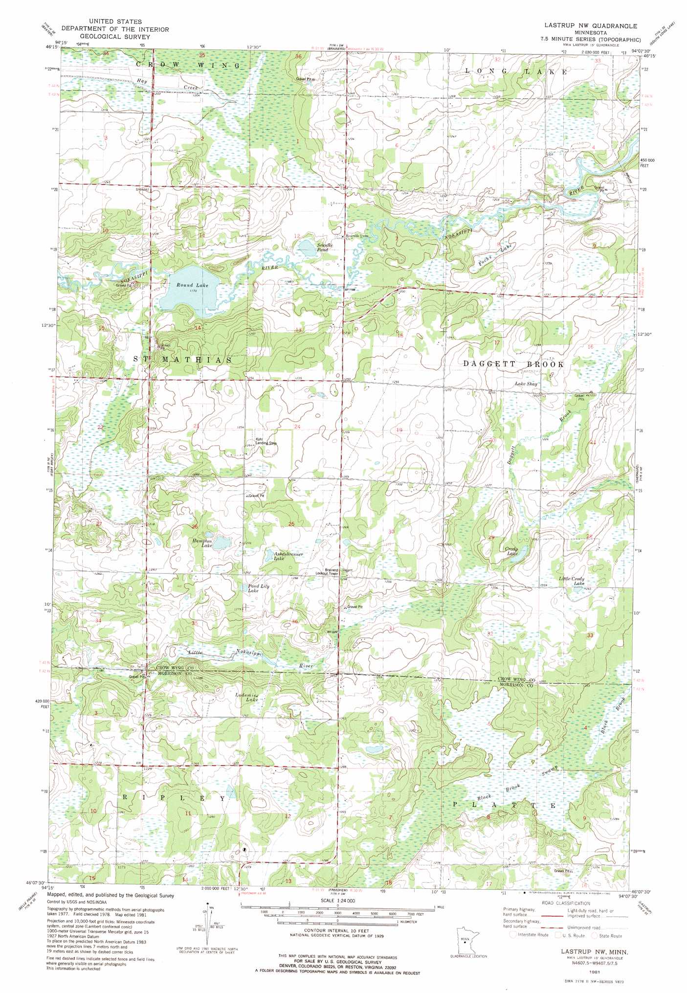
USGS Topo Quad 46094b2 - 1:24,000 scale
| Topo Map Name: | Lastrup Nw |
| USGS Topo Quad ID: | 46094b2 |
| Print Size: | ca. 21 1/4" wide x 27" high |
| Southeast Coordinates: | 46.125° N latitude / 94.125° W longitude |
| Map Center Coordinates: | 46.1875° N latitude / 94.1875° W longitude |
| U.S. State: | MN |
| Filename: | o46094b2.jpg |
| Download Map JPG Image: | Lastrup Nw topo map 1:24,000 scale |
| Map Type: | Topographic |
| Topo Series: | 7.5´ |
| Map Scale: | 1:24,000 |
| Source of Map Images: | United States Geological Survey (USGS) |
| Alternate Map Versions: |
Lastrup NW MN 1981, updated 1982 Download PDF Buy paper map Lastrup NW MN 2010 Download PDF Buy paper map Lastrup NW MN 2013 Download PDF Buy paper map Lastrup NW MN 2016 Download PDF Buy paper map |
1:24,000 Topo Quads surrounding Lastrup Nw
Wilson Bay |
Gull Lake |
Merrifield |
Riverton |
Crosby |
Pillager |
Baxter |
Brainerd |
South Long Lake |
Grave Lake |
Belle Prairie Nw |
Fort Ripley |
Lastrup Nw |
Shephard |
Platte Lake |
Randall |
Belle Prairie |
Freedhem |
Lastrup |
Hillman |
Little Falls West |
Little Falls East |
Pierz Lake |
Pierz |
Ramey Nw |
> Back to 46094a1 at 1:100,000 scale
> Back to 46094a1 at 1:250,000 scale
> Back to U.S. Topo Maps home
Lastrup Nw topo map: Gazetteer
Lastrup Nw: Airports
Kohl Landing Strip elevation 384m 1259′Lastrup Nw: Dams
Round Lake Dam elevation 362m 1187′Lastrup Nw: Lakes
Ashenbrenner Lake elevation 387m 1269′Crody Lake elevation 376m 1233′
Fuchs Lake elevation 365m 1197′
Hampton Lake elevation 383m 1256′
Lake Shay elevation 377m 1236′
Little Crody Lake elevation 386m 1266′
Lodemier Lake elevation 386m 1266′
Mud Lake elevation 366m 1200′
Pond Lake elevation 357m 1171′
Pond Lily Lake elevation 383m 1256′
Sewells Pond elevation 357m 1171′
Lastrup Nw: Reservoirs
Round Lake elevation 362m 1187′Lastrup Nw: Swamps
Black Brook Swamp elevation 380m 1246′Lastrup Nw digital topo map on disk
Buy this Lastrup Nw topo map showing relief, roads, GPS coordinates and other geographical features, as a high-resolution digital map file on DVD: