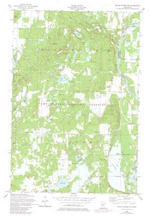
Belle Prairie Nw Topo Map Minnesota
To zoom in, hover over the map of Belle Prairie Nw
USGS Topo Quad 46094b4 - 1:24,000 scale
| Topo Map Name: | Belle Prairie Nw |
| USGS Topo Quad ID: | 46094b4 |
| Print Size: | ca. 21 1/4" wide x 27" high |
| Southeast Coordinates: | 46.125° N latitude / 94.375° W longitude |
| Map Center Coordinates: | 46.1875° N latitude / 94.4375° W longitude |
| U.S. State: | MN |
| Filename: | o46094b4.jpg |
| Download Map JPG Image: | Belle Prairie Nw topo map 1:24,000 scale |
| Map Type: | Topographic |
| Topo Series: | 7.5´ |
| Map Scale: | 1:24,000 |
| Source of Map Images: | United States Geological Survey (USGS) |
| Alternate Map Versions: |
Belle Prairie NW MN 1956, updated 1958 Download PDF Buy paper map Belle Prairie NW MN 1956, updated 1974 Download PDF Buy paper map Belle Prairie NW MN 1956, updated 1980 Download PDF Buy paper map Belle Prairie NW MN 2010 Download PDF Buy paper map Belle Prairie NW MN 2013 Download PDF Buy paper map Belle Prairie NW MN 2016 Download PDF Buy paper map |
1:24,000 Topo Quads surrounding Belle Prairie Nw
> Back to 46094a1 at 1:100,000 scale
> Back to 46094a1 at 1:250,000 scale
> Back to U.S. Topo Maps home
Belle Prairie Nw topo map: Gazetteer
Belle Prairie Nw: Canals
Broken Bow Creek elevation 352m 1154′Belle Prairie Nw: Islands
Pipe Island elevation 348m 1141′Belle Prairie Nw: Lakes
Bass Lake elevation 417m 1368′Cockburn Lake elevation 418m 1371′
Coon Stump Lake elevation 418m 1371′
Deer Lake elevation 437m 1433′
Fosdick Lake elevation 385m 1263′
Frog Lake elevation 365m 1197′
Holden Lake elevation 369m 1210′
Lake Alott elevation 430m 1410′
Lake Ericson elevation 438m 1437′
Long Lake elevation 424m 1391′
Mallard Lake elevation 424m 1391′
Miller Lake elevation 369m 1210′
Mud Lake elevation 430m 1410′
Mud Lake elevation 388m 1272′
Muskrat Lake elevation 432m 1417′
Prentice Pond elevation 358m 1174′
Pugh Lake elevation 430m 1410′
Quick Lake elevation 432m 1417′
Round Lake elevation 369m 1210′
Sheep Lake elevation 406m 1332′
Still Lake elevation 439m 1440′
Belle Prairie Nw: Reservoirs
Hager Pond elevation 348m 1141′Belle Prairie Nw: Swamps
Hole in Day Marsh elevation 352m 1154′Belle Prairie Nw digital topo map on disk
Buy this Belle Prairie Nw topo map showing relief, roads, GPS coordinates and other geographical features, as a high-resolution digital map file on DVD:


