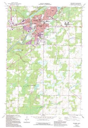
Brainerd Topo Map Minnesota
To zoom in, hover over the map of Brainerd
USGS Topo Quad 46094c2 - 1:24,000 scale
| Topo Map Name: | Brainerd |
| USGS Topo Quad ID: | 46094c2 |
| Print Size: | ca. 21 1/4" wide x 27" high |
| Southeast Coordinates: | 46.25° N latitude / 94.125° W longitude |
| Map Center Coordinates: | 46.3125° N latitude / 94.1875° W longitude |
| U.S. State: | MN |
| Filename: | o46094c2.jpg |
| Download Map JPG Image: | Brainerd topo map 1:24,000 scale |
| Map Type: | Topographic |
| Topo Series: | 7.5´ |
| Map Scale: | 1:24,000 |
| Source of Map Images: | United States Geological Survey (USGS) |
| Alternate Map Versions: |
Brainerd MN 1973, updated 1976 Download PDF Buy paper map Brainerd MN 1973, updated 1995 Download PDF Buy paper map Brainerd MN 2010 Download PDF Buy paper map Brainerd MN 2013 Download PDF Buy paper map Brainerd MN 2016 Download PDF Buy paper map |
1:24,000 Topo Quads surrounding Brainerd
> Back to 46094a1 at 1:100,000 scale
> Back to 46094a1 at 1:250,000 scale
> Back to U.S. Topo Maps home
Brainerd topo map: Gazetteer
Brainerd: Airports
Jackson Field elevation 381m 1250′Brainerd: Islands
First Island elevation 356m 1167′Brainerd: Lakes
Boom Lake elevation 352m 1154′Buffalo Lake elevation 353m 1158′
Brainerd: Parks
Adamson Field elevation 352m 1154′Bane Park elevation 375m 1230′
Boom Park elevation 356m 1167′
Buffalo Hills Park elevation 376m 1233′
Cooks State Wildlife Management Area elevation 382m 1253′
Gregory Park elevation 370m 1213′
Jaycees Park elevation 371m 1217′
Lum Park elevation 363m 1190′
Mill Park elevation 365m 1197′
Northland Arboretum elevation 365m 1197′
O'Brien Park elevation 374m 1227′
Brainerd: Populated Places
Brainerd elevation 371m 1217′East Gate Mobile Home Park elevation 363m 1190′
Meadow View Manor elevation 378m 1240′
Westwood Mobile Home Park elevation 364m 1194′
Brainerd: Post Offices
Brainerd Post Office elevation 370m 1213′Brainerd: Ranges
Cuyuna Range elevation 363m 1190′Brainerd: Streams
Buffalo Creek elevation 352m 1154′Little Buffalo Creek elevation 351m 1151′
Brainerd digital topo map on disk
Buy this Brainerd topo map showing relief, roads, GPS coordinates and other geographical features, as a high-resolution digital map file on DVD:


