Motley Topo Map Minnesota
To zoom in, hover over the map of Motley
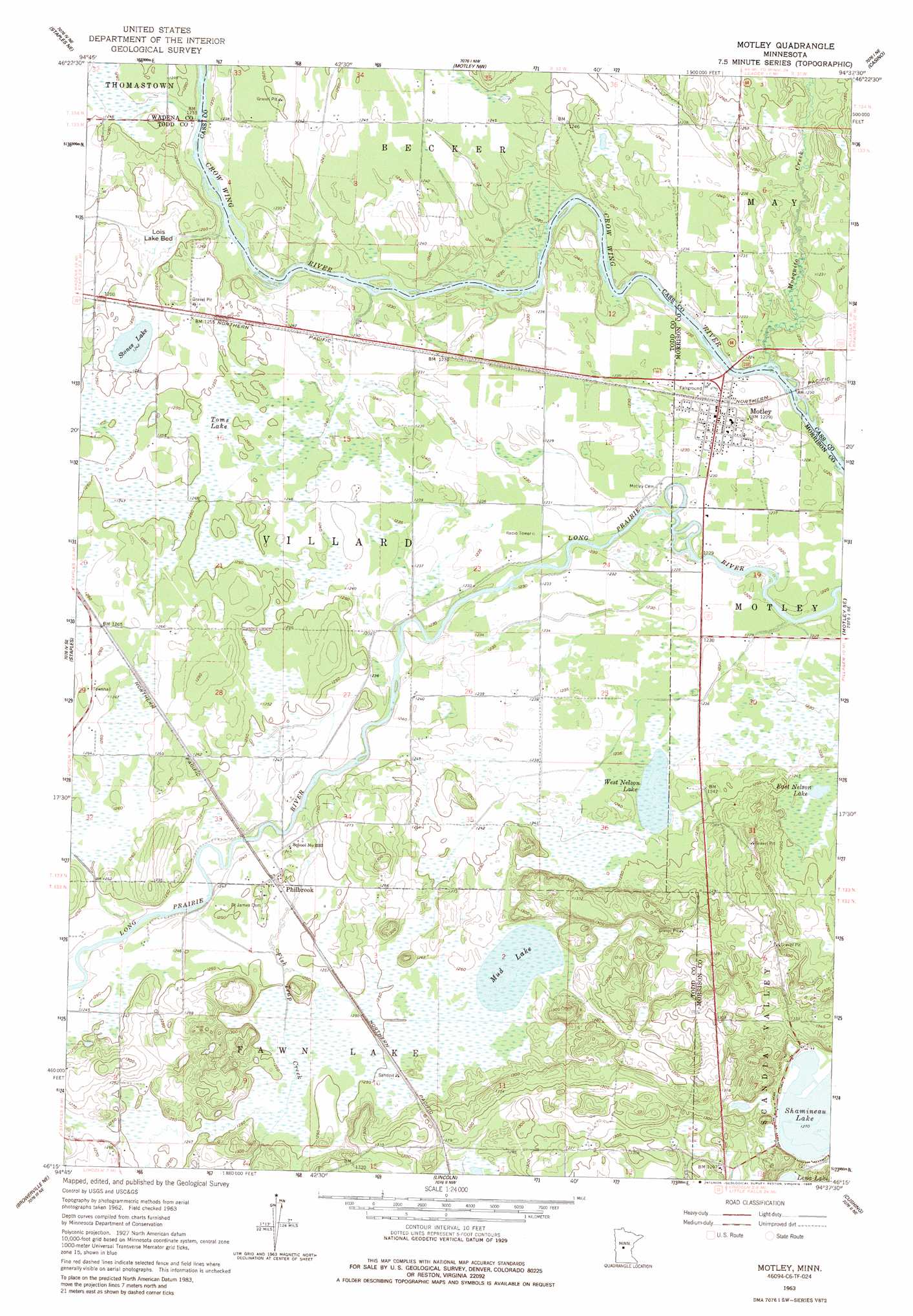
USGS Topo Quad 46094c6 - 1:24,000 scale
| Topo Map Name: | Motley |
| USGS Topo Quad ID: | 46094c6 |
| Print Size: | ca. 21 1/4" wide x 27" high |
| Southeast Coordinates: | 46.25° N latitude / 94.625° W longitude |
| Map Center Coordinates: | 46.3125° N latitude / 94.6875° W longitude |
| U.S. State: | MN |
| Filename: | o46094c6.jpg |
| Download Map JPG Image: | Motley topo map 1:24,000 scale |
| Map Type: | Topographic |
| Topo Series: | 7.5´ |
| Map Scale: | 1:24,000 |
| Source of Map Images: | United States Geological Survey (USGS) |
| Alternate Map Versions: |
Motley MN 1963, updated 1964 Download PDF Buy paper map Motley MN 1963, updated 1986 Download PDF Buy paper map Motley MN 2010 Download PDF Buy paper map Motley MN 2013 Download PDF Buy paper map Motley MN 2016 Download PDF Buy paper map |
1:24,000 Topo Quads surrounding Motley
Nimrod Sw |
Oylen |
Leader |
Graff |
Pine River Sw |
Aldrich North |
Staples Ne |
Motley Nw |
Casino |
Wilson Bay |
Aldrich South |
Staples |
Motley |
Motley Se |
Pillager |
Clarissa |
Browerville Ne |
Lincoln |
Cushing |
Belle Prairie Nw |
Browerville Sw |
Browerville |
Lake Beauty |
Randall West |
Randall |
> Back to 46094a1 at 1:100,000 scale
> Back to 46094a1 at 1:250,000 scale
> Back to U.S. Topo Maps home
Motley topo map: Gazetteer
Motley: Airports
Moreys Airport elevation 373m 1223′Motley: Flats
Lois Lake Bed elevation 377m 1236′Motley: Lakes
East Nelson Lake elevation 375m 1230′Mud Lake elevation 382m 1253′
Stones Lake elevation 379m 1243′
West Nelson Lake elevation 375m 1230′
Motley: Parks
Motley Wayside Park elevation 375m 1230′Motley: Populated Places
Motley elevation 375m 1230′Philbrook elevation 381m 1250′
Motley: Post Offices
Motley Post Office elevation 375m 1230′Philbrook Post Office (historical) elevation 381m 1250′
Motley: Streams
Fish Trap Creek elevation 375m 1230′Mosquito Creek elevation 368m 1207′
Motley: Swamps
Toms Lake elevation 380m 1246′Motley digital topo map on disk
Buy this Motley topo map showing relief, roads, GPS coordinates and other geographical features, as a high-resolution digital map file on DVD: