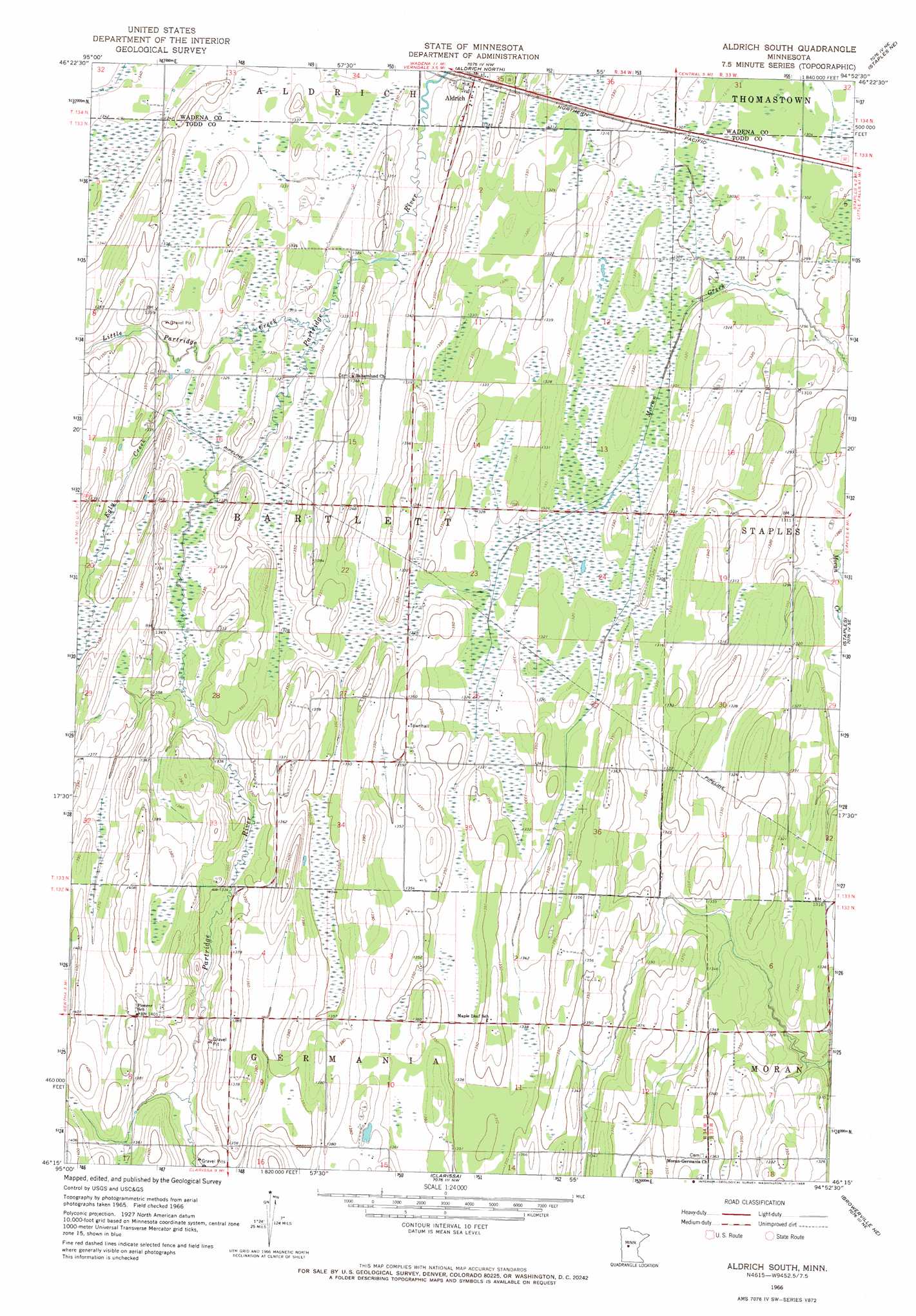
Aldrich South Topo Map Minnesota
To zoom in, hover over the map of Aldrich South
USGS Topo Quad 46094c8 - 1:24,000 scale
| Topo Map Name: | Aldrich South |
| USGS Topo Quad ID: | 46094c8 |
| Print Size: | ca. 21 1/4" wide x 27" high |
| Southeast Coordinates: | 46.25° N latitude / 94.875° W longitude |
| Map Center Coordinates: | 46.3125° N latitude / 94.9375° W longitude |
| U.S. State: | MN |
| Filename: | o46094c8.jpg |
| Download Map JPG Image: | Aldrich South topo map 1:24,000 scale |
| Map Type: | Topographic |
| Topo Series: | 7.5´ |
| Map Scale: | 1:24,000 |
| Source of Map Images: | United States Geological Survey (USGS) |
| Alternate Map Versions: |
Aldrich South MN 1966, updated 1968 Download PDF Buy paper map Aldrich South MN 2010 Download PDF Buy paper map Aldrich South MN 2013 Download PDF Buy paper map Aldrich South MN 2016 Download PDF Buy paper map |
1:24,000 Topo Quads surrounding Aldrich South
Sebeka Sw |
Blue Grass |
Nimrod Sw |
Oylen |
Leader |
Wadena |
Verndale |
Aldrich North |
Staples Ne |
Motley Nw |
Wrightstown |
Bertha |
Aldrich South |
Staples |
Motley |
Eagle Bend Nw |
Eagle Bend |
Clarissa |
Browerville Ne |
Lincoln |
Rose City |
Clotho |
Browerville Sw |
Browerville |
Lake Beauty |
> Back to 46094a1 at 1:100,000 scale
> Back to 46094a1 at 1:250,000 scale
> Back to U.S. Topo Maps home
Aldrich South topo map: Gazetteer
Aldrich South: Streams
Egly Creek elevation 403m 1322′Little Partridge River elevation 402m 1318′
Aldrich South digital topo map on disk
Buy this Aldrich South topo map showing relief, roads, GPS coordinates and other geographical features, as a high-resolution digital map file on DVD: