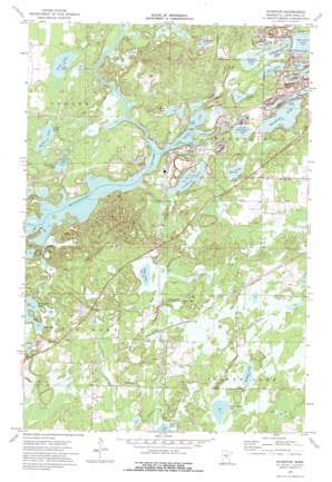
Riverton Topo Map Minnesota
To zoom in, hover over the map of Riverton
USGS Topo Quad 46094d1 - 1:24,000 scale
| Topo Map Name: | Riverton |
| USGS Topo Quad ID: | 46094d1 |
| Print Size: | ca. 21 1/4" wide x 27" high |
| Southeast Coordinates: | 46.375° N latitude / 94° W longitude |
| Map Center Coordinates: | 46.4375° N latitude / 94.0625° W longitude |
| U.S. State: | MN |
| Filename: | o46094d1.jpg |
| Download Map JPG Image: | Riverton topo map 1:24,000 scale |
| Map Type: | Topographic |
| Topo Series: | 7.5´ |
| Map Scale: | 1:24,000 |
| Source of Map Images: | United States Geological Survey (USGS) |
| Alternate Map Versions: |
Riverton MN 1973, updated 1976 Download PDF Buy paper map Riverton MN 2010 Download PDF Buy paper map Riverton MN 2013 Download PDF Buy paper map Riverton MN 2016 Download PDF Buy paper map |
1:24,000 Topo Quads surrounding Riverton
> Back to 46094a1 at 1:100,000 scale
> Back to 46094a1 at 1:250,000 scale
> Back to U.S. Topo Maps home
Riverton topo map: Gazetteer
Riverton: Dams
Pascoe Lake Dam elevation 365m 1197′Riverton: Lakes
Blackhoof Lake elevation 365m 1197′Fawn Lake elevation 366m 1200′
Hay Lake elevation 373m 1223′
Hay Lake elevation 367m 1204′
Hoppy Lake elevation 382m 1253′
Horseshoe Lake elevation 363m 1190′
Horseshoe Lake elevation 365m 1197′
June Lake elevation 362m 1187′
Little Blackhoof Lake elevation 364m 1194′
Little Menomin Lake elevation 364m 1194′
Little Rabbit Lake elevation 358m 1174′
Mud Lake elevation 365m 1197′
Pascoe Lake elevation 363m 1190′
Portage Lake elevation 363m 1190′
Spider Lake elevation 367m 1204′
Spruce Lake elevation 364m 1194′
Twin Island Lake elevation 381m 1250′
Riverton: Mines
Alstead Mine elevation 359m 1177′Arco Mine elevation 356m 1167′
Carlson Mine elevation 360m 1181′
Huntington Mine elevation 378m 1240′
Mahnomen Number Two Mine elevation 398m 1305′
Mallen Mine elevation 364m 1194′
Rowe Mine elevation 358m 1174′
Sagamore Mine elevation 363m 1190′
Section Six Mine elevation 366m 1200′
Snoshoe Mine elevation 364m 1194′
Virginia Mine elevation 364m 1194′
Riverton: Parks
Loerch State Wildlife Management Area elevation 375m 1230′Riverton: Populated Places
Homecroft (historical) elevation 385m 1263′Loerch elevation 378m 1240′
Riverton elevation 375m 1230′
Woodrow elevation 387m 1269′
Riverton: Post Offices
Loerch Post Office (historical) elevation 378m 1240′Riverton Post Office (historical) elevation 374m 1227′
Woodrow Post Office (historical) elevation 387m 1269′
Woods Post Office (historical) elevation 384m 1259′
Riverton: Reservoirs
Pascoe Lake elevation 365m 1197′Riverton: Streams
Hay Creek elevation 366m 1200′Ironton Creek elevation 359m 1177′
Rabbit River elevation 358m 1174′
Sand Creek elevation 358m 1174′
Riverton digital topo map on disk
Buy this Riverton topo map showing relief, roads, GPS coordinates and other geographical features, as a high-resolution digital map file on DVD:


