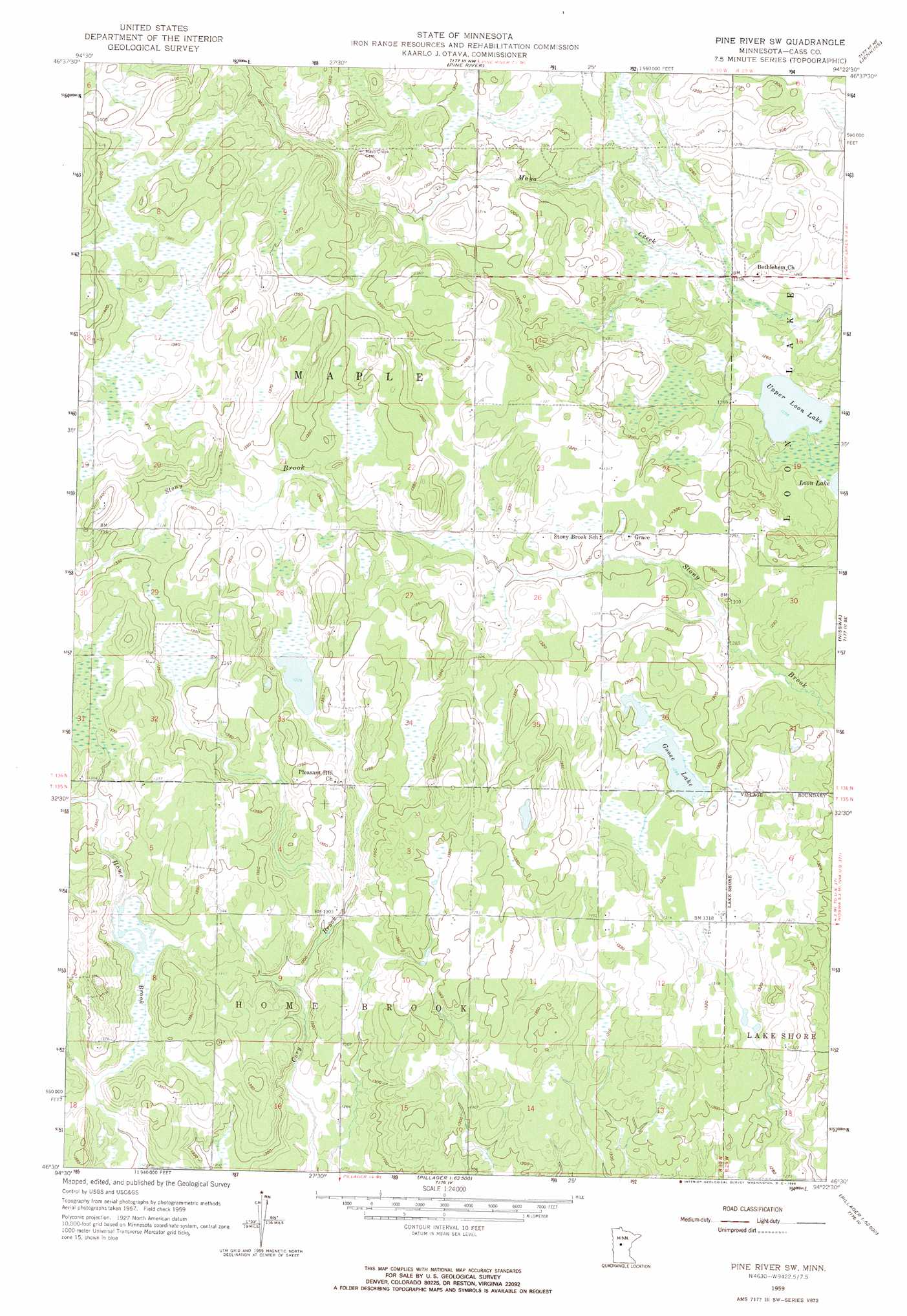
Pine River Sw Topo Map Minnesota
To zoom in, hover over the map of Pine River Sw
USGS Topo Quad 46094e4 - 1:24,000 scale
| Topo Map Name: | Pine River Sw |
| USGS Topo Quad ID: | 46094e4 |
| Print Size: | ca. 21 1/4" wide x 27" high |
| Southeast Coordinates: | 46.5° N latitude / 94.375° W longitude |
| Map Center Coordinates: | 46.5625° N latitude / 94.4375° W longitude |
| U.S. State: | MN |
| Filename: | o46094e4.jpg |
| Download Map JPG Image: | Pine River Sw topo map 1:24,000 scale |
| Map Type: | Topographic |
| Topo Series: | 7.5´ |
| Map Scale: | 1:24,000 |
| Source of Map Images: | United States Geological Survey (USGS) |
| Alternate Map Versions: |
Pine River SW MN 1959, updated 1960 Download PDF Buy paper map Pine River SW MN 1959, updated 1966 Download PDF Buy paper map Pine River SW MN 2010 Download PDF Buy paper map Pine River SW MN 2013 Download PDF Buy paper map Pine River SW MN 2016 Download PDF Buy paper map |
1:24,000 Topo Quads surrounding Pine River Sw
Oshawa |
Backus |
Mildred |
Lake Ada |
Stewart Lake |
Spider Lake |
Bungo Creek |
Pine River |
Jenkins |
Lower Whitefish Lake |
Leader |
Graff |
Pine River Sw |
Nisswa |
Pelican Lake |
Motley Nw |
Casino |
Wilson Bay |
Gull Lake |
Merrifield |
Motley |
Motley Se |
Pillager |
Baxter |
Brainerd |
> Back to 46094e1 at 1:100,000 scale
> Back to 46094a1 at 1:250,000 scale
> Back to U.S. Topo Maps home
Pine River Sw topo map: Gazetteer
Pine River Sw: Lakes
Goose Lake elevation 395m 1295′Upper Loon Lake elevation 383m 1256′
Pine River Sw: Post Offices
Stonybrook Post Office (historical) elevation 412m 1351′Pine River Sw digital topo map on disk
Buy this Pine River Sw topo map showing relief, roads, GPS coordinates and other geographical features, as a high-resolution digital map file on DVD: