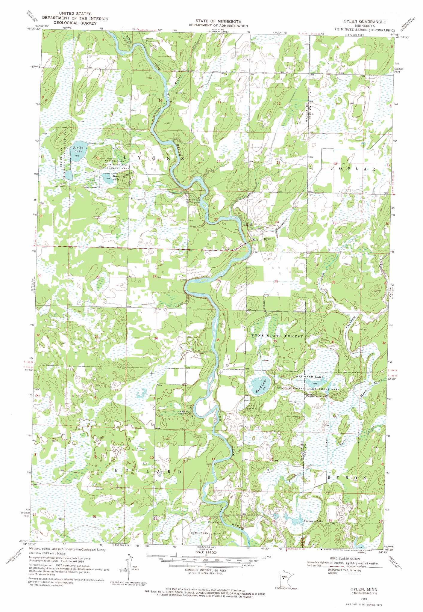
Oylen Topo Map Minnesota
To zoom in, hover over the map of Oylen
USGS Topo Quad 46094e7 - 1:24,000 scale
| Topo Map Name: | Oylen |
| USGS Topo Quad ID: | 46094e7 |
| Print Size: | ca. 21 1/4" wide x 27" high |
| Southeast Coordinates: | 46.5° N latitude / 94.75° W longitude |
| Map Center Coordinates: | 46.5625° N latitude / 94.8125° W longitude |
| U.S. State: | MN |
| Filename: | o46094e7.jpg |
| Download Map JPG Image: | Oylen topo map 1:24,000 scale |
| Map Type: | Topographic |
| Topo Series: | 7.5´ |
| Map Scale: | 1:24,000 |
| Source of Map Images: | United States Geological Survey (USGS) |
| Alternate Map Versions: |
Oylen MN 1969, updated 1972 Download PDF Buy paper map Oylen MN 2010 Download PDF Buy paper map Oylen MN 2013 Download PDF Buy paper map Oylen MN 2016 Download PDF Buy paper map |
1:24,000 Topo Quads surrounding Oylen
Menahga |
Huntersville |
First Crow Wing Lake |
Oshawa |
Backus |
Sebeka |
Nimrod |
Burgen Lake |
Spider Lake |
Bungo Creek |
Blue Grass |
Nimrod Sw |
Oylen |
Leader |
Graff |
Verndale |
Aldrich North |
Staples Ne |
Motley Nw |
Casino |
Bertha |
Aldrich South |
Staples |
Motley |
Motley Se |
> Back to 46094e1 at 1:100,000 scale
> Back to 46094a1 at 1:250,000 scale
> Back to U.S. Topo Maps home
Oylen topo map: Gazetteer
Oylen: Forests
Lyons State Forest elevation 393m 1289′Oylen: Lakes
Farnham Lake elevation 384m 1259′Granning Lake elevation 403m 1322′
Sand Lake elevation 389m 1276′
Strike Lake elevation 402m 1318′
Oylen: Parks
Cottingham Park elevation 387m 1269′Dry Sand Lake State Wildlife Management Area elevation 390m 1279′
Strike Lake State Wildlife Management Area elevation 402m 1318′
Oylen: Populated Places
Oylen elevation 397m 1302′Oylen: Streams
Beaver Creek elevation 399m 1309′Farnham Creek elevation 382m 1253′
Little Swamp Creek elevation 398m 1305′
Martin Creek elevation 387m 1269′
Tower Creek elevation 387m 1269′
Oylen digital topo map on disk
Buy this Oylen topo map showing relief, roads, GPS coordinates and other geographical features, as a high-resolution digital map file on DVD: