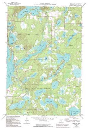
Cross Lake Topo Map Minnesota
To zoom in, hover over the map of Cross Lake
USGS Topo Quad 46094f1 - 1:24,000 scale
| Topo Map Name: | Cross Lake |
| USGS Topo Quad ID: | 46094f1 |
| Print Size: | ca. 21 1/4" wide x 27" high |
| Southeast Coordinates: | 46.625° N latitude / 94° W longitude |
| Map Center Coordinates: | 46.6875° N latitude / 94.0625° W longitude |
| U.S. State: | MN |
| Filename: | o46094f1.jpg |
| Download Map JPG Image: | Cross Lake topo map 1:24,000 scale |
| Map Type: | Topographic |
| Topo Series: | 7.5´ |
| Map Scale: | 1:24,000 |
| Source of Map Images: | United States Geological Survey (USGS) |
| Alternate Map Versions: |
Cross Lake MN 1960, updated 1961 Download PDF Buy paper map Cross Lake MN 1960, updated 1966 Download PDF Buy paper map Cross Lake MN 1960, updated 1981 Download PDF Buy paper map Cross Lake MN 1960, updated 1995 Download PDF Buy paper map Cross Lake MN 2010 Download PDF Buy paper map Cross Lake MN 2013 Download PDF Buy paper map Cross Lake MN 2016 Download PDF Buy paper map |
1:24,000 Topo Quads surrounding Cross Lake
> Back to 46094e1 at 1:100,000 scale
> Back to 46094a1 at 1:250,000 scale
> Back to U.S. Topo Maps home
Cross Lake topo map: Gazetteer
Cross Lake: Capes
Black Point elevation 392m 1286′Cook Point elevation 386m 1266′
Cross Lake: Channels
The Narrows elevation 384m 1259′Cross Lake: Dams
Eagle Lake Dam elevation 383m 1256′Greer Lake Dam elevation 367m 1204′
Pine River Dam elevation 374m 1227′
Velvet Lake Dam elevation 372m 1220′
Cross Lake: Islands
Berg Island elevation 387m 1269′Cross Lake: Lakes
Adney Lake elevation 370m 1213′Bass Lake elevation 370m 1213′
Bass Lake elevation 379m 1243′
Big Bird Lake elevation 367m 1204′
Buchite Lake elevation 385m 1263′
Command Lake elevation 379m 1243′
Cranberry Lake elevation 376m 1233′
Cranberry Lake elevation 379m 1243′
Daggett Lake elevation 375m 1230′
Davis Lake elevation 383m 1256′
Dolney Lake elevation 375m 1230′
East Fox Lake elevation 384m 1259′
Fern Lake elevation 373m 1223′
Four Acre Lake elevation 378m 1240′
Goodrich Lake elevation 377m 1236′
Grass Lake elevation 382m 1253′
Greer Lake elevation 367m 1204′
Lily Pad Lake elevation 376m 1233′
Little Bird Lake elevation 367m 1204′
Little Ox Lake elevation 375m 1230′
Little Pickerel Lake elevation 381m 1250′
Little Pine Lake elevation 375m 1230′
McClain Lake elevation 376m 1233′
Meyer Lake elevation 378m 1240′
O'Brien Lake elevation 376m 1233′
Ox Lake elevation 375m 1230′
Pickerel Lake elevation 381m 1250′
Pine Lake elevation 364m 1194′
Rock Lake elevation 376m 1233′
Sand Lake elevation 382m 1253′
Tamarack Lake elevation 374m 1227′
Tiff Lake elevation 373m 1223′
Velvet Lake elevation 372m 1220′
West Fox Lake elevation 384m 1259′
Cross Lake: Pillars
The Needles elevation 386m 1266′Cross Lake: Populated Places
Cross Lake elevation 378m 1240′Fifty Lakes elevation 393m 1289′
Golden Rule Trailer Park elevation 373m 1223′
Cross Lake: Post Offices
Crosslake Post Office elevation 376m 1233′Fifty Lakes Post Office elevation 390m 1279′
Cross Lake: Reservoirs
Cross Lake elevation 374m 1227′Eagle Lake elevation 383m 1256′
Greer Lake elevation 367m 1204′
Phelps Lake elevation 372m 1220′
Pine River Reservoir elevation 374m 1227′
Cross Lake: Streams
Daggett Creek elevation 376m 1233′Fox Creek elevation 379m 1243′
Cross Lake: Swamps
Big Bog elevation 380m 1246′Cross Lake digital topo map on disk
Buy this Cross Lake topo map showing relief, roads, GPS coordinates and other geographical features, as a high-resolution digital map file on DVD:


