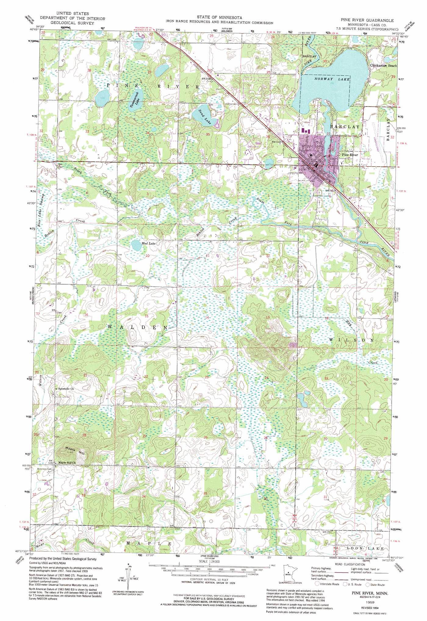
Pine River Topo Map Minnesota
To zoom in, hover over the map of Pine River
USGS Topo Quad 46094f4 - 1:24,000 scale
| Topo Map Name: | Pine River |
| USGS Topo Quad ID: | 46094f4 |
| Print Size: | ca. 21 1/4" wide x 27" high |
| Southeast Coordinates: | 46.625° N latitude / 94.375° W longitude |
| Map Center Coordinates: | 46.6875° N latitude / 94.4375° W longitude |
| U.S. State: | MN |
| Filename: | o46094f4.jpg |
| Download Map JPG Image: | Pine River topo map 1:24,000 scale |
| Map Type: | Topographic |
| Topo Series: | 7.5´ |
| Map Scale: | 1:24,000 |
| Source of Map Images: | United States Geological Survey (USGS) |
| Alternate Map Versions: |
Pine River MN 1959, updated 1960 Download PDF Buy paper map Pine River MN 1959, updated 1995 Download PDF Buy paper map Pine River MN 2010 Download PDF Buy paper map Pine River MN 2013 Download PDF Buy paper map Pine River MN 2016 Download PDF Buy paper map |
1:24,000 Topo Quads surrounding Pine River
Crystal Lake |
Hackensack |
Webb Lake |
Woman Lake |
Longville |
Oshawa |
Backus |
Mildred |
Lake Ada |
Stewart Lake |
Spider Lake |
Bungo Creek |
Pine River |
Jenkins |
Lower Whitefish Lake |
Leader |
Graff |
Pine River Sw |
Nisswa |
Pelican Lake |
Motley Nw |
Casino |
Wilson Bay |
Gull Lake |
Merrifield |
> Back to 46094e1 at 1:100,000 scale
> Back to 46094a1 at 1:250,000 scale
> Back to U.S. Topo Maps home
Pine River topo map: Gazetteer
Pine River: Airports
Pine River Regional Airport elevation 394m 1292′Pine River: Dams
Norway Lake Dam elevation 391m 1282′Pine River: Lakes
Mud Lake elevation 393m 1289′Norway Lake elevation 392m 1286′
Sand Lake elevation 394m 1292′
Tamarack Lake elevation 396m 1299′
Pine River: Populated Places
Chickamaw Beach elevation 397m 1302′Pine River elevation 394m 1292′
Pine River: Post Offices
Pine River Post Office elevation 394m 1292′Pine River: Reservoirs
Norway Lake elevation 391m 1282′Pine River: Streams
Behler Creek elevation 388m 1272′Hoblin Creek elevation 390m 1279′
South Fork Pine River elevation 388m 1272′
Wilson Creek elevation 393m 1289′
Pine River: Summits
Maple Hill elevation 469m 1538′Pine River digital topo map on disk
Buy this Pine River topo map showing relief, roads, GPS coordinates and other geographical features, as a high-resolution digital map file on DVD: